Headwaters Of All Streams Within Mckittrick Canyon Watershed To Nf Boundary River Run
Community Reviews
Been here? Share the conditions.
Reviews, ratings & photos are added in the free Snoflo iOS app — rate a spot, tag the conditions, and your visit is verified by location. Add or manage your reviews from the app.
Headwaters Of All Streams Within Mckittrick Canyon Watershed To Nf Boundary
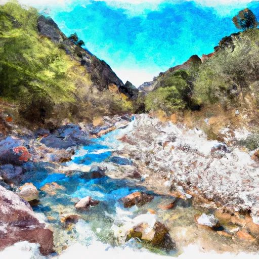
The Whitewater River Run features numerous rapids and obstacles, including "The Slide," a long, steep drop with a tricky entrance, and "The Chute," a narrow channel with a tight turn at the bottom. There are also several waterfalls and ledges along the route. Due to the high level of difficulty, this run is recommended for experienced kayakers and rafters only.
Specific regulations apply to the Whitewater River Run, including the requirement for all boaters to wear personal flotation devices (PFDs) and to carry a whistle and a rescue throw bag. Additionally, motorized watercraft are not allowed on this section of the river. It is important to note that water levels can change rapidly and unexpectedly, so boaters should always be prepared for changing conditions and exercise caution.
Plan your run down to the hour
Same weather feed Snoflo's iOS app uses -- updated continuously from NOAA / yr.no. Watch the precipitation column on the meteogram; rain ahead of a run typically lifts flows 12-48 hours later depending on the basin.
Next 5 days, hour by hour
Temperature line with weather symbols on top, snow + rain accumulation as columns, humidity as a dotted line.
5-day forecast table
Every 3 hours, broken out across temperature, snow, rain, humidity, and wind. Each cell is colour-coded relative to the column min/max.
| Time | Condition | Temp (°F) | Snow (in) | Rain (in) | Humidity (%) | Wind (mps) | Wind dir |
|---|---|---|---|---|---|---|---|
| Loading detailed forecast… | |||||||
15-day temperature & precipitation
Daily temperatures, snow, and rain projected over the next two weeks -- the upstream story that drives next week's flows.
Regional streamflow levels
USGS streamgauges around Headwaters Of All Streams Within Mckittrick Canyon Watershed To Nf Boundary -- useful for spotting upstream pulses and gauging which tributary is contributing what.
| Streamgauge | Discharge | View |
|---|---|---|
| Dark Canyon Draw Near Whites City | · | → |
| Black River Above Malaga | 6 cfs | → |
| Rocky Arroyo At Hwy Brd Nr Carlsbad | · | → |
| Dark Canyon At Carlsbad | · | → |
| Delaware River Nr Red Bluff | 49 cfs | → |
| Pecos River Below Dark Canyon At Carlsbad | 29 cfs | → |
Plan a longer trip
The closest boat launches, other paddle runs, and campgrounds so a day on the water can grow into a full weekend.
Other river runs
- Headwaters Of Big Canyon To Nf Boundary
- Headwaters Of Middle Fork Big Canyon And North Fork Big Canyon To Nf Boundary
- Southern Boundary Of Sec 3, T26s, R21e Along Dark Canyon To Confluence Of Dark And Fir Canyons In Sec 25, T25s, R21e
- Headwaters Of Cottonwood Canyon In Sec 32, T25s, R22e To Confluence Of Cottonwood And Dark Canyons In Sec 10, T25s, R22e
- Headwaters Of Horse Spring In Sec 13, T25s, R22e To Confluence Of Horse Spring And Horse Canyon In Sec 11, T25s, R22e
Campgrounds
- Wilderness Ridge Campground
- Mckittrick Ridge Campground
- Mckittrick Ridge Backcountry Campground
- Dog Canyon Campground
- Dog Canyon - Guadalupe Mountains National Park
- Mescalero Campground
Whitewater safety
- Check the flow before you run
- Use the linked-gauge card and Regional Flow panel above. Class ratings change with flow -- a Class III at low water can become Class IV+ at high water.
- Know your skill ceiling
- Pick runs comfortably below your ceiling. Cold-water and big-water runs raise the consequences of any mistake.
- Wear the right gear
- Helmet, PFD, drysuit / wetsuit when water is below 60°F. Throw bag, knife, and whistle on your person, not in the boat.
- Scout, set safety, and run with a team
- Scout new rapids on foot, set safety with throw bags above the consequence pool, and run with at least one other competent paddler.
- Respect the river
- Strainers, undercuts, low-head dams, and wood can kill at any class rating. When in doubt, portage.
Set push alerts in the Snoflo app
Save Headwaters Of All Streams Within Mckittrick Canyon Watershed To Nf Boundary as a favorite, set a discharge threshold (e.g. "alert me when flow hits 600 cfs"), and the iOS app pushes the moment the linked gauge crosses.
About Headwaters Of All Streams Within Mckittrick Canyon Watershed To Nf Boundary
What's the optimal flow for Headwaters Of All Streams Within Mckittrick Canyon Watershed To Nf Boundary?
The optimal flow depends on the section and the craft. Check the Run Details panel for the linked gauge and current status.
How fresh is the cfs reading on this page?
The linked USGS streamgauge reports continuously (every 15 minutes); Snoflo refreshes throughout the day. Hover the streamflow sparkline to read individual datapoints.
What's the whitewater class?
See the Run Details panel for the class rating Snoflo tracks for this run. Class ratings change with flow -- a Class III at low water can become Class IV in high water.
Where do I put in / take out?
Tap Directions in the hero above to open driving directions to the put-in. For shuttle planning, check the Nearby Boat Launches panel and the river run operator's site.
Can I get alerts when flows hit the optimal range?
Yes -- alerts are managed in the Snoflo iOS app. Favorite this run, set a discharge threshold, and you'll get a push the moment the gauge crosses.
Other runs near here
Snoflo-tracked paddle runs within driving distance of Headwaters Of All Streams Within Mckittrick Canyon Watershed To Nf Boundary.