Headwaters To Santee River Confluence River Run
Community Reviews
Been here? Share the conditions.
Reviews, ratings & photos are added in the free Snoflo iOS app — rate a spot, tag the conditions, and your visit is verified by location. Add or manage your reviews from the app.
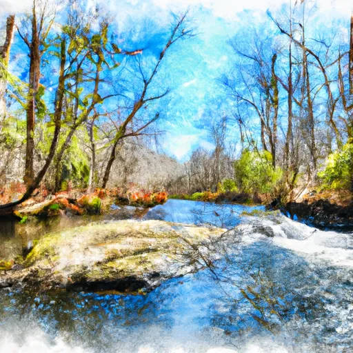
Headwaters To Santee River Confluence
Regulations for this area include a mandatory personal flotation device (PFD) for each person on board, as well as a whistle and a light source for night paddling. Additionally, camping is only allowed in designated areas, and fires are prohibited except in established fire rings. Watercraft must also be registered with the South Carolina Department of Natural Resources.
Overall, the Whitewater River Run from Headwaters to Santee River Confluence offers a thrilling and challenging adventure for intermediate paddlers. It is important to note that water levels can fluctuate quickly, so it is essential to check current water levels before embarking on this journey.
Plan your run down to the hour
Same weather feed Snoflo's iOS app uses -- updated continuously from NOAA / yr.no. Watch the precipitation column on the meteogram; rain ahead of a run typically lifts flows 12-48 hours later depending on the basin.
Next 5 days, hour by hour
Temperature line with weather symbols on top, snow + rain accumulation as columns, humidity as a dotted line.
5-day forecast table
Every 3 hours, broken out across temperature, snow, rain, humidity, and wind. Each cell is colour-coded relative to the column min/max.
| Time | Condition | Temp (°F) | Snow (in) | Rain (in) | Humidity (%) | Wind (mps) | Wind dir |
|---|---|---|---|---|---|---|---|
| Loading detailed forecast… | |||||||
15-day temperature & precipitation
Daily temperatures, snow, and rain projected over the next two weeks -- the upstream story that drives next week's flows.
Regional streamflow levels
USGS streamgauges around Headwaters To Santee River Confluence -- useful for spotting upstream pulses and gauging which tributary is contributing what.
| Streamgauge | Discharge | View |
|---|---|---|
| Santee River Nr Jamestown | 395 cfs | → |
| Back River At Dupont Intake Nr Kittredge | 2,320 cfs | → |
| Lake Moultrie Tailrace Canal At Moncks Corner | 421 cfs | → |
| Turkey Creek Near Maryville | 0 cfs | → |
| Santee River Near Pineville | 650 cfs | → |
| Black River At Kingstree | 19 cfs | → |
Plan a longer trip
The closest boat launches, other paddle runs, and campgrounds so a day on the water can grow into a full weekend.
Boat launches
- Forest Service Road 211-B, Mcclellanville
- Forest Road 204 F, Jamestown
- State Highway 402 Berkeley County
- Buckhall Landing Road Charleston County
- Lenuds (Us17 Bridge)
- Sandhole Road, Georgetown
Other river runs
- Headwater To Echaw Road
- Echaw Road To Snatee River Confluence
- Lake Moultrie Outlet To Saltwater
- Highway 402 To Old Santee Canal/Cooper River Confluence
- Headwaters To Highway 402
Campgrounds
- Honey Hill Recreation Area
- Honey Hill
- Halfway Creek Trail Camp
- Guilliard Lake
- Buckhall
- Buck Hall Recreation Area
Fishing spots
Whitewater safety
- Check the flow before you run
- Use the linked-gauge card and Regional Flow panel above. Class ratings change with flow -- a Class III at low water can become Class IV+ at high water.
- Know your skill ceiling
- Pick runs comfortably below your ceiling. Cold-water and big-water runs raise the consequences of any mistake.
- Wear the right gear
- Helmet, PFD, drysuit / wetsuit when water is below 60°F. Throw bag, knife, and whistle on your person, not in the boat.
- Scout, set safety, and run with a team
- Scout new rapids on foot, set safety with throw bags above the consequence pool, and run with at least one other competent paddler.
- Respect the river
- Strainers, undercuts, low-head dams, and wood can kill at any class rating. When in doubt, portage.
Set push alerts in the Snoflo app
Save Headwaters To Santee River Confluence as a favorite, set a discharge threshold (e.g. "alert me when flow hits 600 cfs"), and the iOS app pushes the moment the linked gauge crosses.
About Headwaters To Santee River Confluence
What's the optimal flow for Headwaters To Santee River Confluence?
The optimal flow depends on the section and the craft. Check the Run Details panel for the linked gauge and current status.
How fresh is the cfs reading on this page?
The linked USGS streamgauge reports continuously (every 15 minutes); Snoflo refreshes throughout the day. Hover the streamflow sparkline to read individual datapoints.
What's the whitewater class?
See the Run Details panel for the class rating Snoflo tracks for this run. Class ratings change with flow -- a Class III at low water can become Class IV in high water.
Where do I put in / take out?
Tap Directions in the hero above to open driving directions to the put-in. For shuttle planning, check the Nearby Boat Launches panel and the river run operator's site.
Can I get alerts when flows hit the optimal range?
Yes -- alerts are managed in the Snoflo iOS app. Favorite this run, set a discharge threshold, and you'll get a push the moment the gauge crosses.
Other runs near here
Snoflo-tracked paddle runs within driving distance of Headwaters To Santee River Confluence.