Preserve Boundary Of The Big Sandy Unit To Confluence With Village Creek River Run
Community Reviews
Been here? Share the conditions.
Reviews, ratings & photos are added in the free Snoflo iOS app — rate a spot, tag the conditions, and your visit is verified by location. Add or manage your reviews from the app.
Preserve Boundary Of The Big Sandy Unit To Confluence With Village Creek
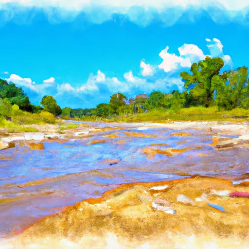
The Big Sandy Rapid is a class III rapid that features a long wave train and a large boulder garden. It requires precise navigation and quick decision-making from paddlers. The Railroad Rapid, on the other hand, is a class IV rapid that requires advanced paddling skills and experience. It features a steep drop and a series of large boulders that create challenging hydraulic conditions.
To ensure the safety of visitors, the area has specific regulations that must be followed. For instance, paddlers are required to have appropriate safety equipment, including a personal flotation device and a helmet. Additionally, camping is only allowed in designated areas, and visitors must obtain a permit before entering the preserve.
Overall, the Whitewater River Run Preserve Boundary of the Big Sandy Unit to Confluence with Village Creek in Texas is a thrilling destination for whitewater rafting enthusiasts. It offers a challenging yet rewarding experience for paddlers of all skill levels, and visitors are reminded to follow the area's regulations to ensure a safe and enjoyable trip.
Plan your run down to the hour
Same weather feed Snoflo's iOS app uses -- updated continuously from NOAA / yr.no. Watch the precipitation column on the meteogram; rain ahead of a run typically lifts flows 12-48 hours later depending on the basin.
Next 5 days, hour by hour
Temperature line with weather symbols on top, snow + rain accumulation as columns, humidity as a dotted line.
5-day forecast table
Every 3 hours, broken out across temperature, snow, rain, humidity, and wind. Each cell is colour-coded relative to the column min/max.
| Time | Condition | Temp (°F) | Snow (in) | Rain (in) | Humidity (%) | Wind (mps) | Wind dir |
|---|---|---|---|---|---|---|---|
| Loading detailed forecast… | |||||||
15-day temperature & precipitation
Daily temperatures, snow, and rain projected over the next two weeks -- the upstream story that drives next week's flows.
Regional streamflow levels
USGS streamgauges around Preserve Boundary Of The Big Sandy Unit To Confluence With Village Creek -- useful for spotting upstream pulses and gauging which tributary is contributing what.
| Streamgauge | Discharge | View |
|---|---|---|
| Long King Ck At Livingston | 10 cfs | → |
| Menard Ck Nr Rye | 57 cfs | → |
| Trinity Rv Nr Goodrich | 2,140 cfs | → |
| Trinity Rv At Romayor | 2,420 cfs | → |
| Kickapoo Ck At Onalaska | 1 cfs | → |
| Neches Rv Nr Rockland | 498 cfs | → |
Plan a longer trip
The closest boat launches, other paddle runs, and campgrounds so a day on the water can grow into a full weekend.
Boat launches
Other river runs
- Preserve Boundary In The Big Sandy Unit To Confluence With Trinity River
- Confluence With Big Sandy Creek To Confluence With The Neches River
- Preserve Boundary In The Big Sandy Unit To Confluence With Big Sandy Creek
- Us Highway 59 To Us Highway 69
- State Highway 7 To Us Highway 59
Campgrounds
Whitewater safety
- Check the flow before you run
- Use the linked-gauge card and Regional Flow panel above. Class ratings change with flow -- a Class III at low water can become Class IV+ at high water.
- Know your skill ceiling
- Pick runs comfortably below your ceiling. Cold-water and big-water runs raise the consequences of any mistake.
- Wear the right gear
- Helmet, PFD, drysuit / wetsuit when water is below 60°F. Throw bag, knife, and whistle on your person, not in the boat.
- Scout, set safety, and run with a team
- Scout new rapids on foot, set safety with throw bags above the consequence pool, and run with at least one other competent paddler.
- Respect the river
- Strainers, undercuts, low-head dams, and wood can kill at any class rating. When in doubt, portage.
Set push alerts in the Snoflo app
Save Preserve Boundary Of The Big Sandy Unit To Confluence With Village Creek as a favorite, set a discharge threshold (e.g. "alert me when flow hits 600 cfs"), and the iOS app pushes the moment the linked gauge crosses.
About Preserve Boundary Of The Big Sandy Unit To Confluence With Village Creek
What's the optimal flow for Preserve Boundary Of The Big Sandy Unit To Confluence With Village Creek?
The optimal flow depends on the section and the craft. Check the Run Details panel for the linked gauge and current status.
How fresh is the cfs reading on this page?
The linked USGS streamgauge reports continuously (every 15 minutes); Snoflo refreshes throughout the day. Hover the streamflow sparkline to read individual datapoints.
What's the whitewater class?
See the Run Details panel for the class rating Snoflo tracks for this run. Class ratings change with flow -- a Class III at low water can become Class IV in high water.
Where do I put in / take out?
Tap Directions in the hero above to open driving directions to the put-in. For shuttle planning, check the Nearby Boat Launches panel and the river run operator's site.
Can I get alerts when flows hit the optimal range?
Yes -- alerts are managed in the Snoflo iOS app. Favorite this run, set a discharge threshold, and you'll get a push the moment the gauge crosses.
Other runs near here
Snoflo-tracked paddle runs within driving distance of Preserve Boundary Of The Big Sandy Unit To Confluence With Village Creek.