Preserve Boundary In The Lance Rosier Unit To Confluence With Pine Island Bayou River Run
Community Reviews
Been here? Share the conditions.
Reviews, ratings & photos are added in the free Snoflo iOS app — rate a spot, tag the conditions, and your visit is verified by location. Add or manage your reviews from the app.
Preserve Boundary In The Lance Rosier Unit To Confluence With Pine Island Bayou
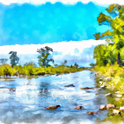
There are several specific river rapids and obstacles on this river run, including the "Pinball" rapid, which is a Class III rapid with multiple channels and boulder gardens. Other notable rapids include "Satan's Staircase," "Little Niagara," and "The Chute." There are also several large boulders and fallen trees that create challenging obstacles for kayakers and rafters.
There are specific regulations that apply to this area. The river run is located within the Big Thicket National Preserve, and as such, visitors must follow all rules and regulations set forth by the National Park Service. Visitors are also required to obtain a permit before using the river run. Additionally, visitors must abide by Leave No Trace principles and pack out all trash and debris.
Overall, the Whitewater River Run Preserve Boundary in the Lance Rosier Unit to Confluence with Pine Island Bayou is a challenging and exciting river run that is popular among kayakers and rafters. With its fast-moving rapids, challenging obstacles, and beautiful scenery, it is a must-visit destination for any outdoor enthusiast.
Plan your run down to the hour
Same weather feed Snoflo's iOS app uses -- updated continuously from NOAA / yr.no. Watch the precipitation column on the meteogram; rain ahead of a run typically lifts flows 12-48 hours later depending on the basin.
Next 5 days, hour by hour
Temperature line with weather symbols on top, snow + rain accumulation as columns, humidity as a dotted line.
5-day forecast table
Every 3 hours, broken out across temperature, snow, rain, humidity, and wind. Each cell is colour-coded relative to the column min/max.
| Time | Condition | Temp (°F) | Snow (in) | Rain (in) | Humidity (%) | Wind (mps) | Wind dir |
|---|---|---|---|---|---|---|---|
| Loading detailed forecast… | |||||||
15-day temperature & precipitation
Daily temperatures, snow, and rain projected over the next two weeks -- the upstream story that drives next week's flows.
Regional streamflow levels
USGS streamgauges around Preserve Boundary In The Lance Rosier Unit To Confluence With Pine Island Bayou -- useful for spotting upstream pulses and gauging which tributary is contributing what.
| Streamgauge | Discharge | View |
|---|---|---|
| Pine Island Bayou Nr Sour Lake | 88 cfs | → |
| Village Ck Nr Kountze | 360 cfs | → |
| Menard Ck Nr Rye | 57 cfs | → |
| Trinity Rv At Romayor | 2,420 cfs | → |
| Pine Island Bayou Abv Bi Pump Plant | 260 cfs | → |
| Trinity Rv At Liberty | 4,080 cfs | → |
Plan a longer trip
The closest boat launches, other paddle runs, and campgrounds so a day on the water can grow into a full weekend.
Other river runs
- Confluence With Big Sandy Creek To Confluence With The Neches River
- Preserve Boundary In The Lance Rosier Unit To Confluence With The Neches River
- Preserve Boundary In The Big Sandy Unit To Confluence With Trinity River
- Preserve Boundary In The Big Sandy Unit To Confluence With Big Sandy Creek
- Hwy 96 Bridge To Neches River Saltwater Barrier
Whitewater safety
- Check the flow before you run
- Use the linked-gauge card and Regional Flow panel above. Class ratings change with flow -- a Class III at low water can become Class IV+ at high water.
- Know your skill ceiling
- Pick runs comfortably below your ceiling. Cold-water and big-water runs raise the consequences of any mistake.
- Wear the right gear
- Helmet, PFD, drysuit / wetsuit when water is below 60°F. Throw bag, knife, and whistle on your person, not in the boat.
- Scout, set safety, and run with a team
- Scout new rapids on foot, set safety with throw bags above the consequence pool, and run with at least one other competent paddler.
- Respect the river
- Strainers, undercuts, low-head dams, and wood can kill at any class rating. When in doubt, portage.
Set push alerts in the Snoflo app
Save Preserve Boundary In The Lance Rosier Unit To Confluence With Pine Island Bayou as a favorite, set a discharge threshold (e.g. "alert me when flow hits 600 cfs"), and the iOS app pushes the moment the linked gauge crosses.
About Preserve Boundary In The Lance Rosier Unit To Confluence With Pine Island Bayou
What's the optimal flow for Preserve Boundary In The Lance Rosier Unit To Confluence With Pine Island Bayou?
The optimal flow depends on the section and the craft. Check the Run Details panel for the linked gauge and current status.
How fresh is the cfs reading on this page?
The linked USGS streamgauge reports continuously (every 15 minutes); Snoflo refreshes throughout the day. Hover the streamflow sparkline to read individual datapoints.
What's the whitewater class?
See the Run Details panel for the class rating Snoflo tracks for this run. Class ratings change with flow -- a Class III at low water can become Class IV in high water.
Where do I put in / take out?
Tap Directions in the hero above to open driving directions to the put-in. For shuttle planning, check the Nearby Boat Launches panel and the river run operator's site.
Can I get alerts when flows hit the optimal range?
Yes -- alerts are managed in the Snoflo iOS app. Favorite this run, set a discharge threshold, and you'll get a push the moment the gauge crosses.
Other runs near here
Snoflo-tracked paddle runs within driving distance of Preserve Boundary In The Lance Rosier Unit To Confluence With Pine Island Bayou.