Headwaters To End Of Kendall Farm Road River Run
Community Reviews
Been here? Share the conditions.
Reviews, ratings & photos are added in the free Snoflo iOS app — rate a spot, tag the conditions, and your visit is verified by location. Add or manage your reviews from the app.
Headwaters To End Of Kendall Farm Road
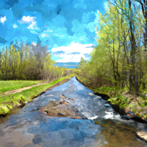
The segment mileage from the Headwaters to the End of Kendall Farm Road is approximately 4 miles. During the run, paddlers will encounter specific river rapids and obstacles such as the "Pinball" rapid, which is a series of boulder gardens that require precise navigation. They will also encounter the "Rattlesnake" rapid, which is a narrow and technical rapid with a tricky exit.
Specific regulations to the area include a Vermont fishing license requirement for anyone over the age of 15 who is fishing. Paddlers should also be aware of private property along the river and avoid trespassing. Additionally, the Vermont Department of Environmental Conservation advises paddlers to practice Leave No Trace principles and avoid disturbing the natural environment.
In conclusion, the Whitewater River Headwaters to End of Kendall Farm Road offers an exciting Class III river run with a specific streamflow range, segment mileage, and challenging rapids and obstacles. Paddlers should be aware of specific regulations to the area and practice responsible outdoor recreation.
Plan your run down to the hour
Same weather feed Snoflo's iOS app uses -- updated continuously from NOAA / yr.no. Watch the precipitation column on the meteogram; rain ahead of a run typically lifts flows 12-48 hours later depending on the basin.
Next 5 days, hour by hour
Temperature line with weather symbols on top, snow + rain accumulation as columns, humidity as a dotted line.
5-day forecast table
Every 3 hours, broken out across temperature, snow, rain, humidity, and wind. Each cell is colour-coded relative to the column min/max.
| Time | Condition | Temp (°F) | Snow (in) | Rain (in) | Humidity (%) | Wind (mps) | Wind dir |
|---|---|---|---|---|---|---|---|
| Loading detailed forecast… | |||||||
15-day temperature & precipitation
Daily temperatures, snow, and rain projected over the next two weeks -- the upstream story that drives next week's flows.
Regional streamflow levels
USGS streamgauges around Headwaters To End Of Kendall Farm Road -- useful for spotting upstream pulses and gauging which tributary is contributing what.
| Streamgauge | Discharge | View |
|---|---|---|
| West River At Jamaica | 36 cfs | → |
| West River Below Townshend Dam Near Townshend | 46 cfs | → |
| Mettawee River Near Pawlet | 215 cfs | → |
| Walloomsac River Near North Bennington | 51 cfs | → |
| Batten Kill Below Mill At Battenville Ny | 166 cfs | → |
| Saxtons River At Saxtons River | 19 cfs | → |
Plan a longer trip
The closest boat launches, other paddle runs, and campgrounds so a day on the water can grow into a full weekend.
Boat launches
- Town Shed Road Manchester
- Dufresne Pond Road Manchester
- Gale Meadow Road Londonderry
- Winhall Station Road Londonderry
- Ice House Road Londonderry
- Batten Kill Road Arlington
Other river runs
- End Of Kendall Farm Road To Confluence With West River
- Wilderness Boundary To Confluence With Batten Kill
- Headwaters To Wilderness Boundary
- Arlington, Vt To Manchester, Vt
- Lye Brook Wilderness Boundary To Confluence Of Batten Kill
Campgrounds
- Stratton View Tenting Area
- North Bourne Pond
- South Bourne Pond
- Grout Pond
- Grout Pond Recreation Area
- Winhall Brook
Whitewater safety
- Check the flow before you run
- Use the linked-gauge card and Regional Flow panel above. Class ratings change with flow -- a Class III at low water can become Class IV+ at high water.
- Know your skill ceiling
- Pick runs comfortably below your ceiling. Cold-water and big-water runs raise the consequences of any mistake.
- Wear the right gear
- Helmet, PFD, drysuit / wetsuit when water is below 60°F. Throw bag, knife, and whistle on your person, not in the boat.
- Scout, set safety, and run with a team
- Scout new rapids on foot, set safety with throw bags above the consequence pool, and run with at least one other competent paddler.
- Respect the river
- Strainers, undercuts, low-head dams, and wood can kill at any class rating. When in doubt, portage.
Set push alerts in the Snoflo app
Save Headwaters To End Of Kendall Farm Road as a favorite, set a discharge threshold (e.g. "alert me when flow hits 600 cfs"), and the iOS app pushes the moment the linked gauge crosses.
About Headwaters To End Of Kendall Farm Road
What's the optimal flow for Headwaters To End Of Kendall Farm Road?
The optimal flow depends on the section and the craft. Check the Run Details panel for the linked gauge and current status.
How fresh is the cfs reading on this page?
The linked USGS streamgauge reports continuously (every 15 minutes); Snoflo refreshes throughout the day. Hover the streamflow sparkline to read individual datapoints.
What's the whitewater class?
See the Run Details panel for the class rating Snoflo tracks for this run. Class ratings change with flow -- a Class III at low water can become Class IV in high water.
Where do I put in / take out?
Tap Directions in the hero above to open driving directions to the put-in. For shuttle planning, check the Nearby Boat Launches panel and the river run operator's site.
Can I get alerts when flows hit the optimal range?
Yes -- alerts are managed in the Snoflo iOS app. Favorite this run, set a discharge threshold, and you'll get a push the moment the gauge crosses.
Other runs near here
Snoflo-tracked paddle runs within driving distance of Headwaters To End Of Kendall Farm Road.