Headwaters To Wilderness Boundary River Run
Community Reviews
Been here? Share the conditions.
Reviews, ratings & photos are added in the free Snoflo iOS app — rate a spot, tag the conditions, and your visit is verified by location. Add or manage your reviews from the app.
Headwaters To Wilderness Boundary
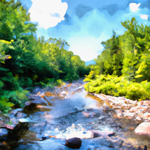
The Whitewater River run Headwaters to Wilderness Boundary features several exciting rapids and obstacles that add to the thrill of the run. One of the most notable rapids on this stretch is "The Gauntlet," which is a technical Class III rapid with several twists and turns. Other challenging rapids include "The Notch" and "The S-Turns."
To ensure the safety of all paddlers, there are specific regulations to the area that must be followed. For example, all paddlers must wear a personal flotation device (PFD) at all times while on the river. Additionally, all boats must have a whistle or other audible signaling device, and paddlers must have a solid roll and self-rescue skills.
Overall, the Whitewater River run Headwaters to Wilderness Boundary is a thrilling and challenging run that offers a great experience for intermediate-level paddlers. It is important to follow all regulations and guidelines to ensure a safe and enjoyable trip.
Plan your run down to the hour
Same weather feed Snoflo's iOS app uses -- updated continuously from NOAA / yr.no. Watch the precipitation column on the meteogram; rain ahead of a run typically lifts flows 12-48 hours later depending on the basin.
Next 5 days, hour by hour
Temperature line with weather symbols on top, snow + rain accumulation as columns, humidity as a dotted line.
5-day forecast table
Every 3 hours, broken out across temperature, snow, rain, humidity, and wind. Each cell is colour-coded relative to the column min/max.
| Time | Condition | Temp (°F) | Snow (in) | Rain (in) | Humidity (%) | Wind (mps) | Wind dir |
|---|---|---|---|---|---|---|---|
| Loading detailed forecast… | |||||||
15-day temperature & precipitation
Daily temperatures, snow, and rain projected over the next two weeks -- the upstream story that drives next week's flows.
Regional streamflow levels
USGS streamgauges around Headwaters To Wilderness Boundary -- useful for spotting upstream pulses and gauging which tributary is contributing what.
| Streamgauge | Discharge | View |
|---|---|---|
| West River At Jamaica | 40 cfs | → |
| West River Below Townshend Dam Near Townshend | 46 cfs | → |
| Walloomsac River Near North Bennington | 45 cfs | → |
| Batten Kill Below Mill At Battenville Ny | 200 cfs | → |
| Mettawee River Near Pawlet | 215 cfs | → |
| Hoosic River Near Eagle Bridge Ny | 260 cfs | → |
Plan a longer trip
The closest boat launches, other paddle runs, and campgrounds so a day on the water can grow into a full weekend.
Boat launches
- Dufresne Pond Road Manchester
- Town Shed Road Manchester
- Batten Kill Road Arlington
- Gale Meadow Road Londonderry
- Somerset
- Winhall Station Road Londonderry
Other river runs
- Headwaters To Proclamation Boundary
- Wilderness Boundary To Confluence With Batten Kill
- Lye Brook Wilderness Boundary To Confluence Of Batten Kill
- Headwaters To End Of Kendall Farm Road
- End Of Kendall Farm Road To Confluence With West River
Campgrounds
- South Bourne Pond
- North Bourne Pond
- Stratton View Tenting Area
- Grout Pond Recreation Area
- Grout Pond
- Camping On The Battenkill
Whitewater safety
- Check the flow before you run
- Use the linked-gauge card and Regional Flow panel above. Class ratings change with flow -- a Class III at low water can become Class IV+ at high water.
- Know your skill ceiling
- Pick runs comfortably below your ceiling. Cold-water and big-water runs raise the consequences of any mistake.
- Wear the right gear
- Helmet, PFD, drysuit / wetsuit when water is below 60°F. Throw bag, knife, and whistle on your person, not in the boat.
- Scout, set safety, and run with a team
- Scout new rapids on foot, set safety with throw bags above the consequence pool, and run with at least one other competent paddler.
- Respect the river
- Strainers, undercuts, low-head dams, and wood can kill at any class rating. When in doubt, portage.
Set push alerts in the Snoflo app
Save Headwaters To Wilderness Boundary as a favorite, set a discharge threshold (e.g. "alert me when flow hits 600 cfs"), and the iOS app pushes the moment the linked gauge crosses.
About Headwaters To Wilderness Boundary
What's the optimal flow for Headwaters To Wilderness Boundary?
The optimal flow depends on the section and the craft. Check the Run Details panel for the linked gauge and current status.
How fresh is the cfs reading on this page?
The linked USGS streamgauge reports continuously (every 15 minutes); Snoflo refreshes throughout the day. Hover the streamflow sparkline to read individual datapoints.
What's the whitewater class?
See the Run Details panel for the class rating Snoflo tracks for this run. Class ratings change with flow -- a Class III at low water can become Class IV in high water.
Where do I put in / take out?
Tap Directions in the hero above to open driving directions to the put-in. For shuttle planning, check the Nearby Boat Launches panel and the river run operator's site.
Can I get alerts when flows hit the optimal range?
Yes -- alerts are managed in the Snoflo iOS app. Favorite this run, set a discharge threshold, and you'll get a push the moment the gauge crosses.
Other runs near here
Snoflo-tracked paddle runs within driving distance of Headwaters To Wilderness Boundary.