Summary
The ideal streamflow range for this run is between 300 and 800 cfs. At lower levels, the run can become too shallow, while at higher levels, the rapids can become dangerous and difficult to navigate.
This run is rated as a class III, meaning it has moderate rapids with moderate, irregular waves. The total segment mileage is approximately 6 miles long. The first 2 miles are a relatively easy class I-II, but the last 4 miles are more challenging with constant class III rapids.
There are several notable rapids and obstacles on this run, including the "Labrador" rapid, which is a class III rapid that requires precise navigation. The "Surf City" rapid is another notable feature, which has a powerful wave that can be surfed by experienced paddlers.
There are some regulations to be aware of when planning a trip on this river. All paddlers are required to wear personal floatation devices at all times and are encouraged to wear helmets. Additionally, it is recommended that paddlers have some experience with class III rapids before attempting this run.
Overall, the Whitewater River Run from Headwaters to Folsom Brook offers a fun and challenging experience for intermediate paddlers, with beautiful scenery and exciting rapids to navigate.
°F
°F
mph
Wind
%
Humidity
15-Day Weather Outlook
River Run Details
| Last Updated | 2026-02-07 |
| River Levels | 17 cfs (2.57 ft) |
| Percent of Normal | 68% |
| Status | |
| Class Level | i-ii |
| Elevation | ft |
| Streamflow Discharge | cfs |
| Gauge Height | ft |
| Reporting Streamgage | USGS 01142500 |
5-Day Hourly Forecast Detail
Nearby Streamflow Levels
 Ayers Brook At Randolph
|
25cfs |
 Dog River At Northfield Falls
|
49cfs |
 Mad River Near Moretown
|
266cfs |
 Otter Creek At Middlebury
|
744cfs |
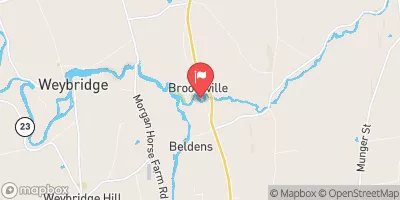 New Haven River At Brooksville Nr Middlebury
|
194cfs |
 Winooski River At Montpelier
|
337cfs |
Area Campgrounds
| Location | Reservations | Toilets |
|---|---|---|
 Yestermarrow Camp Ground
|
||
 Sparks Landing Primitive Campsite
|
||
 Allis State Park
|
||
 Bingo
Bingo
|


 Headwaters To Folsom Brook
 Proclamation Boundary To Proclamation Boundary
 Confluence With Alder Creek To Confluence With Middlebury River