2026-02-12T01:00:00-05:00
The bulk of the accumulating snow has ended. There will still be some light snow showers through the rest of the night, but any additional accumulations will be less than an inch.
Summary
The ideal streamflow range for this run is between 500-1500 cfs. This section of the river is rated as Class II-III, meaning that it is suitable for intermediate paddlers with some experience navigating rapids. The segment mileage is approximately 7.5 miles, and the run features several notable rapids, including the "Washing Machine," "Pinball," and "Squeeze Play."
Paddlers should be aware that the run does feature some potential hazards, including downed trees and strong currents. Additionally, the river is subject to seasonal fluctuations in water levels, which can impact the overall difficulty of the run. It is recommended that paddlers consult with local outfitters or other experienced paddlers before attempting this run to ensure that they have a clear understanding of the current water conditions and potential hazards.
There are a few specific regulations that paddlers should be aware of when planning their trip. First, all paddlers are required to wear a personal flotation device (PFD) while on the river. Additionally, paddlers should be aware of any private property along the riverbank and should avoid trespassing. Finally, paddlers should avoid disturbing any wildlife or natural resources in the area.
°F
°F
mph
Wind
%
Humidity
15-Day Weather Outlook
River Run Details
| Last Updated | 2026-01-20 |
| River Levels | 68 cfs (1.57 ft) |
| Percent of Normal | 57% |
| Status | |
| Class Level | ii-iii |
| Elevation | ft |
| Streamflow Discharge | cfs |
| Gauge Height | ft |
| Reporting Streamgage | USGS 01334000 |
5-Day Hourly Forecast Detail
Nearby Streamflow Levels
 Hoosic River Near Williamstown
|
159cfs |
 Walloomsac River Near North Bennington
|
118cfs |
 Green River At Williamstown
|
35cfs |
 Hoosic River At Adams
|
35cfs |
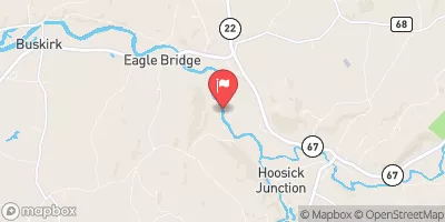 Hoosic River Near Eagle Bridge Ny
|
786cfs |
 Deerfield River At Charlemont
|
914cfs |
Area Campgrounds
| Location | Reservations | Toilets |
|---|---|---|
 Woodford State Park
|
||
 Red Mill Brook
|
||
 Clarksburg State Park
|
||
 Sherman Brook Campsite
|
||
 Historic Valley
|


 South Stream Access Area Road Pownal
 Stamford Town Line To Confluence With City Stream
 Woodford To Woodford Hollow
 First Bridge To Walloomsac Brook
 Headwaters To First Bridge
 Headwaters To North Of Searsburg Reservoir
 Woodford State Park
 Wilderness Glastenbury
 Clarksburg State Park
 Mountain Meadow Natural Area
 Historic Valley Park