Headwaters And Includes All Tributaries To Confluence With Bridge Creek River Run
Community Reviews
Been here? Share the conditions.
Reviews, ratings & photos are added in the free Snoflo iOS app — rate a spot, tag the conditions, and your visit is verified by location. Add or manage your reviews from the app.
Headwaters And Includes All Tributaries To Confluence With Bridge Creek
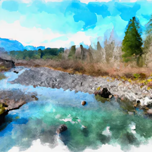
The ideal streamflow range for the Whitewater River Run is between 1,000-5,000 cubic feet per second (cfs). This range provides enough water to create thrilling rapids while still ensuring the safety of paddlers. The river is rated as a Class III-IV, which means that it has moderate to difficult rapids with significant drops and obstacles. It is recommended for experienced paddlers and those who have completed a whitewater safety course.
The segment mileage of the Whitewater River Run varies depending on the route taken. The most popular section is the 8-mile stretch between the Skagit River and the town of Marblemount. This section includes numerous rapids, such as Railroad Rapid and Pipeline Rapid, which offer an exciting challenge to paddlers.
There are specific rapids and obstacles to be aware of when navigating the Whitewater River Run. For example, Fangs Rapid is known for its series of sharp rocks that can damage equipment. Additionally, paddlers should be cautious of wood debris that can accumulate in the river and avoid the large boulders in Boulder Alley.
There are specific regulations in place to ensure the safety of all those who use the Whitewater River Run. For example, all paddlers are required to wear a US Coast Guard-approved personal flotation device (PFD) and a helmet. Additionally, there are restrictions on the use of motorized watercraft and on the placement of anchors in the river.
Overall, the Whitewater River Run offers an exciting and challenging experience for whitewater enthusiasts. With its ideal streamflow range, class rating, segment mileage, and specific rapids and obstacles, it is a must-visit destination for experienced paddlers. However, it is important to follow all regulations and safety guidelines to ensure a safe and enjoyable trip.
Plan your run down to the hour
Same weather feed Snoflo's iOS app uses -- updated continuously from NOAA / yr.no. Watch the precipitation column on the meteogram; rain ahead of a run typically lifts flows 12-48 hours later depending on the basin.
Next 5 days, hour by hour
Temperature line with weather symbols on top, snow + rain accumulation as columns, humidity as a dotted line.
5-day forecast table
Every 3 hours, broken out across temperature, snow, rain, humidity, and wind. Each cell is colour-coded relative to the column min/max.
| Time | Condition | Temp (°F) | Snow (in) | Rain (in) | Humidity (%) | Wind (mps) | Wind dir |
|---|---|---|---|---|---|---|---|
| Loading detailed forecast… | |||||||
15-day temperature & precipitation
Daily temperatures, snow, and rain projected over the next two weeks -- the upstream story that drives next week's flows.
Regional streamflow levels
USGS streamgauges around Headwaters And Includes All Tributaries To Confluence With Bridge Creek -- useful for spotting upstream pulses and gauging which tributary is contributing what.
| Streamgauge | Discharge | View |
|---|---|---|
| Stehekin River At Stehekin | 1,280 cfs | → |
| Salix Creek At S Cascade Gl Near Marblemount | 0 cfs | → |
| Methow River Above Goat Creek Near Mazama | 166 cfs | → |
| Chewuch River At Winthrop | 88 cfs | → |
| Methow River At Winthrop | 380 cfs | → |
| Thunder Creek Near Newhalem | 1,220 cfs | → |
Plan a longer trip
The closest boat launches, other paddle runs, and campgrounds so a day on the water can grow into a full weekend.
Whitewater safety
- Check the flow before you run
- Use the linked-gauge card and Regional Flow panel above. Class ratings change with flow -- a Class III at low water can become Class IV+ at high water.
- Know your skill ceiling
- Pick runs comfortably below your ceiling. Cold-water and big-water runs raise the consequences of any mistake.
- Wear the right gear
- Helmet, PFD, drysuit / wetsuit when water is below 60°F. Throw bag, knife, and whistle on your person, not in the boat.
- Scout, set safety, and run with a team
- Scout new rapids on foot, set safety with throw bags above the consequence pool, and run with at least one other competent paddler.
- Respect the river
- Strainers, undercuts, low-head dams, and wood can kill at any class rating. When in doubt, portage.
Set push alerts in the Snoflo app
Save Headwaters And Includes All Tributaries To Confluence With Bridge Creek as a favorite, set a discharge threshold (e.g. "alert me when flow hits 600 cfs"), and the iOS app pushes the moment the linked gauge crosses.
About Headwaters And Includes All Tributaries To Confluence With Bridge Creek
What's the optimal flow for Headwaters And Includes All Tributaries To Confluence With Bridge Creek?
The optimal flow depends on the section and the craft. Check the Run Details panel for the linked gauge and current status.
How fresh is the cfs reading on this page?
The linked USGS streamgauge reports continuously (every 15 minutes); Snoflo refreshes throughout the day. Hover the streamflow sparkline to read individual datapoints.
What's the whitewater class?
See the Run Details panel for the class rating Snoflo tracks for this run. Class ratings change with flow -- a Class III at low water can become Class IV in high water.
Where do I put in / take out?
Tap Directions in the hero above to open driving directions to the put-in. For shuttle planning, check the Nearby Boat Launches panel and the river run operator's site.
Can I get alerts when flows hit the optimal range?
Yes -- alerts are managed in the Snoflo iOS app. Favorite this run, set a discharge threshold, and you'll get a push the moment the gauge crosses.
Other runs near here
Snoflo-tracked paddle runs within driving distance of Headwaters And Includes All Tributaries To Confluence With Bridge Creek.