Usfs Road 2870 Bridge To Confluence With Dungeness River River Run
Community Reviews
Been here? Share the conditions.
Reviews, ratings & photos are added in the free Snoflo iOS app — rate a spot, tag the conditions, and your visit is verified by location. Add or manage your reviews from the app.
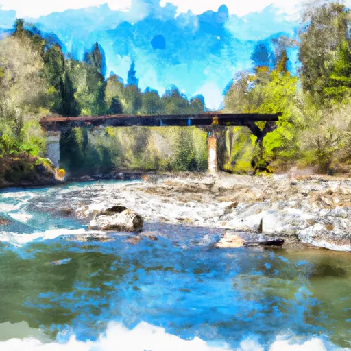
Usfs Road 2870 Bridge To Confluence With Dungeness River
The Whitewater River has several exciting rapids, including Kibbles and Bits, Rock Drop, and Couch Potato. Kibbles and Bits is a class III+ rapid, and it requires careful maneuvering around large boulders and through narrow channels. Rock Drop is a class IV rapid that features a steep drop over a large rock. Couch Potato is a class III rapid that requires precise navigation around a series of boulders.
There are specific regulations in place for the Whitewater River Run. The area is located on federal land managed by the Olympic National Forest, and a Northwest Forest Pass is required for parking. Additionally, all boaters must have a personal flotation device (PFD) and a whistle. Alcohol and drugs are prohibited, and there are restrictions on camping and fires in the area.
In conclusion, the Whitewater River Run is a thrilling and challenging destination for whitewater enthusiasts in Washington. With an ideal streamflow range of 800-3000 cfs, a class III rating, exciting rapids, and specific regulations in place, it is a must-visit for experienced boaters looking for a new challenge.
Plan your run down to the hour
Same weather feed Snoflo's iOS app uses -- updated continuously from NOAA / yr.no. Watch the precipitation column on the meteogram; rain ahead of a run typically lifts flows 12-48 hours later depending on the basin.
Next 5 days, hour by hour
Temperature line with weather symbols on top, snow + rain accumulation as columns, humidity as a dotted line.
5-day forecast table
Every 3 hours, broken out across temperature, snow, rain, humidity, and wind. Each cell is colour-coded relative to the column min/max.
| Time | Condition | Temp (°F) | Snow (in) | Rain (in) | Humidity (%) | Wind (mps) | Wind dir |
|---|---|---|---|---|---|---|---|
| Loading detailed forecast… | |||||||
15-day temperature & precipitation
Daily temperatures, snow, and rain projected over the next two weeks -- the upstream story that drives next week's flows.
Regional streamflow levels
USGS streamgauges around Usfs Road 2870 Bridge To Confluence With Dungeness River -- useful for spotting upstream pulses and gauging which tributary is contributing what.
| Streamgauge | Discharge | View |
|---|---|---|
| Dungeness River Near Sequim | 126 cfs | → |
| Big Quilcene River Below Diversion Nr Quilcene | 26 cfs | → |
| Duckabush River Near Brinnon | 61 cfs | → |
| Elwha River Above Lake Mills Nr Port Angeles | 725 cfs | → |
| Elwha River At Mcdonald Br Near Port Angeles | 380 cfs | → |
| Nf Skokomish R Bl Staircase Rpds Nr Hoodsport | 52 cfs | → |
Plan a longer trip
The closest boat launches, other paddle runs, and campgrounds so a day on the water can grow into a full weekend.
Boat launches
- Olympic Discovery Trail, Sequim
- John Wayne Marina
- Port Williams Road 2499, Sequim
- Gardiner Beach Road 551-781, Sequim
- U.S. 101 286423, Quilcene
- Leland Valley Road West 266-640, Quilcene
Other river runs
- Olympic Nf/Olympic Np Boundary To Usfs Road 2870 Bridge
- Sleepy Hollow Creek To Olympic Nf Boundary
- Silver Creek To Sleepy Hollow Creek
- Forest Road 2860 Bridge To Silver Creek
- Confluence Of Milk Creek And Heather Creeks To Forest Road 2860 Bridge
Campgrounds
- Dungeness Forks Campground
- Dungeness Forks
- Louella Cabin
- Sequim Bay State Park Camping
- Sequim Bay State Park
- Hiker Biker Camping
Whitewater safety
- Check the flow before you run
- Use the linked-gauge card and Regional Flow panel above. Class ratings change with flow -- a Class III at low water can become Class IV+ at high water.
- Know your skill ceiling
- Pick runs comfortably below your ceiling. Cold-water and big-water runs raise the consequences of any mistake.
- Wear the right gear
- Helmet, PFD, drysuit / wetsuit when water is below 60°F. Throw bag, knife, and whistle on your person, not in the boat.
- Scout, set safety, and run with a team
- Scout new rapids on foot, set safety with throw bags above the consequence pool, and run with at least one other competent paddler.
- Respect the river
- Strainers, undercuts, low-head dams, and wood can kill at any class rating. When in doubt, portage.
Set push alerts in the Snoflo app
Save Usfs Road 2870 Bridge To Confluence With Dungeness River as a favorite, set a discharge threshold (e.g. "alert me when flow hits 600 cfs"), and the iOS app pushes the moment the linked gauge crosses.
About Usfs Road 2870 Bridge To Confluence With Dungeness River
What's the optimal flow for Usfs Road 2870 Bridge To Confluence With Dungeness River?
The optimal flow depends on the section and the craft. Check the Run Details panel for the linked gauge and current status.
How fresh is the cfs reading on this page?
The linked USGS streamgauge reports continuously (every 15 minutes); Snoflo refreshes throughout the day. Hover the streamflow sparkline to read individual datapoints.
What's the whitewater class?
See the Run Details panel for the class rating Snoflo tracks for this run. Class ratings change with flow -- a Class III at low water can become Class IV in high water.
Where do I put in / take out?
Tap Directions in the hero above to open driving directions to the put-in. For shuttle planning, check the Nearby Boat Launches panel and the river run operator's site.
Can I get alerts when flows hit the optimal range?
Yes -- alerts are managed in the Snoflo iOS app. Favorite this run, set a discharge threshold, and you'll get a push the moment the gauge crosses.
Other runs near here
Snoflo-tracked paddle runs within driving distance of Usfs Road 2870 Bridge To Confluence With Dungeness River.