Alpine Lakes Wilderness Boundary To Private Land Boundary At North Section Line Of Sec 3, T23n, R14e River Run
Community Reviews
Been here? Share the conditions.
Reviews, ratings & photos are added in the free Snoflo iOS app — rate a spot, tag the conditions, and your visit is verified by location. Add or manage your reviews from the app.
Alpine Lakes Wilderness Boundary To Private Land Boundary At North Section Line Of Sec 3, T23n, R14e
The Whitewater River run is subject to specific regulations to protect the wilderness area and its resources. All boaters are required to obtain a permit from the US Forest Service before embarking on this run. Additionally, camping is allowed only at designated campsites, and fires are prohibited within 100 feet of the river and must be contained within established fire rings.
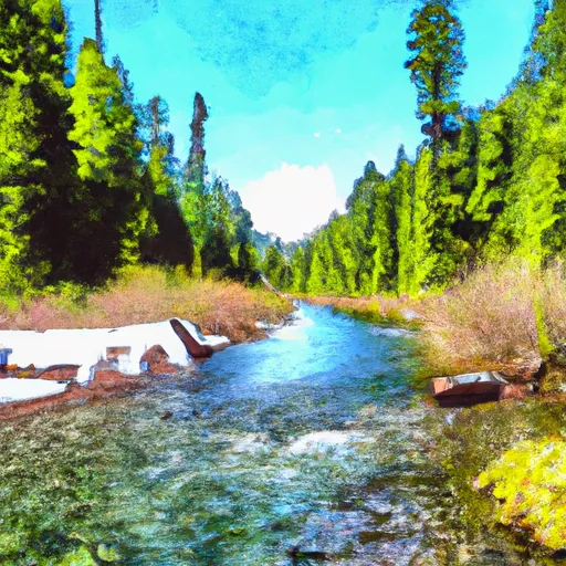
In summary, the Whitewater River run in the Alpine Lakes Wilderness area of Washington state is a thrilling class III-IV river run with a segment mileage of approximately 5.5 miles. The ideal streamflow range is between 300 and 800 cfs, and boaters must obtain a permit from the US Forest Service and follow specific regulations to protect the wilderness area and its resources.
Plan your run down to the hour
Same weather feed Snoflo's iOS app uses -- updated continuously from NOAA / yr.no. Watch the precipitation column on the meteogram; rain ahead of a run typically lifts flows 12-48 hours later depending on the basin.
Next 5 days, hour by hour
Temperature line with weather symbols on top, snow + rain accumulation as columns, humidity as a dotted line.
5-day forecast table
Every 3 hours, broken out across temperature, snow, rain, humidity, and wind. Each cell is colour-coded relative to the column min/max.
| Time | Condition | Temp (°F) | Snow (in) | Rain (in) | Humidity (%) | Wind (mps) | Wind dir |
|---|---|---|---|---|---|---|---|
| Loading detailed forecast… | |||||||
15-day temperature & precipitation
Daily temperatures, snow, and rain projected over the next two weeks -- the upstream story that drives next week's flows.
Regional streamflow levels
USGS streamgauges around Alpine Lakes Wilderness Boundary To Private Land Boundary At North Section Line Of Sec 3, T23n, R14e -- useful for spotting upstream pulses and gauging which tributary is contributing what.
| Streamgauge | Discharge | View |
|---|---|---|
| Icicle Creek Above Snow Creek Near Leavenworth | 168 cfs | → |
| Wenatchee River At Peshastin | 719 cfs | → |
| Sf Snoqualmie River Ab Alice Creek Near Garcia | 34 cfs | → |
| Wenatchee River At Plain | 545 cfs | → |
| Cedar River Below Bear Creek Near Cedar Falls | 18 cfs | → |
| Middle Fork Snoqualmie River Near Tanner | 147 cfs | → |
Plan a longer trip
The closest boat launches, other paddle runs, and campgrounds so a day on the water can grow into a full weekend.
Boat launches
- Scatter Creek Campground
- Cooper Lake Boat Launch
- Salmon La Sac Road, Ronald
- Bakers Lane, Easton
- Wish Poosh Campground And Picnic Area
- Keechelus Lake Boat Launch
Other river runs
- Headwaters In Nw1/4 Of Sec 12, T24n, R13e To Alpine Lakes Wilderness Boundary
- Alpine Lakes Wilderness Boundary To Confluence With Tye River
- Headwaters In Se1/4 Of Sec 29, T24n, R13e To Confluence With Cle Elum River
- Headwaters At Josephine Lake To Alpine Lakes Wilderness Boundary
- Rock Island Campground To Ida Creek
Whitewater safety
- Check the flow before you run
- Use the linked-gauge card and Regional Flow panel above. Class ratings change with flow -- a Class III at low water can become Class IV+ at high water.
- Know your skill ceiling
- Pick runs comfortably below your ceiling. Cold-water and big-water runs raise the consequences of any mistake.
- Wear the right gear
- Helmet, PFD, drysuit / wetsuit when water is below 60°F. Throw bag, knife, and whistle on your person, not in the boat.
- Scout, set safety, and run with a team
- Scout new rapids on foot, set safety with throw bags above the consequence pool, and run with at least one other competent paddler.
- Respect the river
- Strainers, undercuts, low-head dams, and wood can kill at any class rating. When in doubt, portage.
Set push alerts in the Snoflo app
Save Alpine Lakes Wilderness Boundary To Private Land Boundary At North Section Line Of Sec 3, T23n, R14e as a favorite, set a discharge threshold (e.g. "alert me when flow hits 600 cfs"), and the iOS app pushes the moment the linked gauge crosses.
About Alpine Lakes Wilderness Boundary To Private Land Boundary At North Section Line Of Sec 3, T23n, R14e
What's the optimal flow for Alpine Lakes Wilderness Boundary To Private Land Boundary At North Section Line Of Sec 3, T23n, R14e?
The optimal flow depends on the section and the craft. Check the Run Details panel for the linked gauge and current status.
How fresh is the cfs reading on this page?
The linked USGS streamgauge reports continuously (every 15 minutes); Snoflo refreshes throughout the day. Hover the streamflow sparkline to read individual datapoints.
What's the whitewater class?
See the Run Details panel for the class rating Snoflo tracks for this run. Class ratings change with flow -- a Class III at low water can become Class IV in high water.
Where do I put in / take out?
Tap Directions in the hero above to open driving directions to the put-in. For shuttle planning, check the Nearby Boat Launches panel and the river run operator's site.
Can I get alerts when flows hit the optimal range?
Yes -- alerts are managed in the Snoflo iOS app. Favorite this run, set a discharge threshold, and you'll get a push the moment the gauge crosses.
Other runs near here
Snoflo-tracked paddle runs within driving distance of Alpine Lakes Wilderness Boundary To Private Land Boundary At North Section Line Of Sec 3, T23n, R14e.