The Route U.S. 19 Bridge To The Confluence With The Gauley River River Run
Community Reviews
Been here? Share the conditions.
Reviews, ratings & photos are added in the free Snoflo iOS app — rate a spot, tag the conditions, and your visit is verified by location. Add or manage your reviews from the app.
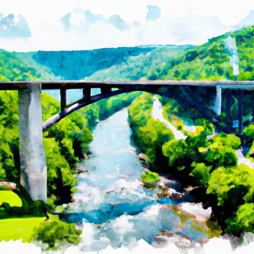
The Route U.S. 19 Bridge To The Confluence With The Gauley River
The segment mileage for the Whitewater River Run is approximately 10 miles, starting at the U.S. 19 Bridge and ending at the confluence with the Gauley River. Along the way, paddlers will encounter challenging rapids and obstacles, including large rocks and steep drops.
To ensure the safety of all paddlers, the state of West Virginia has specific regulations in place for the Whitewater River Run. All paddlers are required to wear a personal flotation device (PFD) at all times while on the river. It is also recommended that paddlers wear a helmet and proper protective gear to prevent injuries.
In conclusion, the Whitewater River Run in West Virginia is a thrilling adventure for experienced paddlers seeking a challenge. The ideal streamflow range, class rating, segment mileage, specific river rapids/obstacles, and specific regulations should all be taken into consideration before embarking on this adventure.
Plan your run down to the hour
Same weather feed Snoflo's iOS app uses -- updated continuously from NOAA / yr.no. Watch the precipitation column on the meteogram; rain ahead of a run typically lifts flows 12-48 hours later depending on the basin.
Next 5 days, hour by hour
Temperature line with weather symbols on top, snow + rain accumulation as columns, humidity as a dotted line.
5-day forecast table
Every 3 hours, broken out across temperature, snow, rain, humidity, and wind. Each cell is colour-coded relative to the column min/max.
| Time | Condition | Temp (°F) | Snow (in) | Rain (in) | Humidity (%) | Wind (mps) | Wind dir |
|---|---|---|---|---|---|---|---|
| Loading detailed forecast… | |||||||
15-day temperature & precipitation
Daily temperatures, snow, and rain projected over the next two weeks -- the upstream story that drives next week's flows.
Regional streamflow levels
USGS streamgauges around The Route U.S. 19 Bridge To The Confluence With The Gauley River -- useful for spotting upstream pulses and gauging which tributary is contributing what.
| Streamgauge | Discharge | View |
|---|---|---|
| Meadow River At Nallen | 551 cfs | → |
| Peters Creek Near Lockwood | 34 cfs | → |
| Gauley River Above Belva | 1,690 cfs | → |
| Kanawha River At Kanawha Falls | 6,790 cfs | → |
| New River At Thurmond | 4,590 cfs | → |
| Gauley River Near Craigsville | 413 cfs | → |
Plan a longer trip
The closest boat launches, other paddle runs, and campgrounds so a day on the water can grow into a full weekend.
Boat launches
- Battle Run Public Boat Launch
- Heritage Farms Drive Nicholas County
- Battle Run
- County Route 19/32 Nicholas County
- Us 19;Wv 41 Summersville
- Fayette Station Road Fayetteville
Other river runs
- Upper Gauley - Summersville Dam To Mason Branch
- Begins Below Summersville Lake To The Town Of Swiss
- Meadow Creek Junction To The Route U.S. 19 Bridge
- Rabbit Run To Private Land .5 Mile From Richwood
- The Cora Brown Bridge In Nicholas County To The Confluence With The Elk River In Braxton County
Campgrounds
- Ray's Campground
- Carnifex Ferry Cabins
- Battle Run
- Battle Run Campground
- Mountain Lake Campground
- Gauley River Wild & Woolly Primitive Campground
Whitewater safety
- Check the flow before you run
- Use the linked-gauge card and Regional Flow panel above. Class ratings change with flow -- a Class III at low water can become Class IV+ at high water.
- Know your skill ceiling
- Pick runs comfortably below your ceiling. Cold-water and big-water runs raise the consequences of any mistake.
- Wear the right gear
- Helmet, PFD, drysuit / wetsuit when water is below 60°F. Throw bag, knife, and whistle on your person, not in the boat.
- Scout, set safety, and run with a team
- Scout new rapids on foot, set safety with throw bags above the consequence pool, and run with at least one other competent paddler.
- Respect the river
- Strainers, undercuts, low-head dams, and wood can kill at any class rating. When in doubt, portage.
Set push alerts in the Snoflo app
Save The Route U.S. 19 Bridge To The Confluence With The Gauley River as a favorite, set a discharge threshold (e.g. "alert me when flow hits 600 cfs"), and the iOS app pushes the moment the linked gauge crosses.
About The Route U.S. 19 Bridge To The Confluence With The Gauley River
What's the optimal flow for The Route U.S. 19 Bridge To The Confluence With The Gauley River?
The optimal flow depends on the section and the craft. Check the Run Details panel for the linked gauge and current status.
How fresh is the cfs reading on this page?
The linked USGS streamgauge reports continuously (every 15 minutes); Snoflo refreshes throughout the day. Hover the streamflow sparkline to read individual datapoints.
What's the whitewater class?
See the Run Details panel for the class rating Snoflo tracks for this run. Class ratings change with flow -- a Class III at low water can become Class IV in high water.
Where do I put in / take out?
Tap Directions in the hero above to open driving directions to the put-in. For shuttle planning, check the Nearby Boat Launches panel and the river run operator's site.
Can I get alerts when flows hit the optimal range?
Yes -- alerts are managed in the Snoflo iOS app. Favorite this run, set a discharge threshold, and you'll get a push the moment the gauge crosses.
Other runs near here
Snoflo-tracked paddle runs within driving distance of The Route U.S. 19 Bridge To The Confluence With The Gauley River.