The U.S. Forest Service Cranberry Campground To The Confluence With The Gauley River River Run
Community Reviews
Been here? Share the conditions.
Reviews, ratings & photos are added in the free Snoflo iOS app — rate a spot, tag the conditions, and your visit is verified by location. Add or manage your reviews from the app.
The U.S. Forest Service Cranberry Campground To The Confluence With The Gauley River
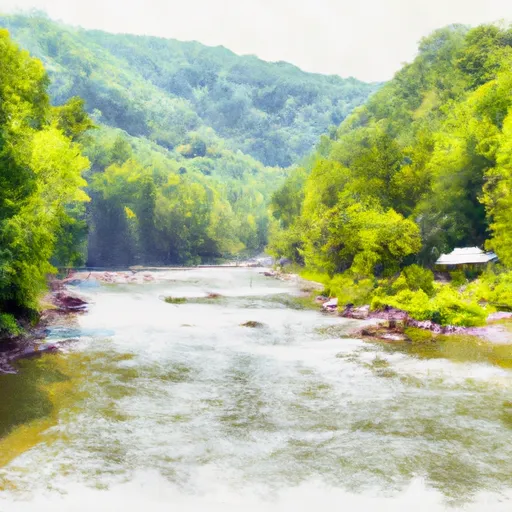
This river is known for its adrenaline-pumping rapids, including Sweets Falls, Big Rock, Iron Ring, and Devil's Backbone. These rapids range from class III to IV and require technical skills to navigate. It is important for kayakers and rafters to be prepared and have adequate experience before attempting this river.
Some specific regulations to the area include the requirement of personal flotation devices (PFDs) for all participants, and the prohibition of alcohol on the river. The U.S. Forest Service also requires a permit for commercial use of the river, and all participants must follow the “leave no trace” principles to minimize impact on the environment.
Overall, the Whitewater River Run is a challenging and exhilarating experience for skilled kayakers and rafters, but it is important to be prepared, follow regulations, and respect the environment.
Plan your run down to the hour
Same weather feed Snoflo's iOS app uses -- updated continuously from NOAA / yr.no. Watch the precipitation column on the meteogram; rain ahead of a run typically lifts flows 12-48 hours later depending on the basin.
Next 5 days, hour by hour
Temperature line with weather symbols on top, snow + rain accumulation as columns, humidity as a dotted line.
5-day forecast table
Every 3 hours, broken out across temperature, snow, rain, humidity, and wind. Each cell is colour-coded relative to the column min/max.
| Time | Condition | Temp (°F) | Snow (in) | Rain (in) | Humidity (%) | Wind (mps) | Wind dir |
|---|---|---|---|---|---|---|---|
| Loading detailed forecast… | |||||||
15-day temperature & precipitation
Daily temperatures, snow, and rain projected over the next two weeks -- the upstream story that drives next week's flows.
Regional streamflow levels
USGS streamgauges around The U.S. Forest Service Cranberry Campground To The Confluence With The Gauley River -- useful for spotting upstream pulses and gauging which tributary is contributing what.
| Streamgauge | Discharge | View |
|---|---|---|
| Williams River At Dyer | 62 cfs | → |
| Cranberry River Near Richwood | 68 cfs | → |
| Gauley River Near Craigsville | 354 cfs | → |
| Elk River Below Webster Springs | 102 cfs | → |
| Greenbrier River At Buckeye | 204 cfs | → |
| Birch River At Herold | 11 cfs | → |
Plan a longer trip
The closest boat launches, other paddle runs, and campgrounds so a day on the water can grow into a full weekend.
Boat launches
- Summit Lake Trail No 201 Greenbrier County
- Big Ditch Lake
- Handley Water Management Area Lake
- Persinger Ford Road Nicholas County
Other river runs
- Three Forks To Spice Run
- The Junction With Williams River To The Junction With Panther Creek
- Darnell Run To Rabbit Run
- Rabbit Run To Private Land .5 Mile From Richwood
- The Headwaters To The U.S. Forest Service Cranberry Campground
Whitewater safety
- Check the flow before you run
- Use the linked-gauge card and Regional Flow panel above. Class ratings change with flow -- a Class III at low water can become Class IV+ at high water.
- Know your skill ceiling
- Pick runs comfortably below your ceiling. Cold-water and big-water runs raise the consequences of any mistake.
- Wear the right gear
- Helmet, PFD, drysuit / wetsuit when water is below 60°F. Throw bag, knife, and whistle on your person, not in the boat.
- Scout, set safety, and run with a team
- Scout new rapids on foot, set safety with throw bags above the consequence pool, and run with at least one other competent paddler.
- Respect the river
- Strainers, undercuts, low-head dams, and wood can kill at any class rating. When in doubt, portage.
Set push alerts in the Snoflo app
Save The U.S. Forest Service Cranberry Campground To The Confluence With The Gauley River as a favorite, set a discharge threshold (e.g. "alert me when flow hits 600 cfs"), and the iOS app pushes the moment the linked gauge crosses.
About The U.S. Forest Service Cranberry Campground To The Confluence With The Gauley River
What's the optimal flow for The U.S. Forest Service Cranberry Campground To The Confluence With The Gauley River?
The optimal flow depends on the section and the craft. Check the Run Details panel for the linked gauge and current status.
How fresh is the cfs reading on this page?
The linked USGS streamgauge reports continuously (every 15 minutes); Snoflo refreshes throughout the day. Hover the streamflow sparkline to read individual datapoints.
What's the whitewater class?
See the Run Details panel for the class rating Snoflo tracks for this run. Class ratings change with flow -- a Class III at low water can become Class IV in high water.
Where do I put in / take out?
Tap Directions in the hero above to open driving directions to the put-in. For shuttle planning, check the Nearby Boat Launches panel and the river run operator's site.
Can I get alerts when flows hit the optimal range?
Yes -- alerts are managed in the Snoflo iOS app. Favorite this run, set a discharge threshold, and you'll get a push the moment the gauge crosses.
Other runs near here
Snoflo-tracked paddle runs within driving distance of The U.S. Forest Service Cranberry Campground To The Confluence With The Gauley River.