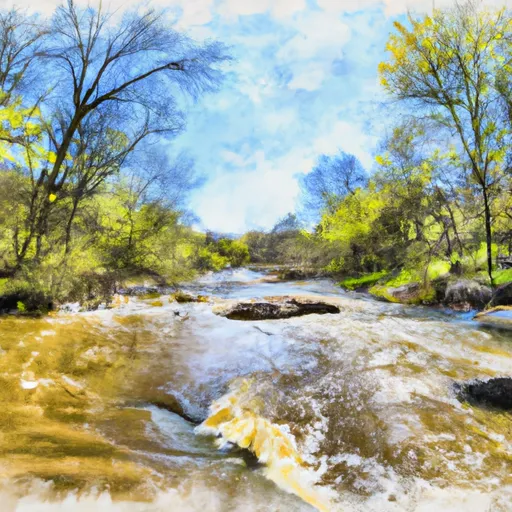
South Branch--Origin In Sec 25, T38n, R14e To Confluence With Main Branch River Run
Community Reviews
Been here? Share the conditions.
Reviews, ratings & photos are added in the free Snoflo iOS app — rate a spot, tag the conditions, and your visit is verified by location. Add or manage your reviews from the app.
South Branch--Origin In Sec 25, T38n, R14e To Confluence With Main Branch
There are several notable rapids and obstacles along the route, such as the "Rock Garden," which is a tight section of the river with several small boulders to navigate around, and "Twin Sisters," which is a pair of back-to-back class III rapids. Additionally, there are several narrow sections of the river that require precise maneuvering to avoid obstacles.
It is important to note that there are specific regulations in place for the Whitewater River Run South Branch. Paddlers must wear a personal flotation device at all times, and camping is only allowed in designated areas. Additionally, paddlers must be aware of private property along the river and respect the landowners' rights.
Plan your run down to the hour
Same weather feed Snoflo's iOS app uses -- updated continuously from NOAA / yr.no. Watch the precipitation column on the meteogram; rain ahead of a run typically lifts flows 12-48 hours later depending on the basin.
Next 5 days, hour by hour
Temperature line with weather symbols on top, snow + rain accumulation as columns, humidity as a dotted line.
5-day forecast table
Every 3 hours, broken out across temperature, snow, rain, humidity, and wind. Each cell is colour-coded relative to the column min/max.
| Time | Condition | Temp (°F) | Snow (in) | Rain (in) | Humidity (%) | Wind (mps) | Wind dir |
|---|---|---|---|---|---|---|---|
| Loading detailed forecast… | |||||||
15-day temperature & precipitation
Daily temperatures, snow, and rain projected over the next two weeks -- the upstream story that drives next week's flows.
Regional streamflow levels
USGS streamgauges around South Branch--Origin In Sec 25, T38n, R14e To Confluence With Main Branch -- useful for spotting upstream pulses and gauging which tributary is contributing what.
| Streamgauge | Discharge | View |
|---|---|---|
| Popple River Near Fence | 51 cfs | → |
| Pine River Below Pine R Powerplant Nr Florence | 204 cfs | → |
| Brule River At Us Highway 2 Near Florence | 214 cfs | → |
| Brule River Near Commonwealth | 537 cfs | → |
| Iron River At County Hwy-424 At Caspian | 69 cfs | → |
| Menominee River Near Florence | 875 cfs | → |
Plan a longer trip
The closest boat launches, other paddle runs, and campgrounds so a day on the water can grow into a full weekend.
Boat launches
- Morgan Lake -- Access
- Gordon Lake -- Access At Se Part Of Lake Nr Laura Lake Road 121
- Laura Lake -- Access
- Ross Lake -- Access
- Hilbert Lake -- Access
- North Nicolet Road 4870, Town Of Ross
Other river runs
- Forest Road 2398 To Eastern Forest Boundary
- Forest Road 2167 To Highway 139
- Highway 139 To Forest Road 2398
- Main Branch-Forest Boundary In Sec 18, T37n, R15e To Railroad Bridge
- Railroad Bridge To 1/4 Mile Downstream From The Ccc Bridge
Campgrounds
- Morgan Lake
- Morgan Lake Recreation Area
- Laura And Gordon Lake Recreation Area
- Laura Lake
- Laura-Gordon Lakes Campground
- Lost Lake Cabins
Fishing spots
Whitewater safety
- Check the flow before you run
- Use the linked-gauge card and Regional Flow panel above. Class ratings change with flow -- a Class III at low water can become Class IV+ at high water.
- Know your skill ceiling
- Pick runs comfortably below your ceiling. Cold-water and big-water runs raise the consequences of any mistake.
- Wear the right gear
- Helmet, PFD, drysuit / wetsuit when water is below 60°F. Throw bag, knife, and whistle on your person, not in the boat.
- Scout, set safety, and run with a team
- Scout new rapids on foot, set safety with throw bags above the consequence pool, and run with at least one other competent paddler.
- Respect the river
- Strainers, undercuts, low-head dams, and wood can kill at any class rating. When in doubt, portage.
Set push alerts in the Snoflo app
Save South Branch--Origin In Sec 25, T38n, R14e To Confluence With Main Branch as a favorite, set a discharge threshold (e.g. "alert me when flow hits 600 cfs"), and the iOS app pushes the moment the linked gauge crosses.
About South Branch--Origin In Sec 25, T38n, R14e To Confluence With Main Branch
What's the optimal flow for South Branch--Origin In Sec 25, T38n, R14e To Confluence With Main Branch?
The optimal flow depends on the section and the craft. Check the Run Details panel for the linked gauge and current status.
How fresh is the cfs reading on this page?
The linked USGS streamgauge reports continuously (every 15 minutes); Snoflo refreshes throughout the day. Hover the streamflow sparkline to read individual datapoints.
What's the whitewater class?
See the Run Details panel for the class rating Snoflo tracks for this run. Class ratings change with flow -- a Class III at low water can become Class IV in high water.
Where do I put in / take out?
Tap Directions in the hero above to open driving directions to the put-in. For shuttle planning, check the Nearby Boat Launches panel and the river run operator's site.
Can I get alerts when flows hit the optimal range?
Yes -- alerts are managed in the Snoflo iOS app. Favorite this run, set a discharge threshold, and you'll get a push the moment the gauge crosses.
Other runs near here
Snoflo-tracked paddle runs within driving distance of South Branch--Origin In Sec 25, T38n, R14e To Confluence With Main Branch.