State Forest Kettle Moraine
Community Reviews
Been here? Share the conditions.
Reviews, ratings & photos are added in the free Snoflo iOS app — rate a spot, tag the conditions, and your visit is verified by location. Add or manage your reviews from the app.
State Forest Kettle Moraine
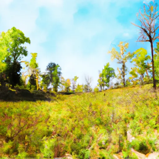
The Kettle Moraine State Forest, Wisconsin, is a captivating natural area that offers visitors a wide array of recreational opportunities and stunning landscapes. Here are some good reasons to visit this state forest, notable points of interest to see, interesting facts about the area, and the best time of year to visit:
Reasons to Visit:
1. Natural Beauty: The Kettle Moraine State Forest is renowned for its exceptional glacial landforms, including kettles, moraines, and winding eskers. These unique geological features offer breathtaking views and opportunities for outdoor enthusiasts to explore.
2. Recreational Activities: The forest provides countless opportunities for hiking, biking, horseback riding, camping, fishing, boating, and wildlife observation. With over 160 miles of trails, visitors can enjoy a variety of outdoor activities and experience the forest's diverse ecosystems.
3. Educational Opportunities: The state forest offers a range of interpretive programs, including guided hikes, nature walks, and educational presentations, allowing visitors to deepen their understanding of the local flora, fauna, and geology.
Points of Interest:
1. Ice Age National Scenic Trail: This trail traverses the Kettle Moraine State Forest and is part of a larger trail system that showcases the unique glacial landscape formed during the last Ice Age. It offers hikers and backpackers a chance to explore the region's geological wonders.
2. Pike Lake Unit: Known for its picturesque Pike Lake, this unit of the state forest offers swimming beaches, picnic areas, and a nature center. Visitors can also explore the adjacent Powder Hill, which provides panoramic views of the surrounding landscape.
3. Southern Unit: The largest unit of the Kettle Moraine State Forest, the Southern Unit boasts rolling hills, glacial lakes, and extensive trails. Visitors can enjoy camping, fishing, horseback riding, and skiing during winter months.
Interesting Facts:
1. The Kettle Moraine State Forest was formed by the last continental glacier, which created a series of ridges and depressions in the landscape.
2. The forest spans over 30,000 acres across multiple units, including the Northern, Southern, Lapham Peak, and Pike Lake units.
3. Kettle Moraine is home to a diverse range of plant and animal species, including white-tailed deer, foxes, wild turkeys, and a variety of bird species.
Best Time to Visit:
The Kettle Moraine State Forest offers year-round opportunities, each season presenting unique experiences. Spring brings blooming wildflowers, while summer provides ideal conditions for outdoor activities like swimming and hiking. Fall showcases vibrant foliage colors, attracting visitors for scenic drives and hiking. Winter offers opportunities for cross-country skiing, snowshoeing, and ice fishing.
Please note that it is essential to verify the information provided by consulting multiple independent sources to ensure accuracy.
Trails in State Forest Kettle Moraine
Named trails whose route falls inside the park.
Camping in State Forest Kettle Moraine
Campgrounds inside the park, with today's conditions score.


Plan your visit down to the hour
Same weather feed Snoflo's iOS app uses -- updated continuously from NOAA / yr.no.
Next 5 days, hour by hour
Temperature line with weather symbols on top, snow + rain accumulation as columns, humidity as a dotted line.
5-day forecast table
Every 3 hours, broken out across temperature, snow, rain, humidity, and wind.
| Time | Condition | Temp (°F) | Snow (in) | Rain (in) | Humidity (%) | Wind (mps) | Wind dir |
|---|---|---|---|---|---|---|---|
| Loading detailed forecast… | |||||||
15-day temperature & precipitation
Daily temperatures, snow, and rain projected over the next two weeks.
Responsible recreation & Leave No Trace
- Know before you go
- Check the operator's site for hours, permit requirements, seasonal closures, and fire restrictions before heading out.
- Stay on trail
- Stick to marked paths to protect vegetation, prevent erosion, and avoid disturbing wildlife habitat.
- Respect wildlife
- Observe from a distance, never feed wildlife, and store food securely if camping is permitted on-site.
- Pack it in, pack it out
- Carry out all trash, food scraps, and gear. Many parks have limited or no trash service.
- Leave what you find
- Don't take rocks, plants, or artifacts. They make the park what it is for the next visitor.
Set push alerts in the Snoflo app
Save State Forest Kettle Moraine as a favorite, set a custom threshold (precipitation, freezing temperatures, fire-restriction days), and the iOS app will push the moment conditions cross.
About State Forest Kettle Moraine
What can I do at State Forest Kettle Moraine?
Most Snoflo-tracked parks support hiking, picnicking, and wildlife viewing. Check the operator's site for activity-specific rules (camping, fishing, paddling, hunting).
How fresh is the weather data?
The hourly forecast updates throughout the day from NOAA / yr.no. Streamflow comes live from USGS streamgauges.
When is the best time to visit?
Use the 15-day temperature & precipitation outlook on this page to plan -- pick a window with comfortable temperatures and low precipitation.
How do I get to State Forest Kettle Moraine?
Tap Directions in the hero above to open driving directions in Google Maps, or Open in map to center the Snoflo interactive map on the park.
Can I get alerts when conditions change?
Yes -- alerts are managed in the Snoflo iOS app. Favorite this park, set a threshold (temperature, precipitation), and you'll get a push the moment it crosses.
Park & land designation reference
A quick legend for the federal and state land categories Snoflo tracks. Each designation comes with different rules around access, recreation, and resource extraction.
- National Park
- Large protected natural areas managed by the federal government to preserve significant landscapes, ecosystems, and cultural resources; recreation is allowed but conservation is the priority.
- State Park
- Public natural or recreational areas managed by a state government, typically smaller than national parks and focused on regional natural features, recreation, and education.
- Local Park
- Community-level parks managed by cities or counties, emphasizing recreation, playgrounds, sports, and green space close to populated areas.
- Wilderness Area
- The highest level of land protection in the U.S.; designated areas where nature is left essentially untouched, with no roads, structures, or motorized motorized access permitted.
- National Recreation Area
- Areas set aside primarily for outdoor recreation (boating, hiking, fishing, often around reservoirs, rivers, or scenic landscapes); may allow more development.
- National Conservation Area (BLM)
- BLM-managed areas with special ecological, cultural, or scientific value; more protection than typical BLM land but less strict than Wilderness Areas.
- State Forest
- State-managed forests focused on habitat, watershed, recreation, and sustainable timber harvest.
- Bureau of Land Management (BLM) Land
- Vast federal lands managed for mixed use -- recreation, grazing, mining, conservation -- with fewer restrictions than national parks or forests.