Park

Mark Twain National Forest

Arkansas, USA Upper White watershed 36.501°, -93.362°
Today high
--
Tonight low
--
Campgrounds
60
Trails
60
Points of interest
4
Loading current conditions…
Next 24 hours
Loading next 24 hours…

Community Reviews

Loading reviews…

Been here? Share the conditions.

Reviews, ratings & photos are added in the free Snoflo iOS app — rate a spot, tag the conditions, and your visit is verified by location. Add or manage your reviews from the app.
Get the app
Mark Twain National Forest -- Arkansas park
Mark Twain National Forest Arkansas · Upper White watershed
About this park

Mark Twain National Forest

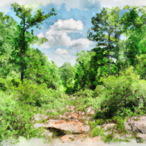
Mark Twain National Forest is a sprawling forest reserve located in the Ozark Highlands of Arkansas. The forest covers over 1.5 million acres and is home to a diverse range of wildlife and outdoor recreation opportunities.

One of the main reasons to visit Mark Twain National Forest is to enjoy the many outdoor activities available. Hiking, camping, fishing, and hunting are just a few of the popular activities visitors can enjoy. The forest also has over 700 miles of trails for hiking, horseback riding, and mountain biking.

There are several specific points of interest to see in Mark Twain National Forest. The Hercules Glades Wilderness Area is a popular spot for hiking and features stunning views and unique rock formations. The Big Piney Creek Recreation Area is another great spot for outdoor activities, with opportunities for swimming, fishing, and camping.

Interesting facts about the area include the fact that the forest was named after the famous American author Mark Twain, who was born in Missouri. The forest is also home to a variety of unique plant and animal species, including the Ozark big-eared bat and the Ozark chinquapin tree.

The best time of year to visit Mark Twain National Forest depends on the activities you want to enjoy. Spring and fall are popular times for hiking and camping, while summer is the best time for swimming and water activities. Winter can be a great time for hunting and other outdoor activities, but visitors should be prepared for colder temperatures.

Overall, Mark Twain National Forest is a beautiful and diverse area that offers something for everyone. Whether you enjoy hiking, camping, fishing, or just exploring the great outdoors, this forest is definitely worth a visit.
StateArkansas
WatershedUpper White
Latitude36.5008°
Longitude-93.3618°
In the park

Streamflow in Mark Twain National Forest

Live USGS discharge at streamgauges inside the park boundary.

GaugeFlow
St. Francis River Near Mill Creek · 2.83 ft gage 317 cfs
Little St. Francis River At Fredericktown · 1.78 ft gage 30 cfs
St. Francis River At Wappapello · 15.67 ft gage 2,810 cfs
Roubidoux Creek Above Ft. Leonard Wood · 2.42 ft gage 25 cfs
Big Piney River Near Big Piney · 2.57 ft gage 207 cfs
Big Piney Below Ft. Leonard Wood · 1.98 ft gage 257 cfs
Beaver Creek At Bradleyville · 2.88 ft gage 79 cfs
Black River At Leeper · 7.21 ft gage 3,680 cfs
East Fork Black River Nr Lesterville · 1.70 ft gage 76 cfs
Eleven Point River Near Bardley · 2.58 ft gage 473 cfs
In the park

Trails in Mark Twain National Forest

Named trails whose route falls inside the park.

17-365
3.5 mi · Hiking, Running
417
2.7 mi · Hiking, Running
Allison Cemetery Trail
2.6 mi · Hiking, Running
Bateman Bottoms
3.7 mi · Hiking, Running
Bell Mountain Trail
8.1 mi · Hiking, Horseback, Running
Big Piney Trail
16.1 mi · Hiking, Running
Black River Trail System
3.1 mi · Biking, Hiking, Running
Campground Trail System
1.9 mi · Biking, Hiking, Running
Campground Trail System
0.6 mi · Biking, Hiking, Running
Cc Wrangler Trail / Ozark Trail - North Fork Section
1.3 mi · Hiking, Running
Cedar Creek Trail
27.9 mi · Hiking, Running
Cedar Creek Trail - Moon Loop
0.1 mi · Hiking, Running
Cedar Creek Trail - Moon Loop
4.4 mi · Hiking, Running
Chadwick 127d
1.3 mi · Hiking, Running
Connector - Ozark Trail To University Forest Trail
8.4 mi · Hiking, Running
County Road 14-361
1.1 mi · Hiking, Running
County Road 519
0.7 mi · Hiking, Running
Cove Road
0.2 mi · Hiking, Running
Devil's Kitchen Trail
1.5 mi · Hiking, Running
Eagle's Nest Trail
2.0 mi · Hiking, Running
Fire Tower Trail
6.6 mi · Hiking, Running
Fire Trail 2281
1.5 mi · Hiking, Running
Forest Rd 3215
2.2 mi · Hiking, Running
Forest Road 4178
3.4 mi · Hiking, Running
Forest Road 735
1.2 mi · Hiking, Running
Forest Road 825
1.1 mi · Hiking, Running
Forest Route 426
2.9 mi · Hiking, Running
Forestry Tr
1.0 mi · Hiking, Running
Fs 2455
0.7 mi · Hiking, Running
Hercules Glade Wilderness Loop
21.2 mi · Hiking, Horseback, Running
James Stephens Eagle Project Bridge
0.0 mi · Hiking, Running
John J Audubon Trail
11.9 mi · Hiking, Running
Lake Wappapello Trail
12.7 mi · Biking, Hiking, Horseback, Running
Lookout Trail
3.7 mi · Hiking, Running
Magnolia Drive
4.9 mi · Hiking, Running
Mill View Trail
1.3 mi · Hiking, Running
Mobley Road
0.2 mi · Hiking, Running
Ottery Cemetary Road
0.8 mi · Hiking, Running
Ozark Trail - Eleven Point Greer
1.1 mi · Biking, Hiking, Horseback, Running
Ozark Trail - Wappapello Section
26.6 mi · Biking, Hiking, Horseback, Running
Ozark Trail North Fork
12.5 mi · Biking, Hiking, Horseback, Running
Ridge Runner Trail
3.8 mi · Hiking, Running
Ridge Runner Trail / Ozark Trail - North Fork
6.3 mi · Hiking, Running
Ripple Lane
0.5 mi · Hiking, Running
Riverside Camp Road
0.1 mi · Biking, Hiking, Running
Shirley School Road
1.2 mi · Hiking, Running
Silver Mines East Trail
0.8 mi · Hiking, Running
Steam Drive
3.3 mi · Hiking, Running
Sutton Bluff Atv 1
6.8 mi · Hiking, Running
Sutton Bluff Atv 13
0.3 mi · Hiking, Running
Sutton Bluff Atv 15
4.4 mi · Hiking, Running
Thorn Lane
1.8 mi · Hiking, Running
Tin Top
6.4 mi · Biking, Hiking, Horseback, Running
Top Ozark Road
1.1 mi · Hiking, Running
University Forest Trail
0.5 mi · Hiking, Running
Walk In Campsites
0.3 mi · Hiking, Running
White Creek Trail
17.5 mi · Hiking, Running
Whitetail Road
1.0 mi · Hiking, Running
Windsor Lane
3.6 mi · Hiking, Running
Wolf Creek Trail
11.0 mi · Hiking, Running
In the park

Camping in Mark Twain National Forest

Campgrounds inside the park, with today's conditions score.

B Bar-K Wrangler Camp
Bar-K Wrangler Camp
B Barn Hollow Float Camp
Barn Hollow Float Camp
B Baxter - Table Rock Lake
Baxter - Table Rock Lake
B Berryman
Berryman
B Berryman Campground
Berryman Campground
B Big M - Table Rock Lake
Big M - Table Rock Lake
B Big Piney Equestrian Camp
Big Piney Equestrian Camp
B Big Piney Trail Primitive
Big Piney Trail Primitive
B Big Piney Trail Primitive
Big Piney Trail Primitive
B Boze Mill Float Camp
Boze Mill Float Camp
B Brazil Creek Trailhead
Brazil Creek Trailhead
C Camelot Rv Park
Camelot Rv Park
C Campbell Point - Table Rock Lake
Campbell Point - Table Rock Lake
C Cobb Ridge
Cobb Ridge
C Cobb Ridge Recreation Area
Cobb Ridge Recreation Area
C Council Bluff - Wild Boar Ridge
Council Bluff - Wild Boar Ridge
C Council Bluff Recreation Area
Council Bluff Recreation Area
D Devils Elbow Campground
Devils Elbow Campground
D Dry Fork
Dry Fork
D Dry Fork Campground
Dry Fork Campground
D Dry Fork Recreation Area
Dry Fork Recreation Area
E Eagle Rock - Table Rock Lake
Eagle Rock - Table Rock Lake
E East Camp
East Camp
F Fourche Lake Recreation Area
Fourche Lake Recreation Area
G Gooseneck
Gooseneck
G Greenbriar Float Camp
Greenbriar Float Camp
G Greenville - Lake Wappapello
Greenville - Lake Wappapello
G Greer Crossing
Greer Crossing
G Greer Crossing Recreation Area
Greer Crossing Recreation Area
H Hazel Creek
Hazel Creek
H Hazel Creek Campground
Hazel Creek Campground
H Horseshoe Bend Float Camp
Horseshoe Bend Float Camp
J Johnsons Shut-Ins State Park
Johnsons Shut-Ins State Park
L Leadership Village
Leadership Village
M Marble Creek Rec Area
Marble Creek Rec Area
M Marble Creek Recreation Area
Marble Creek Recreation Area
M Markham Springs Recreation Area
Markham Springs Recreation Area
M Mccormack Lake Recreation Area
Mccormack Lake Recreation Area
M Morgan Spring Float Camp
Morgan Spring Float Camp
N Noblett Lake Campground
Noblett Lake Campground
O Ozark Trail Gunstock Hollow
Ozark Trail Gunstock Hollow
P Paddy Creek
Paddy Creek
P Panther Branch
Panther Branch
P Pine Ridge
Pine Ridge
P Pine Ridge Campground
Pine Ridge Campground
P Pine Ridge Recreation Area
Pine Ridge Recreation Area
P Piney River Military - Fort Leonard Wood
Piney River Military - Fort Leonard Wood
R Ranger Site
Ranger Site
R Red Bluff
Red Bluff
R Roaring River State Park
Roaring River State Park
S Silver Mines
Silver Mines
S Silver Mines Recreation Area
Silver Mines Recreation Area
S Slabtown Recreation Area
Slabtown Recreation Area
S Stinking Pond Float Camp
Stinking Pond Float Camp
S Sulphur Springs - Lake Wappapello
Sulphur Springs - Lake Wappapello
S Sutton Bluff
Sutton Bluff
S Sutton Bluff Recreation Area
Sutton Bluff Recreation Area
S Sycamore Loop Dispersed - Noblett Lake
Sycamore Loop Dispersed - Noblett Lake
T Trailhead Campsite
Trailhead Campsite
V Viney Creek
Viney Creek
In the park

Points of interest in Mark Twain National Forest

Landmarks and points of interest inside the park boundary.

B Beebe's Roaring River Waterslide
Beebe's Roaring River Waterslide
Attraction
H Huck's Cove
Huck's Cove
Theme Park
U U.S. Army Engineer, Chemical, And Military Police Museum
U.S. Army Engineer, Chemical, And Military Police Museum
Museum
U Uranus, Missouri
Uranus, Missouri
Attraction
Detailed forecast

Plan your visit down to the hour

Same weather feed Snoflo's iOS app uses -- updated continuously from NOAA / yr.no.

Hourly detail

Next 5 days, hour by hour

Temperature line with weather symbols on top, snow + rain accumulation as columns, humidity as a dotted line.

Loading hourly forecast…
Deep dive

5-day forecast table

Every 3 hours, broken out across temperature, snow, rain, humidity, and wind.

TimeConditionTemp (°F)Snow (in)Rain (in)Humidity (%)Wind (mps)Wind dir
Loading detailed forecast…
Long-term outlook

15-day temperature & precipitation

Daily temperatures, snow, and rain projected over the next two weeks.

Loading 15-day outlook…

Responsible recreation & Leave No Trace

Know before you go
Check the operator's site for hours, permit requirements, seasonal closures, and fire restrictions before heading out.
Stay on trail
Stick to marked paths to protect vegetation, prevent erosion, and avoid disturbing wildlife habitat.
Respect wildlife
Observe from a distance, never feed wildlife, and store food securely if camping is permitted on-site.
Pack it in, pack it out
Carry out all trash, food scraps, and gear. Many parks have limited or no trash service.
Leave what you find
Don't take rocks, plants, or artifacts. They make the park what it is for the next visitor.

Set push alerts in the Snoflo app

Save Mark Twain National Forest as a favorite, set a custom threshold (precipitation, freezing temperatures, fire-restriction days), and the iOS app will push the moment conditions cross.

FAQ

About Mark Twain National Forest

What can I do at Mark Twain National Forest?

Most Snoflo-tracked parks support hiking, picnicking, and wildlife viewing. Check the operator's site for activity-specific rules (camping, fishing, paddling, hunting).

How fresh is the weather data?

The hourly forecast updates throughout the day from NOAA / yr.no. Streamflow comes live from USGS streamgauges.

When is the best time to visit?

Use the 15-day temperature & precipitation outlook on this page to plan -- pick a window with comfortable temperatures and low precipitation.

How do I get to Mark Twain National Forest?

Tap Directions in the hero above to open driving directions in Google Maps, or Open in map to center the Snoflo interactive map on the park.

Can I get alerts when conditions change?

Yes -- alerts are managed in the Snoflo iOS app. Favorite this park, set a threshold (temperature, precipitation), and you'll get a push the moment it crosses.

Land designation

Park & land designation reference

A quick legend for the federal and state land categories Snoflo tracks. Each designation comes with different rules around access, recreation, and resource extraction.

National Park
Large protected natural areas managed by the federal government to preserve significant landscapes, ecosystems, and cultural resources; recreation is allowed but conservation is the priority.
State Park
Public natural or recreational areas managed by a state government, typically smaller than national parks and focused on regional natural features, recreation, and education.
Local Park
Community-level parks managed by cities or counties, emphasizing recreation, playgrounds, sports, and green space close to populated areas.
Wilderness Area
The highest level of land protection in the U.S.; designated areas where nature is left essentially untouched, with no roads, structures, or motorized motorized access permitted.
National Recreation Area
Areas set aside primarily for outdoor recreation (boating, hiking, fishing, often around reservoirs, rivers, or scenic landscapes); may allow more development.
National Conservation Area (BLM)
BLM-managed areas with special ecological, cultural, or scientific value; more protection than typical BLM land but less strict than Wilderness Areas.
State Forest
State-managed forests focused on habitat, watershed, recreation, and sustainable timber harvest.
Bureau of Land Management (BLM) Land
Vast federal lands managed for mixed use -- recreation, grazing, mining, conservation -- with fewer restrictions than national parks or forests.