San Joaquin River National Wildlife Refuge
Community Reviews
Been here? Share the conditions.
Reviews, ratings & photos are added in the free Snoflo iOS app — rate a spot, tag the conditions, and your visit is verified by location. Add or manage your reviews from the app.
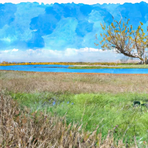
San Joaquin River National Wildlife Refuge
The refuge covers approximately 7,000 acres along the San Joaquin River, making it the largest freshwater wetland in California's Central Valley. Its primary purpose is to provide habitat for migratory birds, including the endangered riparian brush rabbit and the bald eagle. Birdwatching enthusiasts will be delighted to find over 200 species of birds, including the stunning sandhill crane which migrates to the refuge every winter.
The refuge offers several points of interest for visitors to explore. The Marsh Creek Unit presents an opportunity to see a wide variety of wildlife, including waterfowl, shorebirds, and raptors. The Chowchilla Bypass Wildlife Area, which is adjacent to the refuge, provides additional habitat for migratory birds and offers scenic hiking trails. Visitors can also explore the river channel and its associated habitats, which provide excellent opportunities for fishing, boating, and wildlife observation.
Interesting facts about the San Joaquin River National Wildlife Refuge include its role in restoring and preserving California's wetland ecosystems. The refuge has been instrumental in reintroducing several endangered species, such as the riparian brush rabbit, back into their natural habitats. Additionally, the refuge is an important breeding ground for the giant garter snake, a federally threatened species.
The best time to visit the San Joaquin River National Wildlife Refuge is from fall to spring when migratory birds are abundant. During this period, visitors can witness the incredible spectacle of thousands of sandhill cranes, snow geese, and other waterfowl in their winter habitats. It is recommended to check the refuge's website or contact the visitor center for current information on wildlife sightings and refuge conditions.
To ensure accuracy, it is important to verify the information provided by cross-referencing multiple independent sources, such as the official website of the refuge, reputable travel websites, and wildlife conservation organizations.
Trails in San Joaquin River National Wildlife Refuge
Named trails whose route falls inside the park.
Plan your visit down to the hour
Same weather feed Snoflo's iOS app uses -- updated continuously from NOAA / yr.no.
Next 5 days, hour by hour
Temperature line with weather symbols on top, snow + rain accumulation as columns, humidity as a dotted line.
5-day forecast table
Every 3 hours, broken out across temperature, snow, rain, humidity, and wind.
| Time | Condition | Temp (°F) | Snow (in) | Rain (in) | Humidity (%) | Wind (mps) | Wind dir |
|---|---|---|---|---|---|---|---|
| Loading detailed forecast… | |||||||
15-day temperature & precipitation
Daily temperatures, snow, and rain projected over the next two weeks.
Responsible recreation & Leave No Trace
- Know before you go
- Check the operator's site for hours, permit requirements, seasonal closures, and fire restrictions before heading out.
- Stay on trail
- Stick to marked paths to protect vegetation, prevent erosion, and avoid disturbing wildlife habitat.
- Respect wildlife
- Observe from a distance, never feed wildlife, and store food securely if camping is permitted on-site.
- Pack it in, pack it out
- Carry out all trash, food scraps, and gear. Many parks have limited or no trash service.
- Leave what you find
- Don't take rocks, plants, or artifacts. They make the park what it is for the next visitor.
Set push alerts in the Snoflo app
Save San Joaquin River National Wildlife Refuge as a favorite, set a custom threshold (precipitation, freezing temperatures, fire-restriction days), and the iOS app will push the moment conditions cross.
About San Joaquin River National Wildlife Refuge
What can I do at San Joaquin River National Wildlife Refuge?
Most Snoflo-tracked parks support hiking, picnicking, and wildlife viewing. Check the operator's site for activity-specific rules (camping, fishing, paddling, hunting).
How fresh is the weather data?
The hourly forecast updates throughout the day from NOAA / yr.no. Streamflow comes live from USGS streamgauges.
When is the best time to visit?
Use the 15-day temperature & precipitation outlook on this page to plan -- pick a window with comfortable temperatures and low precipitation.
How do I get to San Joaquin River National Wildlife Refuge?
Tap Directions in the hero above to open driving directions in Google Maps, or Open in map to center the Snoflo interactive map on the park.
Can I get alerts when conditions change?
Yes -- alerts are managed in the Snoflo iOS app. Favorite this park, set a threshold (temperature, precipitation), and you'll get a push the moment it crosses.
Park & land designation reference
A quick legend for the federal and state land categories Snoflo tracks. Each designation comes with different rules around access, recreation, and resource extraction.
- National Park
- Large protected natural areas managed by the federal government to preserve significant landscapes, ecosystems, and cultural resources; recreation is allowed but conservation is the priority.
- State Park
- Public natural or recreational areas managed by a state government, typically smaller than national parks and focused on regional natural features, recreation, and education.
- Local Park
- Community-level parks managed by cities or counties, emphasizing recreation, playgrounds, sports, and green space close to populated areas.
- Wilderness Area
- The highest level of land protection in the U.S.; designated areas where nature is left essentially untouched, with no roads, structures, or motorized motorized access permitted.
- National Recreation Area
- Areas set aside primarily for outdoor recreation (boating, hiking, fishing, often around reservoirs, rivers, or scenic landscapes); may allow more development.
- National Conservation Area (BLM)
- BLM-managed areas with special ecological, cultural, or scientific value; more protection than typical BLM land but less strict than Wilderness Areas.
- State Forest
- State-managed forests focused on habitat, watershed, recreation, and sustainable timber harvest.
- Bureau of Land Management (BLM) Land
- Vast federal lands managed for mixed use -- recreation, grazing, mining, conservation -- with fewer restrictions than national parks or forests.