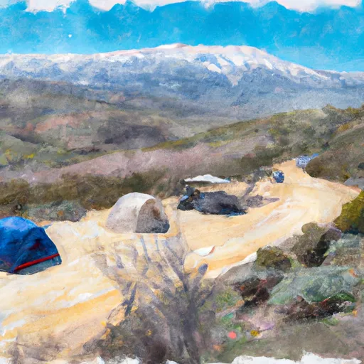
Wilderness Domeland
Community Reviews
Been here? Share the conditions.
Reviews, ratings & photos are added in the free Snoflo iOS app — rate a spot, tag the conditions, and your visit is verified by location. Add or manage your reviews from the app.

Wilderness Domeland
Reasons to Visit:
1. Unspoiled Wilderness: Wilderness Domeland is known for its untouched natural beauty, offering visitors a chance to escape the hustle and bustle of city life and immerse themselves in the tranquility of nature.
2. Hiking and Backpacking: The area is a paradise for outdoor enthusiasts, with miles of scenic trails that showcase the region's diverse landscapes, including granite peaks, lush meadows, and wildflowers.
3. Wildlife Viewing: Wilderness Domeland is home to a variety of wildlife, including black bears, deer, bighorn sheep, and a wide range of bird species. Animal lovers will find ample opportunities to observe and appreciate the biodiversity of the area.
Points of Interest:
1. Domeland Wilderness: This designated wilderness area covers over 130,000 acres and offers countless opportunities for exploration and adventure, with its high peaks, deep canyons, and numerous alpine lakes.
2. South Fork Kern River: The river flows through the Wilderness Domeland area, providing opportunities for fishing, swimming, and enjoying the peaceful ambiance of the flowing water.
3. Trail of 100 Giants: Located nearby, this popular attraction showcases some of the largest and oldest trees in the world, including the famous sequoias. Visitors can walk among these giants along a well-maintained trail.
Interesting Facts:
1. Wilderness Domeland is part of the Sequoia National Forest, which encompasses over 1.1 million acres of diverse landscapes.
2. The area is known for its exceptional starry nights, as light pollution is minimal, making it an ideal place for stargazing and astrophotography.
3. Wilderness Domeland is a habitat for the endangered California condor, and there have been successful efforts to reintroduce these majestic birds to the region.
Best Time to Visit:
The best time to visit Wilderness Domeland is during the summer and early fall months from June to October when the weather is generally warm and pleasant. Springtime brings wildflowers in full bloom, while autumn showcases vibrant fall colors. It's important to note that the area receives heavy snowfall during the winter, making access difficult or impossible.
It is always recommended to verify the information provided by cross-referencing multiple independent sources to ensure accuracy and up-to-date details.
Trails in Wilderness Domeland
Named trails whose route falls inside the park.
Camping in Wilderness Domeland
Campgrounds inside the park, with today's conditions score.
Plan your visit down to the hour
Same weather feed Snoflo's iOS app uses -- updated continuously from NOAA / yr.no.
Next 5 days, hour by hour
Temperature line with weather symbols on top, snow + rain accumulation as columns, humidity as a dotted line.
5-day forecast table
Every 3 hours, broken out across temperature, snow, rain, humidity, and wind.
| Time | Condition | Temp (°F) | Snow (in) | Rain (in) | Humidity (%) | Wind (mps) | Wind dir |
|---|---|---|---|---|---|---|---|
| Loading detailed forecast… | |||||||
15-day temperature & precipitation
Daily temperatures, snow, and rain projected over the next two weeks.
Responsible recreation & Leave No Trace
- Know before you go
- Check the operator's site for hours, permit requirements, seasonal closures, and fire restrictions before heading out.
- Stay on trail
- Stick to marked paths to protect vegetation, prevent erosion, and avoid disturbing wildlife habitat.
- Respect wildlife
- Observe from a distance, never feed wildlife, and store food securely if camping is permitted on-site.
- Pack it in, pack it out
- Carry out all trash, food scraps, and gear. Many parks have limited or no trash service.
- Leave what you find
- Don't take rocks, plants, or artifacts. They make the park what it is for the next visitor.
Set push alerts in the Snoflo app
Save Wilderness Domeland as a favorite, set a custom threshold (precipitation, freezing temperatures, fire-restriction days), and the iOS app will push the moment conditions cross.
About Wilderness Domeland
What can I do at Wilderness Domeland?
Most Snoflo-tracked parks support hiking, picnicking, and wildlife viewing. Check the operator's site for activity-specific rules (camping, fishing, paddling, hunting).
How fresh is the weather data?
The hourly forecast updates throughout the day from NOAA / yr.no. Streamflow comes live from USGS streamgauges.
When is the best time to visit?
Use the 15-day temperature & precipitation outlook on this page to plan -- pick a window with comfortable temperatures and low precipitation.
How do I get to Wilderness Domeland?
Tap Directions in the hero above to open driving directions in Google Maps, or Open in map to center the Snoflo interactive map on the park.
Can I get alerts when conditions change?
Yes -- alerts are managed in the Snoflo iOS app. Favorite this park, set a threshold (temperature, precipitation), and you'll get a push the moment it crosses.
Park & land designation reference
A quick legend for the federal and state land categories Snoflo tracks. Each designation comes with different rules around access, recreation, and resource extraction.
- National Park
- Large protected natural areas managed by the federal government to preserve significant landscapes, ecosystems, and cultural resources; recreation is allowed but conservation is the priority.
- State Park
- Public natural or recreational areas managed by a state government, typically smaller than national parks and focused on regional natural features, recreation, and education.
- Local Park
- Community-level parks managed by cities or counties, emphasizing recreation, playgrounds, sports, and green space close to populated areas.
- Wilderness Area
- The highest level of land protection in the U.S.; designated areas where nature is left essentially untouched, with no roads, structures, or motorized motorized access permitted.
- National Recreation Area
- Areas set aside primarily for outdoor recreation (boating, hiking, fishing, often around reservoirs, rivers, or scenic landscapes); may allow more development.
- National Conservation Area (BLM)
- BLM-managed areas with special ecological, cultural, or scientific value; more protection than typical BLM land but less strict than Wilderness Areas.
- State Forest
- State-managed forests focused on habitat, watershed, recreation, and sustainable timber harvest.
- Bureau of Land Management (BLM) Land
- Vast federal lands managed for mixed use -- recreation, grazing, mining, conservation -- with fewer restrictions than national parks or forests.