St. Marks National Wildlife Refuge
Community Reviews
Been here? Share the conditions.
Reviews, ratings & photos are added in the free Snoflo iOS app — rate a spot, tag the conditions, and your visit is verified by location. Add or manage your reviews from the app.
St. Marks National Wildlife Refuge
One of the primary reasons to visit St. Marks National Wildlife Refuge is its stunning array of wildlife. Over 300 species of birds can be found here, making it a paradise for birdwatchers. The refuge serves as a crucial stopover point for migratory birds, particularly during the spring and fall seasons. Visitors can catch glimpses of bald eagles, herons, wood storks, and even the elusive red-cockaded woodpecker.
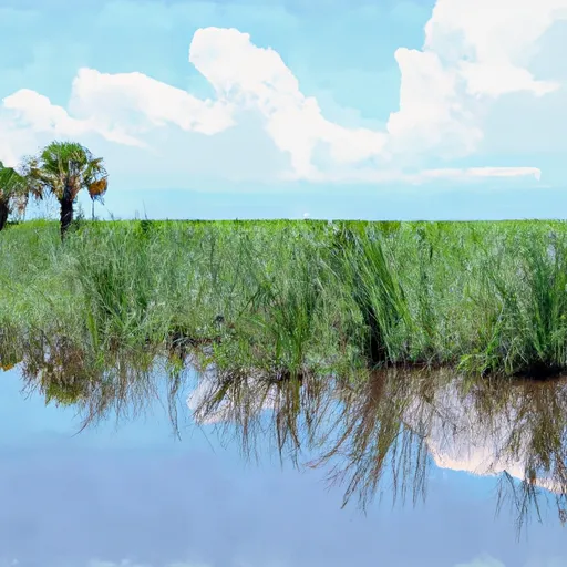
In addition to its avian inhabitants, the refuge is home to many other fascinating animals. Alligators, deer, black bears, bobcats, and even manatees can be spotted in various parts of the refuge. The diverse ecosystems within St. Marks National Wildlife Refuge, including marshes, forests, and coastal habitats, provide a haven for countless species.
There are several notable points of interest within the refuge. St. Marks Lighthouse, a historic structure dating back to 1831, stands proudly on the coastline and offers panoramic views of the surrounding area. The refuge also features several trails and boardwalks, such as the Lighthouse Levee Trail and the Tower Pond Trail, allowing visitors to explore the diverse landscapes and observe wildlife up close.
St. Marks National Wildlife Refuge also holds interesting historical significance. Native American artifacts dating back thousands of years have been discovered within its boundaries, providing insights into the area's rich cultural heritage. Additionally, remnants of historic structures like old forts and fish camps can still be found within the refuge, serving as a reminder of the region's past.
The best time of year to visit St. Marks National Wildlife Refuge largely depends on personal preferences and interests. For birdwatchers, the spring and fall migrations offer exceptional opportunities to witness a plethora of avian species. Winter is also a popular time for birding, as species like ducks and geese gather in large numbers. However, it is important to note that summer can be quite hot and humid, with increased mosquito activity.
In summary, St. Marks National Wildlife Refuge in Florida is a must-visit destination for nature enthusiasts and wildlife lovers. With its diverse ecosystems, abundant wildlife, historical significance, and various points of interest, the refuge offers a memorable experience for visitors. Whether exploring the trails, observing migratory birds, or immersing oneself in the area's rich history, St. Marks National Wildlife Refuge is a true gem along the Gulf Coast.
Trails in St. Marks National Wildlife Refuge
Named trails whose route falls inside the park.
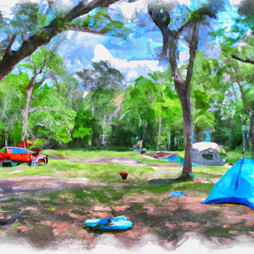
Camping in St. Marks National Wildlife Refuge
Campgrounds inside the park, with today's conditions score.

Points of interest in St. Marks National Wildlife Refuge
Landmarks and points of interest inside the park boundary.

Plan your visit down to the hour
Same weather feed Snoflo's iOS app uses -- updated continuously from NOAA / yr.no.
Next 5 days, hour by hour
Temperature line with weather symbols on top, snow + rain accumulation as columns, humidity as a dotted line.
5-day forecast table
Every 3 hours, broken out across temperature, snow, rain, humidity, and wind.
| Time | Condition | Temp (°F) | Snow (in) | Rain (in) | Humidity (%) | Wind (mps) | Wind dir |
|---|---|---|---|---|---|---|---|
| Loading detailed forecast… | |||||||
15-day temperature & precipitation
Daily temperatures, snow, and rain projected over the next two weeks.
Responsible recreation & Leave No Trace
- Know before you go
- Check the operator's site for hours, permit requirements, seasonal closures, and fire restrictions before heading out.
- Stay on trail
- Stick to marked paths to protect vegetation, prevent erosion, and avoid disturbing wildlife habitat.
- Respect wildlife
- Observe from a distance, never feed wildlife, and store food securely if camping is permitted on-site.
- Pack it in, pack it out
- Carry out all trash, food scraps, and gear. Many parks have limited or no trash service.
- Leave what you find
- Don't take rocks, plants, or artifacts. They make the park what it is for the next visitor.
Set push alerts in the Snoflo app
Save St. Marks National Wildlife Refuge as a favorite, set a custom threshold (precipitation, freezing temperatures, fire-restriction days), and the iOS app will push the moment conditions cross.
About St. Marks National Wildlife Refuge
What can I do at St. Marks National Wildlife Refuge?
Most Snoflo-tracked parks support hiking, picnicking, and wildlife viewing. Check the operator's site for activity-specific rules (camping, fishing, paddling, hunting).
How fresh is the weather data?
The hourly forecast updates throughout the day from NOAA / yr.no. Streamflow comes live from USGS streamgauges.
When is the best time to visit?
Use the 15-day temperature & precipitation outlook on this page to plan -- pick a window with comfortable temperatures and low precipitation.
How do I get to St. Marks National Wildlife Refuge?
Tap Directions in the hero above to open driving directions in Google Maps, or Open in map to center the Snoflo interactive map on the park.
Can I get alerts when conditions change?
Yes -- alerts are managed in the Snoflo iOS app. Favorite this park, set a threshold (temperature, precipitation), and you'll get a push the moment it crosses.
Park & land designation reference
A quick legend for the federal and state land categories Snoflo tracks. Each designation comes with different rules around access, recreation, and resource extraction.
- National Park
- Large protected natural areas managed by the federal government to preserve significant landscapes, ecosystems, and cultural resources; recreation is allowed but conservation is the priority.
- State Park
- Public natural or recreational areas managed by a state government, typically smaller than national parks and focused on regional natural features, recreation, and education.
- Local Park
- Community-level parks managed by cities or counties, emphasizing recreation, playgrounds, sports, and green space close to populated areas.
- Wilderness Area
- The highest level of land protection in the U.S.; designated areas where nature is left essentially untouched, with no roads, structures, or motorized motorized access permitted.
- National Recreation Area
- Areas set aside primarily for outdoor recreation (boating, hiking, fishing, often around reservoirs, rivers, or scenic landscapes); may allow more development.
- National Conservation Area (BLM)
- BLM-managed areas with special ecological, cultural, or scientific value; more protection than typical BLM land but less strict than Wilderness Areas.
- State Forest
- State-managed forests focused on habitat, watershed, recreation, and sustainable timber harvest.
- Bureau of Land Management (BLM) Land
- Vast federal lands managed for mixed use -- recreation, grazing, mining, conservation -- with fewer restrictions than national parks or forests.