Park

Chattahoochee-Oconee National Forest

Georgia, USA Coosa-Tallapoosa watershed 34.332°, -85.358°
Today high
--
Tonight low
--
Campgrounds
60
Trails
60
Points of interest
17
Loading current conditions…
Next 24 hours
Loading next 24 hours…

Community Reviews

Loading reviews…

Been here? Share the conditions.

Reviews, ratings & photos are added in the free Snoflo iOS app — rate a spot, tag the conditions, and your visit is verified by location. Add or manage your reviews from the app.
Get the app
Chattahoochee-Oconee National Forest -- Georgia park
Chattahoochee-Oconee National Forest Georgia · Coosa-Tallapoosa watershed
About this park

Chattahoochee-Oconee National Forest

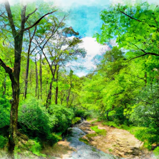
Chattahoochee-Oconee National Forest is located in the state of Georgia and is a popular destination for outdoor enthusiasts. The forest is home to numerous hiking trails, waterfalls, and camping sites, making it an ideal place for visitors to explore nature.

One of the main attractions in the Chattahoochee-Oconee National Forest is the Tallulah Gorge, which features cascading waterfalls and breathtaking views of the surrounding mountains. Other notable points of interest include the Anna Ruby Falls, the Brasstown Bald Mountain, and the Appalachian Trail.

The area is also rich in history, with evidence of ancient Native American settlements found throughout the forest. The Civil War-era Toccoa Falls College is also located in the forest, offering visitors a glimpse into the region's past.

The best time of year to visit the Chattahoochee-Oconee National Forest is in the spring and fall when the weather is mild and the foliage is at its most vibrant. However, the forest is open year-round, and each season offers its own unique charms.

Overall, the Chattahoochee-Oconee National Forest is a must-visit destination for anyone looking to explore the great outdoors in Georgia. With its stunning natural beauty, rich history, and numerous recreational opportunities, it's no wonder that this forest is a favorite among locals and tourists alike.
StateGeorgia
WatershedCoosa-Tallapoosa
Latitude34.3323°
Longitude-85.3576°
In the park

Streamflow in Chattahoochee-Oconee National Forest

Live USGS discharge at streamgauges inside the park boundary.

GaugeFlow
Tallulah River Ab Powerhouse · 5.11 ft gage 37 cfs
Chattooga River Near Clayton · 1.14 ft gage 172 cfs
Tallulah River Near Clayton · 1.98 ft gage 70 cfs
Chattahoochee River At Helen · 0.48 ft gage 48 cfs
Heath Creek Near Armuchee · 0.98 ft gage 3 cfs
Nottely River Near Blairsville · 1.63 ft gage 61 cfs
Toccoa River Near Dial · 1.11 ft gage 203 cfs
In the park

Snowpack in Chattahoochee-Oconee National Forest

Current snow depth at SNOTEL stations inside the park boundary.

Snow stationSnowpack
Dillard 0.7 Nnw 0 in
Sautee 3.5 Sw 0 in
Germany Valley 0 in
In the park

Trails in Chattahoochee-Oconee National Forest

Named trails whose route falls inside the park.

4wd
0.6 mi · Hiking, Running
Amicalola Creek Road
1.5 mi · Hiking, Running
Ash Creek Trail
1.7 mi · Hiking, Running
B4 Loop
0.1 mi · Hiking, Running
Billingsley Creek Road
3.7 mi · Hiking, Running
Black Branch Trail
2.9 mi · Biking, Hiking, Horseback, Running
Black Diamond Tunnel
0.3 mi · Hiking, Running
Burson Road
1.3 mi · Hiking, Running
Campsite
0.0 mi · Hiking, Running
Chattahoochee River Road
9.8 mi · Hiking, Running
Chattooga River Trail
18.3 mi · Hiking, Running
Chattooga River Trail
17.4 mi · Hiking, Running
Chickamauga Creek Trail
6.2 mi · Hiking, Running
Coosa Backcountry Trail
2.3 mi · Hiking, Running
Desoto Falls Trail
0.9 mi · Hiking, Running
Dick's Creek Falls
0.0 mi · Hiking, Running
Dry Creek Mountain Bike Area Parking
0.5 mi · Hiking, Running
Dunaway Gap Road
1.7 mi · Hiking, Running
Fdr-713a Houston Valley Branch
1.7 mi · Biking, Hiking, Running
Fdr-872 Jones Creek Dam Trail
3.8 mi · Biking, Hiking, Horseback, Running
Forest Service Road
0.4 mi · Hiking, Running
Fs 34
1.1 mi · Hiking, Running
Gooch Road South
1.1 mi · Hiking, Running
High Shoals Falls
1.2 mi · Hiking, Running
Honey Stand
2.1 mi · Hiking, Running
Howard Gap Road
1.1 mi · Hiking, Running
Indian Grave Gap Road
4.1 mi · Hiking, Running
Iron Mountain
14.3 mi · Biking, Hiking, Horseback, Running
Johns Mountain Trail
2.3 mi · Hiking, Running
Keown Falls Trail
0.7 mi · Hiking, Running
Long Creek Road
5.5 mi · Hiking, Running
Mill Creek Road
2.1 mi · Biking, Hiking, Running
Mud Creek Falls Trail
1.1 mi · Hiking, Running
North Rim Trail
0.5 mi · Hiking, Running
Overflow Creek Road
7.0 mi · Hiking, Running
Pinhoti Horse Alternative
2.8 mi · Biking, Hiking, Horseback, Running
Raven Rock Road
1.0 mi · Hiking, Running
Road Closed
0.8 mi · Hiking, Running
Rough Ridge
6.8 mi · Hiking, Horseback, Running
Round Mountain Tower Road
1.7 mi · Hiking, Running
Sarahs Creek Road
3.7 mi · Biking, Hiking, Running
Sawmill Road
0.3 mi · Hiking, Running
Smith Creek
4.3 mi · Hiking, Running
South Rim Trail
0.4 mi · Hiking, Running
Stone Place Trail
0.6 mi · Hiking, Running
Stone Place Trail
2.5 mi · Hiking, Running
Stone Place Trail & High Bluff Trail
0.6 mi · Hiking, Running
Tallulah Falls Rail Or Short Line Trail
1.4 mi · Biking, Hiking, Running
Tallulah Falls Railway Trail
0.1 mi · Hiking, Running
Tallulah Gorge Trail
0.1 mi · Hiking, Running
Terrora Lake Loop Trail
0.4 mi · Hiking, Running
To Falls And Amphiteater
0.1 mi · Hiking, Running
Totter Pole Road
4.3 mi · Hiking, Running
Trammel Loop Connector
0.4 mi · Biking, Hiking, Running
Tray Mountain Road
3.4 mi · Hiking, Running
Tuckaluge Creek Road
4.6 mi · Hiking, Running
Upper Terrora Natura Trail
0.4 mi · Hiking, Running
Wagon Train Trail
4.5 mi · Hiking, Running
Warwoman Connector
0.0 mi · Hiking, Running
White Oak Gap Road
5.2 mi · Hiking, Running
In the park

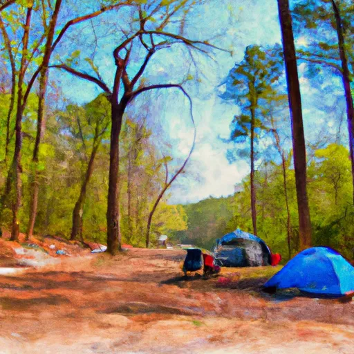
Camping in Chattahoochee-Oconee National Forest

Campgrounds inside the park, with today's conditions score.
A Amicalola Falls State Park
Amicalola Falls State Park
A Amicalola Mountain
Amicalola Mountain
A Andrews Cove
Andrews Cove
A Andrews Cove Campground
Andrews Cove Campground
A Andrews Cove Campsite
Andrews Cove Campsite
B Bear Ridge Group Camp
Bear Ridge Group Camp
B Black Rock Mountain State Park
Black Rock Mountain State Park
B Boggs Creek
Boggs Creek
C Cooper Creek
Cooper Creek
C Cooper Creek Recreation Area
Cooper Creek Recreation Area
C Cottonwood Patch
Cottonwood Patch
C Cottonwood Patch Campground
Cottonwood Patch Campground
D Deep Hole
Deep Hole
D Desoto Falls
Desoto Falls
D Desoto Falls Campground
Desoto Falls Campground
D Desoto Falls Recreation Area
Desoto Falls Recreation Area
D Dockery Lake
Dockery Lake
D Dockery Lake Recreation Area
Dockery Lake Recreation Area
F Frank Gross Recreation Area
Frank Gross Recreation Area
F Freeman/At Campsite
Freeman/At Campsite
G Georgia Mountain Fair Campground
Georgia Mountain Fair Campground
H Hawk Mountain (Base) Campsite
Hawk Mountain (Base) Campsite
J Jacks River Fields
Jacks River Fields
J Jacks River Fields Campground
Jacks River Fields Campground
J James H Sloppy Floyd State Park
James H Sloppy Floyd State Park
J James H. Floyd State Park Campground
James H. Floyd State Park Campground
J Jarrard Gap Campsite
Jarrard Gap Campsite
J Jenny's Creek Campground
Jenny's Creek Campground
L Lake Chatuga
Lake Chatuga
L Lake Rabun Beach Recreation Area
Lake Rabun Beach Recreation Area
L Lake Winfield Scott
Lake Winfield Scott
L Lake Winfield Scott Campground
Lake Winfield Scott Campground
L Lake Yonah County Park
Lake Yonah County Park
L Long Bottom Ford
Long Bottom Ford
L Low Gap Campground
Low Gap Campground
L Low Gap Creek
Low Gap Creek
M Miller Gap Campsite
Miller Gap Campsite
M Moccasin Creek State Park
Moccasin Creek State Park
M Morganton Point
Morganton Point
M Morganton Point Campground
Morganton Point Campground
M Mulky
Mulky
M Mulky Campground
Mulky Campground
N Nichols Campground
Nichols Campground
P Pear Tree Hill Group Camp
Pear Tree Hill Group Camp
P Poteete Creek
Poteete Creek
R Rabun Beach
Rabun Beach
S Sandy Bottoms Campground
Sandy Bottoms Campground
S Sandy Bottoms Rec. Area
Sandy Bottoms Rec. Area
S Sarah's Creek Campground
Sarah's Creek Campground
S Sarahs Creek
Sarahs Creek
S Seed Campground
Seed Campground
T Tallulah Gorge State Park
Tallulah Gorge State Park
T Tallulah River
Tallulah River
T Tallulah River Campground
Tallulah River Campground
T Tate Branch
Tate Branch
T Tate Branch Campground
Tate Branch Campground
T Toccoa River Sandy Bottoms Recreation Area
Toccoa River Sandy Bottoms Recreation Area
U Unicoi State Park
Unicoi State Park
U Upper Chattahoochee River
Upper Chattahoochee River
U Upper Chattahoochee River Campground
Upper Chattahoochee River Campground
Detailed forecast

Plan your visit down to the hour

Same weather feed Snoflo's iOS app uses -- updated continuously from NOAA / yr.no.

Hourly detail

Next 5 days, hour by hour

Temperature line with weather symbols on top, snow + rain accumulation as columns, humidity as a dotted line.

Loading hourly forecast…
Deep dive

5-day forecast table

Every 3 hours, broken out across temperature, snow, rain, humidity, and wind.

TimeConditionTemp (°F)Snow (in)Rain (in)Humidity (%)Wind (mps)Wind dir
Loading detailed forecast…
Long-term outlook

15-day temperature & precipitation

Daily temperatures, snow, and rain projected over the next two weeks.

Loading 15-day outlook…

Responsible recreation & Leave No Trace

Know before you go
Check the operator's site for hours, permit requirements, seasonal closures, and fire restrictions before heading out.
Stay on trail
Stick to marked paths to protect vegetation, prevent erosion, and avoid disturbing wildlife habitat.
Respect wildlife
Observe from a distance, never feed wildlife, and store food securely if camping is permitted on-site.
Pack it in, pack it out
Carry out all trash, food scraps, and gear. Many parks have limited or no trash service.
Leave what you find
Don't take rocks, plants, or artifacts. They make the park what it is for the next visitor.

Set push alerts in the Snoflo app

Save Chattahoochee-Oconee National Forest as a favorite, set a custom threshold (precipitation, freezing temperatures, fire-restriction days), and the iOS app will push the moment conditions cross.

FAQ

About Chattahoochee-Oconee National Forest

What can I do at Chattahoochee-Oconee National Forest?

Most Snoflo-tracked parks support hiking, picnicking, and wildlife viewing. Check the operator's site for activity-specific rules (camping, fishing, paddling, hunting).

How fresh is the weather data?

The hourly forecast updates throughout the day from NOAA / yr.no. Streamflow comes live from USGS streamgauges.

When is the best time to visit?

Use the 15-day temperature & precipitation outlook on this page to plan -- pick a window with comfortable temperatures and low precipitation.

How do I get to Chattahoochee-Oconee National Forest?

Tap Directions in the hero above to open driving directions in Google Maps, or Open in map to center the Snoflo interactive map on the park.

Can I get alerts when conditions change?

Yes -- alerts are managed in the Snoflo iOS app. Favorite this park, set a threshold (temperature, precipitation), and you'll get a push the moment it crosses.

Land designation

Park & land designation reference

A quick legend for the federal and state land categories Snoflo tracks. Each designation comes with different rules around access, recreation, and resource extraction.

National Park
Large protected natural areas managed by the federal government to preserve significant landscapes, ecosystems, and cultural resources; recreation is allowed but conservation is the priority.
State Park
Public natural or recreational areas managed by a state government, typically smaller than national parks and focused on regional natural features, recreation, and education.
Local Park
Community-level parks managed by cities or counties, emphasizing recreation, playgrounds, sports, and green space close to populated areas.
Wilderness Area
The highest level of land protection in the U.S.; designated areas where nature is left essentially untouched, with no roads, structures, or motorized motorized access permitted.
National Recreation Area
Areas set aside primarily for outdoor recreation (boating, hiking, fishing, often around reservoirs, rivers, or scenic landscapes); may allow more development.
National Conservation Area (BLM)
BLM-managed areas with special ecological, cultural, or scientific value; more protection than typical BLM land but less strict than Wilderness Areas.
State Forest
State-managed forests focused on habitat, watershed, recreation, and sustainable timber harvest.
Bureau of Land Management (BLM) Land
Vast federal lands managed for mixed use -- recreation, grazing, mining, conservation -- with fewer restrictions than national parks or forests.