Community Reviews
Been here? Share the conditions.
Reviews, ratings & photos are added in the free Snoflo iOS app — rate a spot, tag the conditions, and your visit is verified by location. Add or manage your reviews from the app.
Wailoa River State Park
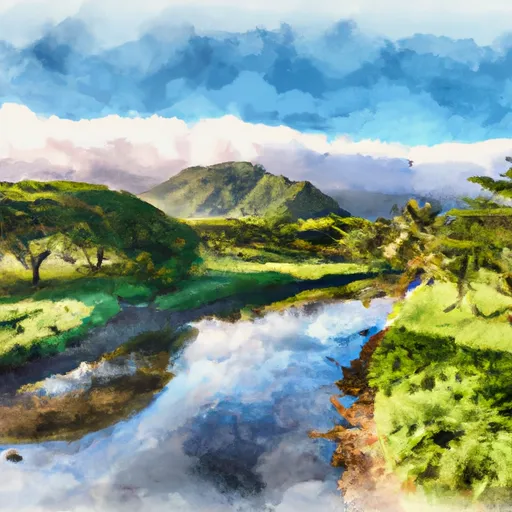
Wailoa River State Park is situated in Hilo, the largest city on the Big Island of Hawaii. It covers an area of approximately 134 acres and provides a serene and peaceful escape for both locals and visitors alike.
Reasons to Visit:
1. Scenic Beauty: The park boasts lush greenery, including native vegetation and beautiful floral displays. The stunning Wailoa River, which runs through the park, adds to its scenic beauty.
2. Cultural Significance: Wailoa River State Park holds immense cultural value. It is home to numerous historic sites, such as the canoe pavilion, the Polynesian voyaging canoe replica, and the iconic King Kamehameha statue.
3. Recreational Activities: The park offers various recreational activities, including walking and jogging paths, picnic areas, and a boat ramp for boating and fishing enthusiasts. There is also a large covered pavilion that hosts events and gatherings.
Points of Interest:
1. King Kamehameha Statue: The park is renowned for its 14-foot-tall bronze statue of King Kamehameha, the first ruler of the Kingdom of Hawaii. It serves as a symbol of Hawaiian heritage and unity.
2. Wailoa Center: The Wailoa Center, located within the park, is an art gallery and cultural center that showcases local artists' work and hosts cultural events, making it a hub for creativity and cultural preservation.
3. Canoe Pavilion: This architectural marvel is a traditional-style canoe house that pays homage to the importance of outrigger canoes in Hawaiian history and culture. It is often used for cultural and educational events.
Interesting Facts:
1. Wailoa River State Park was established in 1979 and has played a significant role in preserving the cultural heritage of the Hilo community.
2. The park is a wetland area and serves as a habitat for various bird species, including the endangered Hawaiian stilt and coot.
3. Wailoa River State Park has been a popular filming location for several movies and TV shows, including scenes from the television series "Lost."
Best Time to Visit:
The best time to visit Wailoa River State Park is during the drier months, which are generally from April to October. The weather is usually pleasant during this time, with fewer chances of rainfall, making it ideal for outdoor activities and exploration.
By verifying the information from multiple independent sources, you can ensure the accuracy of the summary provided above.
Plan your visit down to the hour
Same weather feed Snoflo's iOS app uses -- updated continuously from NOAA / yr.no.
Next 5 days, hour by hour
Temperature line with weather symbols on top, snow + rain accumulation as columns, humidity as a dotted line.
5-day forecast table
Every 3 hours, broken out across temperature, snow, rain, humidity, and wind.
| Time | Condition | Temp (°F) | Snow (in) | Rain (in) | Humidity (%) | Wind (mps) | Wind dir |
|---|---|---|---|---|---|---|---|
| Loading detailed forecast… | |||||||
15-day temperature & precipitation
Daily temperatures, snow, and rain projected over the next two weeks.
Responsible recreation & Leave No Trace
- Know before you go
- Check the operator's site for hours, permit requirements, seasonal closures, and fire restrictions before heading out.
- Stay on trail
- Stick to marked paths to protect vegetation, prevent erosion, and avoid disturbing wildlife habitat.
- Respect wildlife
- Observe from a distance, never feed wildlife, and store food securely if camping is permitted on-site.
- Pack it in, pack it out
- Carry out all trash, food scraps, and gear. Many parks have limited or no trash service.
- Leave what you find
- Don't take rocks, plants, or artifacts. They make the park what it is for the next visitor.
Set push alerts in the Snoflo app
Save Wailoa River State Park as a favorite, set a custom threshold (precipitation, freezing temperatures, fire-restriction days), and the iOS app will push the moment conditions cross.
About Wailoa River State Park
What can I do at Wailoa River State Park?
Most Snoflo-tracked parks support hiking, picnicking, and wildlife viewing. Check the operator's site for activity-specific rules (camping, fishing, paddling, hunting).
How fresh is the weather data?
The hourly forecast updates throughout the day from NOAA / yr.no. Streamflow comes live from USGS streamgauges.
When is the best time to visit?
Use the 15-day temperature & precipitation outlook on this page to plan -- pick a window with comfortable temperatures and low precipitation.
How do I get to Wailoa River State Park?
Tap Directions in the hero above to open driving directions in Google Maps, or Open in map to center the Snoflo interactive map on the park.
Can I get alerts when conditions change?
Yes -- alerts are managed in the Snoflo iOS app. Favorite this park, set a threshold (temperature, precipitation), and you'll get a push the moment it crosses.
Park & land designation reference
A quick legend for the federal and state land categories Snoflo tracks. Each designation comes with different rules around access, recreation, and resource extraction.
- National Park
- Large protected natural areas managed by the federal government to preserve significant landscapes, ecosystems, and cultural resources; recreation is allowed but conservation is the priority.
- State Park
- Public natural or recreational areas managed by a state government, typically smaller than national parks and focused on regional natural features, recreation, and education.
- Local Park
- Community-level parks managed by cities or counties, emphasizing recreation, playgrounds, sports, and green space close to populated areas.
- Wilderness Area
- The highest level of land protection in the U.S.; designated areas where nature is left essentially untouched, with no roads, structures, or motorized motorized access permitted.
- National Recreation Area
- Areas set aside primarily for outdoor recreation (boating, hiking, fishing, often around reservoirs, rivers, or scenic landscapes); may allow more development.
- National Conservation Area (BLM)
- BLM-managed areas with special ecological, cultural, or scientific value; more protection than typical BLM land but less strict than Wilderness Areas.
- State Forest
- State-managed forests focused on habitat, watershed, recreation, and sustainable timber harvest.
- Bureau of Land Management (BLM) Land
- Vast federal lands managed for mixed use -- recreation, grazing, mining, conservation -- with fewer restrictions than national parks or forests.