Wapsipinicon State Park
Community Reviews
Been here? Share the conditions.
Reviews, ratings & photos are added in the free Snoflo iOS app — rate a spot, tag the conditions, and your visit is verified by location. Add or manage your reviews from the app.
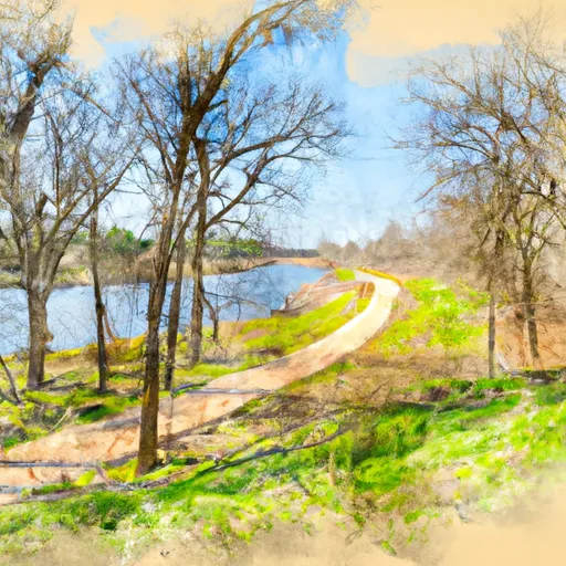
Wapsipinicon State Park
Reasons to Visit:
1. Scenic Beauty: Wapsipinicon State Park boasts picturesque landscapes, including wooded areas, limestone bluffs, and the meandering Wapsipinicon River, making it an ideal destination for nature enthusiasts and photographers.
2. Outdoor Activities: The park offers a variety of recreational opportunities such as camping, hiking, fishing, birdwatching, and picnicking. It also has a boat launch for kayaking or canoeing on the river.
3. Historical Significance: The park features the Stone Arch Bridge, which is listed on the National Register of Historic Places. This beautiful limestone bridge was built in 1876 and offers a glimpse into the area's past.
Points of Interest:
1. Stone Arch Bridge: This historic bridge spans the Wapsipinicon River and provides a scenic backdrop for photography and exploration.
2. Hiking Trails: Wapsipinicon State Park offers several trails that wind through the woods and along the river, providing opportunities for nature walks and wildlife observation.
3. Picnic Areas: There are designated picnic spots where visitors can enjoy a meal while surrounded by nature.
Interesting Facts:
1. The name "Wapsipinicon" originates from the Meskwaki Native American tribe and means "river with many pines."
2. The park covers an area of approximately 394 acres, providing ample space for outdoor activities and relaxation.
3. Wildlife such as white-tailed deer, wild turkeys, and a variety of bird species can be spotted within the park's boundaries.
Best Time to Visit:
The best time to visit Wapsipinicon State Park is during the spring and fall seasons when the temperatures are pleasant, and the foliage displays vibrant colors. Spring brings blooming flowers and migrating birds, while fall showcases the beautiful autumn foliage. Summer is also popular due to warm weather and opportunities for water-based activities.
It is important to verify the accuracy of this information by consulting multiple independent sources, such as the official website of the Iowa Department of Natural Resources and reputable travel guides.
Trails in Wapsipinicon State Park
Named trails whose route falls inside the park.
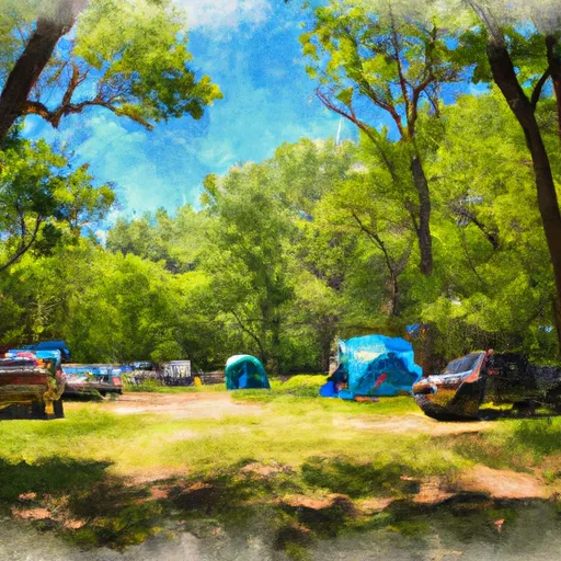
Camping in Wapsipinicon State Park
Campgrounds inside the park, with today's conditions score.
Plan your visit down to the hour
Same weather feed Snoflo's iOS app uses -- updated continuously from NOAA / yr.no.
Next 5 days, hour by hour
Temperature line with weather symbols on top, snow + rain accumulation as columns, humidity as a dotted line.
5-day forecast table
Every 3 hours, broken out across temperature, snow, rain, humidity, and wind.
| Time | Condition | Temp (°F) | Snow (in) | Rain (in) | Humidity (%) | Wind (mps) | Wind dir |
|---|---|---|---|---|---|---|---|
| Loading detailed forecast… | |||||||
15-day temperature & precipitation
Daily temperatures, snow, and rain projected over the next two weeks.
Responsible recreation & Leave No Trace
- Know before you go
- Check the operator's site for hours, permit requirements, seasonal closures, and fire restrictions before heading out.
- Stay on trail
- Stick to marked paths to protect vegetation, prevent erosion, and avoid disturbing wildlife habitat.
- Respect wildlife
- Observe from a distance, never feed wildlife, and store food securely if camping is permitted on-site.
- Pack it in, pack it out
- Carry out all trash, food scraps, and gear. Many parks have limited or no trash service.
- Leave what you find
- Don't take rocks, plants, or artifacts. They make the park what it is for the next visitor.
Set push alerts in the Snoflo app
Save Wapsipinicon State Park as a favorite, set a custom threshold (precipitation, freezing temperatures, fire-restriction days), and the iOS app will push the moment conditions cross.
About Wapsipinicon State Park
What can I do at Wapsipinicon State Park?
Most Snoflo-tracked parks support hiking, picnicking, and wildlife viewing. Check the operator's site for activity-specific rules (camping, fishing, paddling, hunting).
How fresh is the weather data?
The hourly forecast updates throughout the day from NOAA / yr.no. Streamflow comes live from USGS streamgauges.
When is the best time to visit?
Use the 15-day temperature & precipitation outlook on this page to plan -- pick a window with comfortable temperatures and low precipitation.
How do I get to Wapsipinicon State Park?
Tap Directions in the hero above to open driving directions in Google Maps, or Open in map to center the Snoflo interactive map on the park.
Can I get alerts when conditions change?
Yes -- alerts are managed in the Snoflo iOS app. Favorite this park, set a threshold (temperature, precipitation), and you'll get a push the moment it crosses.
Park & land designation reference
A quick legend for the federal and state land categories Snoflo tracks. Each designation comes with different rules around access, recreation, and resource extraction.
- National Park
- Large protected natural areas managed by the federal government to preserve significant landscapes, ecosystems, and cultural resources; recreation is allowed but conservation is the priority.
- State Park
- Public natural or recreational areas managed by a state government, typically smaller than national parks and focused on regional natural features, recreation, and education.
- Local Park
- Community-level parks managed by cities or counties, emphasizing recreation, playgrounds, sports, and green space close to populated areas.
- Wilderness Area
- The highest level of land protection in the U.S.; designated areas where nature is left essentially untouched, with no roads, structures, or motorized motorized access permitted.
- National Recreation Area
- Areas set aside primarily for outdoor recreation (boating, hiking, fishing, often around reservoirs, rivers, or scenic landscapes); may allow more development.
- National Conservation Area (BLM)
- BLM-managed areas with special ecological, cultural, or scientific value; more protection than typical BLM land but less strict than Wilderness Areas.
- State Forest
- State-managed forests focused on habitat, watershed, recreation, and sustainable timber harvest.
- Bureau of Land Management (BLM) Land
- Vast federal lands managed for mixed use -- recreation, grazing, mining, conservation -- with fewer restrictions than national parks or forests.