State Park Milburn Landing
Community Reviews
Been here? Share the conditions.
Reviews, ratings & photos are added in the free Snoflo iOS app — rate a spot, tag the conditions, and your visit is verified by location. Add or manage your reviews from the app.
State Park Milburn Landing
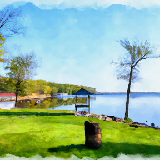
One of the main draws of Milburn Landing State Park is its natural beauty. The park spans over 250 acres of lush forests, marshes, and wetlands, providing a serene and tranquil environment. The Pocomoke River, which borders the park, is a popular spot for boating, fishing, and kayaking. Visitors can explore the river's stunning scenery while engaging in various water activities.
Wildlife enthusiasts will be delighted by the park's diverse ecosystem. Milburn Landing is home to numerous species of birds, including bald eagles, ospreys, herons, and migratory waterfowl. Additionally, visitors might catch a glimpse of white-tailed deer, red foxes, or even river otters. The park offers several hiking trails where visitors can immerse themselves in nature and observe these magnificent creatures.
Milburn Landing State Park also holds historical significance. The area was once occupied by Native American tribes and later became a trading post during colonial times. The park features remnants of old wharves and structures, providing a glimpse into its past. History enthusiasts can learn more about the area's cultural heritage through interpretive displays and educational programs.
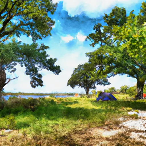
Interesting facts about Milburn Landing State Park include its proximity to the Great Cypress Swamp, one of the northernmost stands of bald cypress trees. This makes it a unique ecosystem worth exploring. Additionally, the park offers camping facilities, picnic areas, and playgrounds, making it ideal for families and outdoor enthusiasts.
The best time to visit Milburn Landing State Park is during the spring and fall seasons. In spring, the park comes alive with vibrant wildflowers and budding trees. The weather is pleasant, and migratory birds return to the area. Fall brings stunning foliage, making it an ideal time for hiking and photography. Summer can be hot and humid, but it offers the opportunity for water activities and camping.
To verify the accuracy of the information provided, it is recommended to consult official sources such as the Maryland Department of Natural Resources website or other reputable travel guides.
Camping in State Park Milburn Landing
Campgrounds inside the park, with today's conditions score.
Plan your visit down to the hour
Same weather feed Snoflo's iOS app uses -- updated continuously from NOAA / yr.no.
Next 5 days, hour by hour
Temperature line with weather symbols on top, snow + rain accumulation as columns, humidity as a dotted line.
5-day forecast table
Every 3 hours, broken out across temperature, snow, rain, humidity, and wind.
| Time | Condition | Temp (°F) | Snow (in) | Rain (in) | Humidity (%) | Wind (mps) | Wind dir |
|---|---|---|---|---|---|---|---|
| Loading detailed forecast… | |||||||
15-day temperature & precipitation
Daily temperatures, snow, and rain projected over the next two weeks.
Responsible recreation & Leave No Trace
- Know before you go
- Check the operator's site for hours, permit requirements, seasonal closures, and fire restrictions before heading out.
- Stay on trail
- Stick to marked paths to protect vegetation, prevent erosion, and avoid disturbing wildlife habitat.
- Respect wildlife
- Observe from a distance, never feed wildlife, and store food securely if camping is permitted on-site.
- Pack it in, pack it out
- Carry out all trash, food scraps, and gear. Many parks have limited or no trash service.
- Leave what you find
- Don't take rocks, plants, or artifacts. They make the park what it is for the next visitor.
Set push alerts in the Snoflo app
Save State Park Milburn Landing as a favorite, set a custom threshold (precipitation, freezing temperatures, fire-restriction days), and the iOS app will push the moment conditions cross.
About State Park Milburn Landing
What can I do at State Park Milburn Landing?
Most Snoflo-tracked parks support hiking, picnicking, and wildlife viewing. Check the operator's site for activity-specific rules (camping, fishing, paddling, hunting).
How fresh is the weather data?
The hourly forecast updates throughout the day from NOAA / yr.no. Streamflow comes live from USGS streamgauges.
When is the best time to visit?
Use the 15-day temperature & precipitation outlook on this page to plan -- pick a window with comfortable temperatures and low precipitation.
How do I get to State Park Milburn Landing?
Tap Directions in the hero above to open driving directions in Google Maps, or Open in map to center the Snoflo interactive map on the park.
Can I get alerts when conditions change?
Yes -- alerts are managed in the Snoflo iOS app. Favorite this park, set a threshold (temperature, precipitation), and you'll get a push the moment it crosses.
Park & land designation reference
A quick legend for the federal and state land categories Snoflo tracks. Each designation comes with different rules around access, recreation, and resource extraction.
- National Park
- Large protected natural areas managed by the federal government to preserve significant landscapes, ecosystems, and cultural resources; recreation is allowed but conservation is the priority.
- State Park
- Public natural or recreational areas managed by a state government, typically smaller than national parks and focused on regional natural features, recreation, and education.
- Local Park
- Community-level parks managed by cities or counties, emphasizing recreation, playgrounds, sports, and green space close to populated areas.
- Wilderness Area
- The highest level of land protection in the U.S.; designated areas where nature is left essentially untouched, with no roads, structures, or motorized motorized access permitted.
- National Recreation Area
- Areas set aside primarily for outdoor recreation (boating, hiking, fishing, often around reservoirs, rivers, or scenic landscapes); may allow more development.
- National Conservation Area (BLM)
- BLM-managed areas with special ecological, cultural, or scientific value; more protection than typical BLM land but less strict than Wilderness Areas.
- State Forest
- State-managed forests focused on habitat, watershed, recreation, and sustainable timber harvest.
- Bureau of Land Management (BLM) Land
- Vast federal lands managed for mixed use -- recreation, grazing, mining, conservation -- with fewer restrictions than national parks or forests.