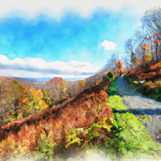
Taconic Trail State Park
Community Reviews
Been here? Share the conditions.
Reviews, ratings & photos are added in the free Snoflo iOS app — rate a spot, tag the conditions, and your visit is verified by location. Add or manage your reviews from the app.
Taconic Trail State Park
Reasons to Visit:
1. Scenic Hiking: Taconic Trail State Park is renowned for its extensive network of hiking trails, which wind through beautiful forests and offer stunning views of the surrounding landscape. It presents opportunities for all levels of hikers, from casual walkers to experienced trekkers.
2. Camping: The park provides camping facilities, allowing visitors to immerse themselves in nature and spend the night under the stars. It offers both tent and RV camping options, with well-maintained sites and basic amenities.
3. Wildlife Watching: Nature lovers will appreciate the diverse range of wildlife that resides in the park. Keep an eye out for deer, foxes, various bird species, and maybe even the occasional black bear.
Points of Interest:
1. Berlin Mountain: Rising to a height of 2,818 feet, Berlin Mountain offers breathtaking panoramic views of the surrounding valleys and mountains. It is a popular destination for hikers seeking an elevated perspective of the area.
2. Berry Pond Preserve: This pristine pond, located within the park, is an ideal spot for picnicking or fishing. Visitors can relax by the water's edge and enjoy the peaceful ambiance.
3. Old Route 2: This historical section of road runs through the park and was part of the original Route 2 before it was relocated. It offers a glimpse into the past and serves as a reminder of the region's rich history.
Interesting Facts:
1. The Taconic Trail, which spans through the park, is a section of the larger Appalachian Trail, one of the most famous long-distance hiking trails in the United States.
2. The park's landscape is characterized by rugged terrain, dense forests, and numerous streams, making it a haven for nature enthusiasts and photographers.
3. Taconic Trail State Park is located near the border of Massachusetts and New York, providing visitors with the opportunity to explore both states during their visit.
Best Time to Visit:
The ideal time to visit Taconic Trail State Park is during the late spring to early fall. The park offers a vibrant display of foliage during the autumn months, making it particularly appealing to visitors. Additionally, the cooler temperatures of spring and fall are more suitable for hiking and camping activities. It is advisable to check the park's official website or contact local authorities for up-to-date information on trail conditions and any seasonal closures.
Please note that although efforts have been made to ensure accuracy, it is always recommended to verify information through multiple independent sources before planning a visit to Taconic Trail State Park.
Trails in Taconic Trail State Park
Named trails whose route falls inside the park.
Plan your visit down to the hour
Same weather feed Snoflo's iOS app uses -- updated continuously from NOAA / yr.no.
Next 5 days, hour by hour
Temperature line with weather symbols on top, snow + rain accumulation as columns, humidity as a dotted line.
5-day forecast table
Every 3 hours, broken out across temperature, snow, rain, humidity, and wind.
| Time | Condition | Temp (°F) | Snow (in) | Rain (in) | Humidity (%) | Wind (mps) | Wind dir |
|---|---|---|---|---|---|---|---|
| Loading detailed forecast… | |||||||
15-day temperature & precipitation
Daily temperatures, snow, and rain projected over the next two weeks.
Responsible recreation & Leave No Trace
- Know before you go
- Check the operator's site for hours, permit requirements, seasonal closures, and fire restrictions before heading out.
- Stay on trail
- Stick to marked paths to protect vegetation, prevent erosion, and avoid disturbing wildlife habitat.
- Respect wildlife
- Observe from a distance, never feed wildlife, and store food securely if camping is permitted on-site.
- Pack it in, pack it out
- Carry out all trash, food scraps, and gear. Many parks have limited or no trash service.
- Leave what you find
- Don't take rocks, plants, or artifacts. They make the park what it is for the next visitor.
Set push alerts in the Snoflo app
Save Taconic Trail State Park as a favorite, set a custom threshold (precipitation, freezing temperatures, fire-restriction days), and the iOS app will push the moment conditions cross.
About Taconic Trail State Park
What can I do at Taconic Trail State Park?
Most Snoflo-tracked parks support hiking, picnicking, and wildlife viewing. Check the operator's site for activity-specific rules (camping, fishing, paddling, hunting).
How fresh is the weather data?
The hourly forecast updates throughout the day from NOAA / yr.no. Streamflow comes live from USGS streamgauges.
When is the best time to visit?
Use the 15-day temperature & precipitation outlook on this page to plan -- pick a window with comfortable temperatures and low precipitation.
How do I get to Taconic Trail State Park?
Tap Directions in the hero above to open driving directions in Google Maps, or Open in map to center the Snoflo interactive map on the park.
Can I get alerts when conditions change?
Yes -- alerts are managed in the Snoflo iOS app. Favorite this park, set a threshold (temperature, precipitation), and you'll get a push the moment it crosses.
Park & land designation reference
A quick legend for the federal and state land categories Snoflo tracks. Each designation comes with different rules around access, recreation, and resource extraction.
- National Park
- Large protected natural areas managed by the federal government to preserve significant landscapes, ecosystems, and cultural resources; recreation is allowed but conservation is the priority.
- State Park
- Public natural or recreational areas managed by a state government, typically smaller than national parks and focused on regional natural features, recreation, and education.
- Local Park
- Community-level parks managed by cities or counties, emphasizing recreation, playgrounds, sports, and green space close to populated areas.
- Wilderness Area
- The highest level of land protection in the U.S.; designated areas where nature is left essentially untouched, with no roads, structures, or motorized motorized access permitted.
- National Recreation Area
- Areas set aside primarily for outdoor recreation (boating, hiking, fishing, often around reservoirs, rivers, or scenic landscapes); may allow more development.
- National Conservation Area (BLM)
- BLM-managed areas with special ecological, cultural, or scientific value; more protection than typical BLM land but less strict than Wilderness Areas.
- State Forest
- State-managed forests focused on habitat, watershed, recreation, and sustainable timber harvest.
- Bureau of Land Management (BLM) Land
- Vast federal lands managed for mixed use -- recreation, grazing, mining, conservation -- with fewer restrictions than national parks or forests.