Thacher Island National Wildlife Refuge
Community Reviews
Been here? Share the conditions.
Reviews, ratings & photos are added in the free Snoflo iOS app — rate a spot, tag the conditions, and your visit is verified by location. Add or manage your reviews from the app.
Thacher Island National Wildlife Refuge
One of the main attractions of Thacher Island National Wildlife Refuge is its abundant bird population. The refuge serves as a crucial nesting ground for various seabirds, including the endangered roseate terns. Visitors can witness these graceful birds in their natural habitat, and the refuge provides an excellent opportunity for birdwatching enthusiasts.
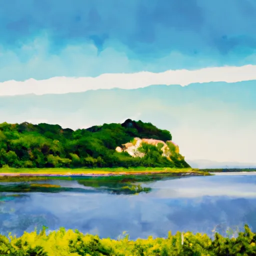
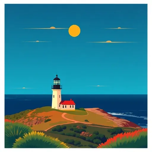
The refuge is also known for its breathtaking scenic beauty. The twin lighthouses on Thacher Island, named the North Lighthouse and the South Lighthouse, are iconic structures that offer visitors a glimpse into the region's maritime history. These lighthouses, dating back to the 18th century, stand tall on rocky cliffs and provide spectacular views of the Atlantic Ocean. The surrounding landscapes, including the rocky shorelines and picturesque beaches, make for fantastic photo opportunities.
Interesting facts about Thacher Island National Wildlife Refuge include its distinction as the only national wildlife refuge in Massachusetts solely dedicated to seabirds. The refuge was established in 1972 to protect and preserve the nesting habitats of various bird species. It covers approximately 52 acres and is managed by the U.S. Fish and Wildlife Service.
The best time to visit Thacher Island National Wildlife Refuge is during the summer months, particularly from May to September, when the weather is generally pleasant, and wildlife activity is at its peak. While the island is accessible by private boat, visitors can also take guided tours offered by local organizations. It's essential to check the refuge's operating hours and access restrictions beforehand.
To ensure accuracy, it is recommended to verify the information provided by consulting multiple independent sources such as the official website of the U.S. Fish and Wildlife Service, local tourism boards, and reputable travel guides.
Points of interest in Thacher Island National Wildlife Refuge
Landmarks and points of interest inside the park boundary.
Plan your visit down to the hour
Same weather feed Snoflo's iOS app uses -- updated continuously from NOAA / yr.no.
Next 5 days, hour by hour
Temperature line with weather symbols on top, snow + rain accumulation as columns, humidity as a dotted line.
5-day forecast table
Every 3 hours, broken out across temperature, snow, rain, humidity, and wind.
| Time | Condition | Temp (°F) | Snow (in) | Rain (in) | Humidity (%) | Wind (mps) | Wind dir |
|---|---|---|---|---|---|---|---|
| Loading detailed forecast… | |||||||
15-day temperature & precipitation
Daily temperatures, snow, and rain projected over the next two weeks.
Responsible recreation & Leave No Trace
- Know before you go
- Check the operator's site for hours, permit requirements, seasonal closures, and fire restrictions before heading out.
- Stay on trail
- Stick to marked paths to protect vegetation, prevent erosion, and avoid disturbing wildlife habitat.
- Respect wildlife
- Observe from a distance, never feed wildlife, and store food securely if camping is permitted on-site.
- Pack it in, pack it out
- Carry out all trash, food scraps, and gear. Many parks have limited or no trash service.
- Leave what you find
- Don't take rocks, plants, or artifacts. They make the park what it is for the next visitor.
Set push alerts in the Snoflo app
Save Thacher Island National Wildlife Refuge as a favorite, set a custom threshold (precipitation, freezing temperatures, fire-restriction days), and the iOS app will push the moment conditions cross.
About Thacher Island National Wildlife Refuge
What can I do at Thacher Island National Wildlife Refuge?
Most Snoflo-tracked parks support hiking, picnicking, and wildlife viewing. Check the operator's site for activity-specific rules (camping, fishing, paddling, hunting).
How fresh is the weather data?
The hourly forecast updates throughout the day from NOAA / yr.no. Streamflow comes live from USGS streamgauges.
When is the best time to visit?
Use the 15-day temperature & precipitation outlook on this page to plan -- pick a window with comfortable temperatures and low precipitation.
How do I get to Thacher Island National Wildlife Refuge?
Tap Directions in the hero above to open driving directions in Google Maps, or Open in map to center the Snoflo interactive map on the park.
Can I get alerts when conditions change?
Yes -- alerts are managed in the Snoflo iOS app. Favorite this park, set a threshold (temperature, precipitation), and you'll get a push the moment it crosses.
Park & land designation reference
A quick legend for the federal and state land categories Snoflo tracks. Each designation comes with different rules around access, recreation, and resource extraction.
- National Park
- Large protected natural areas managed by the federal government to preserve significant landscapes, ecosystems, and cultural resources; recreation is allowed but conservation is the priority.
- State Park
- Public natural or recreational areas managed by a state government, typically smaller than national parks and focused on regional natural features, recreation, and education.
- Local Park
- Community-level parks managed by cities or counties, emphasizing recreation, playgrounds, sports, and green space close to populated areas.
- Wilderness Area
- The highest level of land protection in the U.S.; designated areas where nature is left essentially untouched, with no roads, structures, or motorized motorized access permitted.
- National Recreation Area
- Areas set aside primarily for outdoor recreation (boating, hiking, fishing, often around reservoirs, rivers, or scenic landscapes); may allow more development.
- National Conservation Area (BLM)
- BLM-managed areas with special ecological, cultural, or scientific value; more protection than typical BLM land but less strict than Wilderness Areas.
- State Forest
- State-managed forests focused on habitat, watershed, recreation, and sustainable timber harvest.
- Bureau of Land Management (BLM) Land
- Vast federal lands managed for mixed use -- recreation, grazing, mining, conservation -- with fewer restrictions than national parks or forests.