Wilderness Bob Marshall
Community Reviews
Been here? Share the conditions.
Reviews, ratings & photos are added in the free Snoflo iOS app — rate a spot, tag the conditions, and your visit is verified by location. Add or manage your reviews from the app.

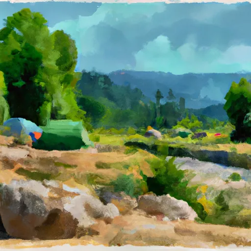
Wilderness Bob Marshall
Reasons to Visit:
1. Pristine Wilderness: Wilderness Bob Marshall is one of the largest designated wilderness areas in the contiguous United States, spanning over one million acres. It offers unparalleled opportunities for hiking, backpacking, camping, fishing, and wildlife viewing.
2. Unspoiled Scenery: The area is characterized by rugged mountains, deep valleys, alpine lakes, and dense forests, making it a paradise for outdoor enthusiasts and nature lovers.
3. Abundant Wildlife: Visitors may have the chance to spot a diverse range of wildlife, including grizzly bears, black bears, elk, moose, mountain goats, wolves, and numerous bird species.
4. Solitude and Tranquility: With its vast size and limited infrastructure, Wilderness Bob Marshall offers a true wilderness experience, allowing visitors to escape the hustle and bustle of daily life and immerse themselves in the serenity of the natural world.
Points of Interest:
1. Bob Marshall Wilderness Area: This is the core of the Wilderness Bob Marshall, providing endless opportunities for backpacking, horseback riding, and exploring. It features over 1,700 miles of trails, including sections of the legendary Continental Divide Trail.
2. Great Bear Wilderness: Adjacent to the Bob Marshall Wilderness, this area is characterized by stunning mountain vistas and is home to the Great Bear, White River, and Sun rivers. It offers fantastic fishing and beautiful alpine meadows.
3. Seeley-Swan Valley: Located on the western side of the wilderness, this valley offers numerous recreational activities such as boating, fishing, wildlife viewing, and camping. It is also a gateway to many trailheads leading into the wilderness area.
Interesting Facts:
1. The Bob Marshall Wilderness Complex is part of the larger Crown of the Continent ecosystem, which spans an incredible 10 million acres across Montana, Alberta, and British Columbia.
2. The wilderness area was named after Bob Marshall, a renowned conservationist and one of the founders of The Wilderness Society.
3. Wilderness Bob Marshall is home to some of the most pristine wilderness ecosystems in the Northern Rockies, preserving critical habitats and providing a refuge for a wide range of species.
Best Time to Visit:
The best time to visit Wilderness Bob Marshall depends on the activities you wish to pursue. The summer months (June to August) offer the most pleasant weather, with warm temperatures and longer daylight hours, making it ideal for hiking, camping, and wildlife viewing. However, it is also the busiest time of the year. Spring (April to May) and fall (September to October) can be less crowded, offering cooler temperatures and vibrant autumn colors. Winter (November to March) brings snow and colder temperatures, making it suitable for winter activities like cross-country skiing and snowshoeing, but access may be limited.
Please note that the accuracy of the information provided is based on various sources and may be subject to change. It is always recommended to consult official park websites or local authorities for the most up-to-date information before planning your visit.
Snowpack in Wilderness Bob Marshall
Current snow depth at SNOTEL stations inside the park boundary.
Trails in Wilderness Bob Marshall
Named trails whose route falls inside the park.
Camping in Wilderness Bob Marshall
Campgrounds inside the park, with today's conditions score.
Plan your visit down to the hour
Same weather feed Snoflo's iOS app uses -- updated continuously from NOAA / yr.no.
Next 5 days, hour by hour
Temperature line with weather symbols on top, snow + rain accumulation as columns, humidity as a dotted line.
5-day forecast table
Every 3 hours, broken out across temperature, snow, rain, humidity, and wind.
| Time | Condition | Temp (°F) | Snow (in) | Rain (in) | Humidity (%) | Wind (mps) | Wind dir |
|---|---|---|---|---|---|---|---|
| Loading detailed forecast… | |||||||
15-day temperature & precipitation
Daily temperatures, snow, and rain projected over the next two weeks.
Responsible recreation & Leave No Trace
- Know before you go
- Check the operator's site for hours, permit requirements, seasonal closures, and fire restrictions before heading out.
- Stay on trail
- Stick to marked paths to protect vegetation, prevent erosion, and avoid disturbing wildlife habitat.
- Respect wildlife
- Observe from a distance, never feed wildlife, and store food securely if camping is permitted on-site.
- Pack it in, pack it out
- Carry out all trash, food scraps, and gear. Many parks have limited or no trash service.
- Leave what you find
- Don't take rocks, plants, or artifacts. They make the park what it is for the next visitor.
Set push alerts in the Snoflo app
Save Wilderness Bob Marshall as a favorite, set a custom threshold (precipitation, freezing temperatures, fire-restriction days), and the iOS app will push the moment conditions cross.
About Wilderness Bob Marshall
What can I do at Wilderness Bob Marshall?
Most Snoflo-tracked parks support hiking, picnicking, and wildlife viewing. Check the operator's site for activity-specific rules (camping, fishing, paddling, hunting).
How fresh is the weather data?
The hourly forecast updates throughout the day from NOAA / yr.no. Streamflow comes live from USGS streamgauges.
When is the best time to visit?
Use the 15-day temperature & precipitation outlook on this page to plan -- pick a window with comfortable temperatures and low precipitation.
How do I get to Wilderness Bob Marshall?
Tap Directions in the hero above to open driving directions in Google Maps, or Open in map to center the Snoflo interactive map on the park.
Can I get alerts when conditions change?
Yes -- alerts are managed in the Snoflo iOS app. Favorite this park, set a threshold (temperature, precipitation), and you'll get a push the moment it crosses.
Park & land designation reference
A quick legend for the federal and state land categories Snoflo tracks. Each designation comes with different rules around access, recreation, and resource extraction.
- National Park
- Large protected natural areas managed by the federal government to preserve significant landscapes, ecosystems, and cultural resources; recreation is allowed but conservation is the priority.
- State Park
- Public natural or recreational areas managed by a state government, typically smaller than national parks and focused on regional natural features, recreation, and education.
- Local Park
- Community-level parks managed by cities or counties, emphasizing recreation, playgrounds, sports, and green space close to populated areas.
- Wilderness Area
- The highest level of land protection in the U.S.; designated areas where nature is left essentially untouched, with no roads, structures, or motorized motorized access permitted.
- National Recreation Area
- Areas set aside primarily for outdoor recreation (boating, hiking, fishing, often around reservoirs, rivers, or scenic landscapes); may allow more development.
- National Conservation Area (BLM)
- BLM-managed areas with special ecological, cultural, or scientific value; more protection than typical BLM land but less strict than Wilderness Areas.
- State Forest
- State-managed forests focused on habitat, watershed, recreation, and sustainable timber harvest.
- Bureau of Land Management (BLM) Land
- Vast federal lands managed for mixed use -- recreation, grazing, mining, conservation -- with fewer restrictions than national parks or forests.