Wilderness Presidential Range-Dry River
Community Reviews
Been here? Share the conditions.
Reviews, ratings & photos are added in the free Snoflo iOS app — rate a spot, tag the conditions, and your visit is verified by location. Add or manage your reviews from the app.

Wilderness Presidential Range-Dry River
One of the main draws of the Wilderness Presidential Range-Dry River area is its breathtaking scenery. Situated within the White Mountains, visitors can immerse themselves in the picturesque beauty of this region. Towering peaks, expansive forests, and crystal-clear rivers create a mesmerizing backdrop for outdoor enthusiasts and nature lovers alike.
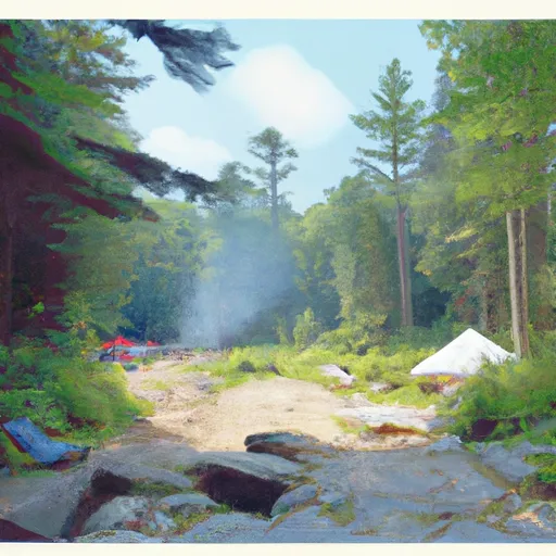
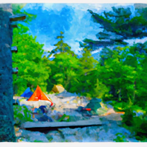
Hiking enthusiasts will find an abundance of trails to explore, catering to all skill levels. One of the most popular trails is the Presidential Range, which offers awe-inspiring views of the surrounding mountains and valleys. The Dry River Wilderness provides an opportunity for backcountry camping and allows visitors to escape into a remote and untouched natural setting.
Apart from its natural wonders, the area also boasts several points of interest. Notably, the Mount Washington Auto Road offers a thrilling driving experience to the summit of New England's highest peak, Mount Washington. This road allows visitors to witness breathtaking panoramic views and experience the extremes of weather that the mountain is known for.
Furthermore, the area has historical significance, being home to the Appalachian Mountain Club's high mountain huts. These huts were built as early as the late 19th century and continue to serve as shelters for hikers today. Staying in one of these huts provides a unique opportunity to connect with the history of mountaineering in the region.
Interesting facts about the Wilderness Presidential Range-Dry River area include its association with the famous Appalachian Trail, which traverses through this region. Additionally, Mount Washington, located within the area, has recorded some of the most extreme weather conditions in the world, with wind speeds reaching hurricane force.
The best time to visit the Wilderness Presidential Range-Dry River area largely depends on personal preferences and desired activities. Summer offers mild temperatures, lush greenery, and excellent hiking conditions. Fall, however, is particularly enchanting with its vibrant foliage, making it the perfect time for scenic drives and photography. Winter enthusiasts can enjoy skiing, snowboarding, and snowshoeing, while spring brings the opportunity to witness the area's stunning wildflower blooms.
To ensure accuracy, it is advisable to verify the information provided by cross-referencing multiple independent sources.
Trails in Wilderness Presidential Range-Dry River
Named trails whose route falls inside the park.
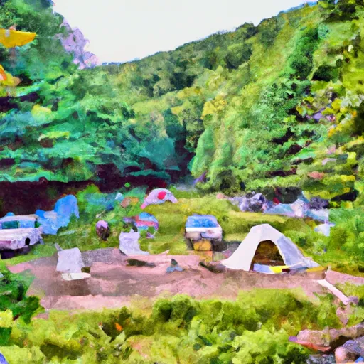
Camping in Wilderness Presidential Range-Dry River
Campgrounds inside the park, with today's conditions score.
Plan your visit down to the hour
Same weather feed Snoflo's iOS app uses -- updated continuously from NOAA / yr.no.
Next 5 days, hour by hour
Temperature line with weather symbols on top, snow + rain accumulation as columns, humidity as a dotted line.
5-day forecast table
Every 3 hours, broken out across temperature, snow, rain, humidity, and wind.
| Time | Condition | Temp (°F) | Snow (in) | Rain (in) | Humidity (%) | Wind (mps) | Wind dir |
|---|---|---|---|---|---|---|---|
| Loading detailed forecast… | |||||||
15-day temperature & precipitation
Daily temperatures, snow, and rain projected over the next two weeks.
Responsible recreation & Leave No Trace
- Know before you go
- Check the operator's site for hours, permit requirements, seasonal closures, and fire restrictions before heading out.
- Stay on trail
- Stick to marked paths to protect vegetation, prevent erosion, and avoid disturbing wildlife habitat.
- Respect wildlife
- Observe from a distance, never feed wildlife, and store food securely if camping is permitted on-site.
- Pack it in, pack it out
- Carry out all trash, food scraps, and gear. Many parks have limited or no trash service.
- Leave what you find
- Don't take rocks, plants, or artifacts. They make the park what it is for the next visitor.
Set push alerts in the Snoflo app
Save Wilderness Presidential Range-Dry River as a favorite, set a custom threshold (precipitation, freezing temperatures, fire-restriction days), and the iOS app will push the moment conditions cross.
About Wilderness Presidential Range-Dry River
What can I do at Wilderness Presidential Range-Dry River?
Most Snoflo-tracked parks support hiking, picnicking, and wildlife viewing. Check the operator's site for activity-specific rules (camping, fishing, paddling, hunting).
How fresh is the weather data?
The hourly forecast updates throughout the day from NOAA / yr.no. Streamflow comes live from USGS streamgauges.
When is the best time to visit?
Use the 15-day temperature & precipitation outlook on this page to plan -- pick a window with comfortable temperatures and low precipitation.
How do I get to Wilderness Presidential Range-Dry River?
Tap Directions in the hero above to open driving directions in Google Maps, or Open in map to center the Snoflo interactive map on the park.
Can I get alerts when conditions change?
Yes -- alerts are managed in the Snoflo iOS app. Favorite this park, set a threshold (temperature, precipitation), and you'll get a push the moment it crosses.
Park & land designation reference
A quick legend for the federal and state land categories Snoflo tracks. Each designation comes with different rules around access, recreation, and resource extraction.
- National Park
- Large protected natural areas managed by the federal government to preserve significant landscapes, ecosystems, and cultural resources; recreation is allowed but conservation is the priority.
- State Park
- Public natural or recreational areas managed by a state government, typically smaller than national parks and focused on regional natural features, recreation, and education.
- Local Park
- Community-level parks managed by cities or counties, emphasizing recreation, playgrounds, sports, and green space close to populated areas.
- Wilderness Area
- The highest level of land protection in the U.S.; designated areas where nature is left essentially untouched, with no roads, structures, or motorized motorized access permitted.
- National Recreation Area
- Areas set aside primarily for outdoor recreation (boating, hiking, fishing, often around reservoirs, rivers, or scenic landscapes); may allow more development.
- National Conservation Area (BLM)
- BLM-managed areas with special ecological, cultural, or scientific value; more protection than typical BLM land but less strict than Wilderness Areas.
- State Forest
- State-managed forests focused on habitat, watershed, recreation, and sustainable timber harvest.
- Bureau of Land Management (BLM) Land
- Vast federal lands managed for mixed use -- recreation, grazing, mining, conservation -- with fewer restrictions than national parks or forests.