Whittingham State Conservation Area
Community Reviews
Been here? Share the conditions.
Reviews, ratings & photos are added in the free Snoflo iOS app — rate a spot, tag the conditions, and your visit is verified by location. Add or manage your reviews from the app.
Whittingham State Conservation Area
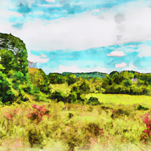
One of the main reasons to visit Whittingham State Conservation Area is the opportunity to explore its well-maintained trails. The park boasts a variety of walking and hiking trails that wind through dense forests, open meadows, and along peaceful streams. These trails offer visitors a chance to immerse themselves in the area's natural beauty and provide excellent opportunities for wildlife observation and birdwatching.
The conservation area is also home to a remarkable range of wildlife. Visitors may encounter white-tailed deer, rabbits, foxes, and a variety of bird species, including hawks and woodpeckers. This makes Whittingham a haven for nature enthusiasts and wildlife photographers.
One of the notable points of interest within the conservation area is the pristine Dennis Creek. This creek runs through the park and provides a peaceful setting for fishing or simply enjoying the tranquility of the surroundings. Anglers can try their luck at catching trout, bass, and other freshwater fish species.
In addition to its natural beauty, Whittingham State Conservation Area has an interesting historical background. The park was once part of a larger property known as the Vineland State School, a residential facility for individuals with developmental disabilities. The conservation area now serves as a serene public space, giving visitors the opportunity to hike, picnic, and enjoy nature.
The best time to visit Whittingham State Conservation Area is during the spring and fall seasons. The park comes alive with vibrant colors in the spring as wildflowers bloom, and the foliage offers stunning views in the fall. During these seasons, the weather is mild, making it ideal for outdoor activities.
To ensure accuracy, it is recommended to verify the information about Whittingham State Conservation Area by cross-referencing multiple independent sources, such as official park websites and reputable travel guides.
Plan your visit down to the hour
Same weather feed Snoflo's iOS app uses -- updated continuously from NOAA / yr.no.
Next 5 days, hour by hour
Temperature line with weather symbols on top, snow + rain accumulation as columns, humidity as a dotted line.
5-day forecast table
Every 3 hours, broken out across temperature, snow, rain, humidity, and wind.
| Time | Condition | Temp (°F) | Snow (in) | Rain (in) | Humidity (%) | Wind (mps) | Wind dir |
|---|---|---|---|---|---|---|---|
| Loading detailed forecast… | |||||||
15-day temperature & precipitation
Daily temperatures, snow, and rain projected over the next two weeks.
Responsible recreation & Leave No Trace
- Know before you go
- Check the operator's site for hours, permit requirements, seasonal closures, and fire restrictions before heading out.
- Stay on trail
- Stick to marked paths to protect vegetation, prevent erosion, and avoid disturbing wildlife habitat.
- Respect wildlife
- Observe from a distance, never feed wildlife, and store food securely if camping is permitted on-site.
- Pack it in, pack it out
- Carry out all trash, food scraps, and gear. Many parks have limited or no trash service.
- Leave what you find
- Don't take rocks, plants, or artifacts. They make the park what it is for the next visitor.
Set push alerts in the Snoflo app
Save Whittingham State Conservation Area as a favorite, set a custom threshold (precipitation, freezing temperatures, fire-restriction days), and the iOS app will push the moment conditions cross.
About Whittingham State Conservation Area
What can I do at Whittingham State Conservation Area?
Most Snoflo-tracked parks support hiking, picnicking, and wildlife viewing. Check the operator's site for activity-specific rules (camping, fishing, paddling, hunting).
How fresh is the weather data?
The hourly forecast updates throughout the day from NOAA / yr.no. Streamflow comes live from USGS streamgauges.
When is the best time to visit?
Use the 15-day temperature & precipitation outlook on this page to plan -- pick a window with comfortable temperatures and low precipitation.
How do I get to Whittingham State Conservation Area?
Tap Directions in the hero above to open driving directions in Google Maps, or Open in map to center the Snoflo interactive map on the park.
Can I get alerts when conditions change?
Yes -- alerts are managed in the Snoflo iOS app. Favorite this park, set a threshold (temperature, precipitation), and you'll get a push the moment it crosses.
Park & land designation reference
A quick legend for the federal and state land categories Snoflo tracks. Each designation comes with different rules around access, recreation, and resource extraction.
- National Park
- Large protected natural areas managed by the federal government to preserve significant landscapes, ecosystems, and cultural resources; recreation is allowed but conservation is the priority.
- State Park
- Public natural or recreational areas managed by a state government, typically smaller than national parks and focused on regional natural features, recreation, and education.
- Local Park
- Community-level parks managed by cities or counties, emphasizing recreation, playgrounds, sports, and green space close to populated areas.
- Wilderness Area
- The highest level of land protection in the U.S.; designated areas where nature is left essentially untouched, with no roads, structures, or motorized motorized access permitted.
- National Recreation Area
- Areas set aside primarily for outdoor recreation (boating, hiking, fishing, often around reservoirs, rivers, or scenic landscapes); may allow more development.
- National Conservation Area (BLM)
- BLM-managed areas with special ecological, cultural, or scientific value; more protection than typical BLM land but less strict than Wilderness Areas.
- State Forest
- State-managed forests focused on habitat, watershed, recreation, and sustainable timber harvest.
- Bureau of Land Management (BLM) Land
- Vast federal lands managed for mixed use -- recreation, grazing, mining, conservation -- with fewer restrictions than national parks or forests.