San Andres National Wildlife Refuge
Community Reviews
Been here? Share the conditions.
Reviews, ratings & photos are added in the free Snoflo iOS app — rate a spot, tag the conditions, and your visit is verified by location. Add or manage your reviews from the app.
San Andres National Wildlife Refuge
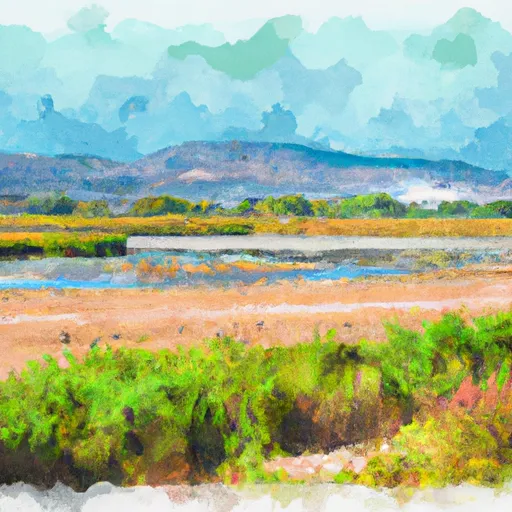
San Andres National Wildlife Refuge, encompassing approximately 57,000 acres, is situated in the southern region of New Mexico. The refuge is primarily known for its stunning landscapes, diverse wildlife, and exceptional birding opportunities. It is managed by the U.S. Fish and Wildlife Service.
Reasons to visit:
1. Wildlife Viewing: San Andres National Wildlife Refuge provides habitat for a wide range of wildlife species. Visitors may encounter mule deer, pronghorn antelope, coyotes, foxes, and various small mammals.
2. Birding Paradise: The refuge is renowned for its birding opportunities, with over 200 bird species documented. Birdwatchers can spot golden eagles, turkey vultures, roadrunners, burrowing owls, and various raptors.
3. Scenic Beauty: The refuge boasts breathtaking landscapes, including mountain ranges, vast grasslands, and desert scrub. Visitors can enjoy panoramic views and take in the natural beauty of the area.
4. Hiking and Photography: San Andres offers numerous hiking trails that provide access to the refuge's stunning vistas and wildlife observation areas. Additionally, photographers will find countless opportunities to capture the area's beauty.
Points of Interest:
1. Mount Riley: Rising to an elevation of 6,540 feet, Mount Riley is the highest peak within the refuge and offers panoramic views of the surrounding landscape.
2. Water Canyon: A picturesque canyon that provides critical water sources for wildlife within the refuge. Exploring Water Canyon allows visitors to experience the area's unique flora and fauna.
3. Wildlife Observation Points: Numerous observation points are strategically located throughout the refuge, providing ideal vantage points to spot various wildlife species.
4. Historic Ranching Structures: San Andres National Wildlife Refuge was once home to several historic ranches. Visitors can explore remnants of these structures, providing insight into the area's rich cultural heritage.
Interesting Facts:
1. San Andres National Wildlife Refuge is part of the Chihuahuan Desert ecosystem, characterized by its unique plant and animal life.
2. The refuge was established in 1941 as a haven for wildlife and habitat preservation.
3. San Andres serves as a crucial corridor for the migration of wildlife, including the iconic pronghorn antelope.
4. The refuge offers limited hunting opportunities for specific game species during designated seasons. However, hunting is strictly regulated and requires proper permits.
Best time to visit:
The best time to visit San Andres National Wildlife Refuge is during the spring and fall seasons. Spring brings mild temperatures, blooming wildflowers, and an abundance of bird species. Fall offers similar conditions, with colorful foliage and pleasant weather. Summers can be extremely hot, while winters bring cooler temperatures and occasional snowfall.
It is always advisable to check the U.S. Fish and Wildlife Service's official website or contact the refuge directly to get the most up-to-date information on visiting hours, access, and any special considerations.
Plan your visit down to the hour
Same weather feed Snoflo's iOS app uses -- updated continuously from NOAA / yr.no.
Next 5 days, hour by hour
Temperature line with weather symbols on top, snow + rain accumulation as columns, humidity as a dotted line.
5-day forecast table
Every 3 hours, broken out across temperature, snow, rain, humidity, and wind.
| Time | Condition | Temp (°F) | Snow (in) | Rain (in) | Humidity (%) | Wind (mps) | Wind dir |
|---|---|---|---|---|---|---|---|
| Loading detailed forecast… | |||||||
15-day temperature & precipitation
Daily temperatures, snow, and rain projected over the next two weeks.
Responsible recreation & Leave No Trace
- Know before you go
- Check the operator's site for hours, permit requirements, seasonal closures, and fire restrictions before heading out.
- Stay on trail
- Stick to marked paths to protect vegetation, prevent erosion, and avoid disturbing wildlife habitat.
- Respect wildlife
- Observe from a distance, never feed wildlife, and store food securely if camping is permitted on-site.
- Pack it in, pack it out
- Carry out all trash, food scraps, and gear. Many parks have limited or no trash service.
- Leave what you find
- Don't take rocks, plants, or artifacts. They make the park what it is for the next visitor.
Set push alerts in the Snoflo app
Save San Andres National Wildlife Refuge as a favorite, set a custom threshold (precipitation, freezing temperatures, fire-restriction days), and the iOS app will push the moment conditions cross.
About San Andres National Wildlife Refuge
What can I do at San Andres National Wildlife Refuge?
Most Snoflo-tracked parks support hiking, picnicking, and wildlife viewing. Check the operator's site for activity-specific rules (camping, fishing, paddling, hunting).
How fresh is the weather data?
The hourly forecast updates throughout the day from NOAA / yr.no. Streamflow comes live from USGS streamgauges.
When is the best time to visit?
Use the 15-day temperature & precipitation outlook on this page to plan -- pick a window with comfortable temperatures and low precipitation.
How do I get to San Andres National Wildlife Refuge?
Tap Directions in the hero above to open driving directions in Google Maps, or Open in map to center the Snoflo interactive map on the park.
Can I get alerts when conditions change?
Yes -- alerts are managed in the Snoflo iOS app. Favorite this park, set a threshold (temperature, precipitation), and you'll get a push the moment it crosses.
Park & land designation reference
A quick legend for the federal and state land categories Snoflo tracks. Each designation comes with different rules around access, recreation, and resource extraction.
- National Park
- Large protected natural areas managed by the federal government to preserve significant landscapes, ecosystems, and cultural resources; recreation is allowed but conservation is the priority.
- State Park
- Public natural or recreational areas managed by a state government, typically smaller than national parks and focused on regional natural features, recreation, and education.
- Local Park
- Community-level parks managed by cities or counties, emphasizing recreation, playgrounds, sports, and green space close to populated areas.
- Wilderness Area
- The highest level of land protection in the U.S.; designated areas where nature is left essentially untouched, with no roads, structures, or motorized motorized access permitted.
- National Recreation Area
- Areas set aside primarily for outdoor recreation (boating, hiking, fishing, often around reservoirs, rivers, or scenic landscapes); may allow more development.
- National Conservation Area (BLM)
- BLM-managed areas with special ecological, cultural, or scientific value; more protection than typical BLM land but less strict than Wilderness Areas.
- State Forest
- State-managed forests focused on habitat, watershed, recreation, and sustainable timber harvest.
- Bureau of Land Management (BLM) Land
- Vast federal lands managed for mixed use -- recreation, grazing, mining, conservation -- with fewer restrictions than national parks or forests.