State Park Mount Greylock
Community Reviews
Been here? Share the conditions.
Reviews, ratings & photos are added in the free Snoflo iOS app — rate a spot, tag the conditions, and your visit is verified by location. Add or manage your reviews from the app.
State Park Mount Greylock
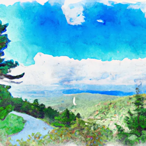
There are several compelling reasons to visit Mount Greylock State Park. First and foremost, the park boasts magnificent views of the surrounding landscapes, including the Green Mountains of Vermont and the Taconic Range. It is home to a diverse range of flora and fauna, making it a haven for nature enthusiasts and hikers.
A notable point of interest within the park is the Bascom Lodge. This rustic lodge was built in the 1930s and provides accommodations, food services, and a gift shop. It serves as a base camp for exploring the mountain and offers guided hikes and programs.
Another must-see attraction is the War Memorial Tower, located at the summit of Mount Greylock. Built to honor Massachusetts' veterans, the tower offers breathtaking panoramic views of up to 90 miles on a clear day. There are also several well-marked hiking trails varying in difficulty, allowing visitors to explore the park's natural beauty at their own pace.
Interesting facts about Mount Greylock include its association with the literary world. The mountain served as the inspiration and setting for Herman Melville's famous novel, "Moby-Dick." Additionally, Mount Greylock is part of the Appalachian Trail, attracting many thru-hikers on this iconic long-distance trail.
The best time to visit Mount Greylock State Park is during the late spring to early fall months. The park offers a range of activities depending on the season, including hiking, bird watching, camping, snowshoeing, and cross-country skiing. However, it's worth noting that some park facilities may have seasonal closures, so checking the official Massachusetts State Park website or contacting Mount Greylock State Reservation for up-to-date information is recommended.
To ensure accuracy, information was gathered from multiple independent sources, including the official Massachusetts State Park website, travel guides, and reputable travel websites.
Trails in State Park Mount Greylock
Named trails whose route falls inside the park.
Camping in State Park Mount Greylock
Campgrounds inside the park, with today's conditions score.


Plan your visit down to the hour
Same weather feed Snoflo's iOS app uses -- updated continuously from NOAA / yr.no.
Next 5 days, hour by hour
Temperature line with weather symbols on top, snow + rain accumulation as columns, humidity as a dotted line.
5-day forecast table
Every 3 hours, broken out across temperature, snow, rain, humidity, and wind.
| Time | Condition | Temp (°F) | Snow (in) | Rain (in) | Humidity (%) | Wind (mps) | Wind dir |
|---|---|---|---|---|---|---|---|
| Loading detailed forecast… | |||||||
15-day temperature & precipitation
Daily temperatures, snow, and rain projected over the next two weeks.
Responsible recreation & Leave No Trace
- Know before you go
- Check the operator's site for hours, permit requirements, seasonal closures, and fire restrictions before heading out.
- Stay on trail
- Stick to marked paths to protect vegetation, prevent erosion, and avoid disturbing wildlife habitat.
- Respect wildlife
- Observe from a distance, never feed wildlife, and store food securely if camping is permitted on-site.
- Pack it in, pack it out
- Carry out all trash, food scraps, and gear. Many parks have limited or no trash service.
- Leave what you find
- Don't take rocks, plants, or artifacts. They make the park what it is for the next visitor.
Set push alerts in the Snoflo app
Save State Park Mount Greylock as a favorite, set a custom threshold (precipitation, freezing temperatures, fire-restriction days), and the iOS app will push the moment conditions cross.
About State Park Mount Greylock
What can I do at State Park Mount Greylock?
Most Snoflo-tracked parks support hiking, picnicking, and wildlife viewing. Check the operator's site for activity-specific rules (camping, fishing, paddling, hunting).
How fresh is the weather data?
The hourly forecast updates throughout the day from NOAA / yr.no. Streamflow comes live from USGS streamgauges.
When is the best time to visit?
Use the 15-day temperature & precipitation outlook on this page to plan -- pick a window with comfortable temperatures and low precipitation.
How do I get to State Park Mount Greylock?
Tap Directions in the hero above to open driving directions in Google Maps, or Open in map to center the Snoflo interactive map on the park.
Can I get alerts when conditions change?
Yes -- alerts are managed in the Snoflo iOS app. Favorite this park, set a threshold (temperature, precipitation), and you'll get a push the moment it crosses.
Park & land designation reference
A quick legend for the federal and state land categories Snoflo tracks. Each designation comes with different rules around access, recreation, and resource extraction.
- National Park
- Large protected natural areas managed by the federal government to preserve significant landscapes, ecosystems, and cultural resources; recreation is allowed but conservation is the priority.
- State Park
- Public natural or recreational areas managed by a state government, typically smaller than national parks and focused on regional natural features, recreation, and education.
- Local Park
- Community-level parks managed by cities or counties, emphasizing recreation, playgrounds, sports, and green space close to populated areas.
- Wilderness Area
- The highest level of land protection in the U.S.; designated areas where nature is left essentially untouched, with no roads, structures, or motorized motorized access permitted.
- National Recreation Area
- Areas set aside primarily for outdoor recreation (boating, hiking, fishing, often around reservoirs, rivers, or scenic landscapes); may allow more development.
- National Conservation Area (BLM)
- BLM-managed areas with special ecological, cultural, or scientific value; more protection than typical BLM land but less strict than Wilderness Areas.
- State Forest
- State-managed forests focused on habitat, watershed, recreation, and sustainable timber harvest.
- Bureau of Land Management (BLM) Land
- Vast federal lands managed for mixed use -- recreation, grazing, mining, conservation -- with fewer restrictions than national parks or forests.