Wild Forest Willowemoc
Community Reviews
Been here? Share the conditions.
Reviews, ratings & photos are added in the free Snoflo iOS app — rate a spot, tag the conditions, and your visit is verified by location. Add or manage your reviews from the app.

Wild Forest Willowemoc
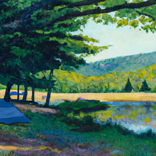
One of the primary reasons to visit Wild Forest Willowemoc is the abundance of outdoor recreational activities it offers. From hiking and camping to fishing and bird-watching, there is something for everyone to enjoy. The area is known for its pristine landscapes, including dense forests, crystal-clear streams, and beautiful waterfalls, making it an ideal destination for nature enthusiasts.
There are several specific points of interest that visitors should explore while in Wild Forest Willowemoc. One such attraction is the Willowemoc Wild Forest, a vast expanse of protected wilderness that offers numerous hiking trails, such as the Willowemoc Trail, which showcases stunning panoramic views. Additionally, the area is home to several scenic waterfalls, including the picturesque Frick Pond Loop, which leads to a serene pond surrounded by towering trees.
Interesting facts about Wild Forest Willowemoc include its historical significance. The region was once inhabited by the indigenous Lenape people, and evidence of their presence can still be found in the area. Furthermore, the Willowemoc Creek, which flows through the region, is renowned for its excellent trout fishing, attracting anglers from all over the country.
The best time of year to visit Wild Forest Willowemoc largely depends on individual preferences and desired activities. Spring and summer months offer pleasant weather for hiking and camping, with vibrant foliage and blooming wildflowers adding to the aesthetic appeal. Fall is particularly stunning, as the forests are painted with a tapestry of vibrant autumn colors. Winter, on the other hand, provides opportunities for winter sports such as snowshoeing and cross-country skiing.
To ensure accuracy, it is recommended to verify the information provided by cross-referencing multiple independent sources such as official state park websites, travel guides, and reputable outdoor enthusiast forums.
Trails in Wild Forest Willowemoc
Named trails whose route falls inside the park.
Camping in Wild Forest Willowemoc
Campgrounds inside the park, with today's conditions score.
Points of interest in Wild Forest Willowemoc
Landmarks and points of interest inside the park boundary.
Plan your visit down to the hour
Same weather feed Snoflo's iOS app uses -- updated continuously from NOAA / yr.no.
Next 5 days, hour by hour
Temperature line with weather symbols on top, snow + rain accumulation as columns, humidity as a dotted line.
5-day forecast table
Every 3 hours, broken out across temperature, snow, rain, humidity, and wind.
| Time | Condition | Temp (°F) | Snow (in) | Rain (in) | Humidity (%) | Wind (mps) | Wind dir |
|---|---|---|---|---|---|---|---|
| Loading detailed forecast… | |||||||
15-day temperature & precipitation
Daily temperatures, snow, and rain projected over the next two weeks.
Responsible recreation & Leave No Trace
- Know before you go
- Check the operator's site for hours, permit requirements, seasonal closures, and fire restrictions before heading out.
- Stay on trail
- Stick to marked paths to protect vegetation, prevent erosion, and avoid disturbing wildlife habitat.
- Respect wildlife
- Observe from a distance, never feed wildlife, and store food securely if camping is permitted on-site.
- Pack it in, pack it out
- Carry out all trash, food scraps, and gear. Many parks have limited or no trash service.
- Leave what you find
- Don't take rocks, plants, or artifacts. They make the park what it is for the next visitor.
Set push alerts in the Snoflo app
Save Wild Forest Willowemoc as a favorite, set a custom threshold (precipitation, freezing temperatures, fire-restriction days), and the iOS app will push the moment conditions cross.
About Wild Forest Willowemoc
What can I do at Wild Forest Willowemoc?
Most Snoflo-tracked parks support hiking, picnicking, and wildlife viewing. Check the operator's site for activity-specific rules (camping, fishing, paddling, hunting).
How fresh is the weather data?
The hourly forecast updates throughout the day from NOAA / yr.no. Streamflow comes live from USGS streamgauges.
When is the best time to visit?
Use the 15-day temperature & precipitation outlook on this page to plan -- pick a window with comfortable temperatures and low precipitation.
How do I get to Wild Forest Willowemoc?
Tap Directions in the hero above to open driving directions in Google Maps, or Open in map to center the Snoflo interactive map on the park.
Can I get alerts when conditions change?
Yes -- alerts are managed in the Snoflo iOS app. Favorite this park, set a threshold (temperature, precipitation), and you'll get a push the moment it crosses.
Park & land designation reference
A quick legend for the federal and state land categories Snoflo tracks. Each designation comes with different rules around access, recreation, and resource extraction.
- National Park
- Large protected natural areas managed by the federal government to preserve significant landscapes, ecosystems, and cultural resources; recreation is allowed but conservation is the priority.
- State Park
- Public natural or recreational areas managed by a state government, typically smaller than national parks and focused on regional natural features, recreation, and education.
- Local Park
- Community-level parks managed by cities or counties, emphasizing recreation, playgrounds, sports, and green space close to populated areas.
- Wilderness Area
- The highest level of land protection in the U.S.; designated areas where nature is left essentially untouched, with no roads, structures, or motorized motorized access permitted.
- National Recreation Area
- Areas set aside primarily for outdoor recreation (boating, hiking, fishing, often around reservoirs, rivers, or scenic landscapes); may allow more development.
- National Conservation Area (BLM)
- BLM-managed areas with special ecological, cultural, or scientific value; more protection than typical BLM land but less strict than Wilderness Areas.
- State Forest
- State-managed forests focused on habitat, watershed, recreation, and sustainable timber harvest.
- Bureau of Land Management (BLM) Land
- Vast federal lands managed for mixed use -- recreation, grazing, mining, conservation -- with fewer restrictions than national parks or forests.