Theodore Roosevelt State Natural Area
Community Reviews
Been here? Share the conditions.
Reviews, ratings & photos are added in the free Snoflo iOS app — rate a spot, tag the conditions, and your visit is verified by location. Add or manage your reviews from the app.
Theodore Roosevelt State Natural Area
Reasons to Visit:
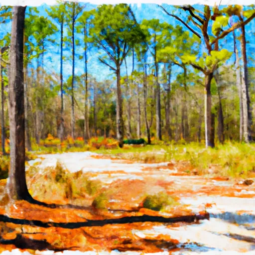
1. Biodiversity: The natural area encompasses approximately 265 acres of diverse ecosystems, including forests, wetlands, and open fields. This variety of habitats supports a rich and diverse array of plant and animal species, making it an excellent destination for nature enthusiasts and wildlife photographers.
2. Hiking and Recreation: The area offers well-maintained hiking trails that wind through forests and along the shores of the adjacent Roanoke River. These trails provide an opportunity to observe wildlife, enjoy peaceful surroundings, and engage in outdoor activities such as birdwatching, fishing, and nature photography.
3. Cultural and Historical Significance: Named after President Theodore Roosevelt, this natural area holds historical importance. Roosevelt visited the region for a hunting trip in 1902 and subsequently established wildlife refuges and national parks to conserve America's natural heritage. Visitors can learn about this legacy and its impact on conservation efforts.
Points of Interest:
1. Roanoke River: The natural area is situated along the Roanoke River, providing opportunities for fishing, kayaking, and canoeing. The river is known for its diverse fish population, including largemouth bass, catfish, and sunfish.
2. Boardwalk Trail: The boardwalk trail stretches through the wetland areas, allowing visitors to observe unique plant species like pitcher plants and experience the vibrant ecosystem up close.
3. Wildlife Viewing: The natural area is home to a wide range of wildlife, including white-tailed deer, bobcats, river otters, and various bird species. Birdwatchers can spot migratory birds such as warblers, herons, and ducks throughout the year.
Interesting Facts:
1. Conservation Efforts: The Theodore Roosevelt State Natural Area is managed by the North Carolina Division of Parks and Recreation, which is dedicated to preserving and protecting the natural resources of the state.
2. Scenic Beauty: The natural area offers breathtaking views of the Roanoke River, serene wetlands, and lush forests, making it a picturesque location for photography enthusiasts.
3. Education and Interpretation: The park provides educational programs, guided hikes, and interpretive displays to foster understanding and appreciation of the area's natural and cultural heritage.
Best Time to Visit:
The best time to visit Theodore Roosevelt State Natural Area is during the spring and fall seasons when temperatures are mild and the foliage is vibrant. Spring brings blooming wildflowers and migratory birds, while the fall offers stunning foliage colors. Summer can be hot and humid, but it is still a good time for activities such as fishing and boating. Winter is generally quieter, with fewer visitors, but offers peaceful hiking opportunities for those seeking solitude.
Note: It is always advisable to check the official website or contact the natural area directly for the most up-to-date information, as park policies and conditions may change.
Plan your visit down to the hour
Same weather feed Snoflo's iOS app uses -- updated continuously from NOAA / yr.no.
Next 5 days, hour by hour
Temperature line with weather symbols on top, snow + rain accumulation as columns, humidity as a dotted line.
5-day forecast table
Every 3 hours, broken out across temperature, snow, rain, humidity, and wind.
| Time | Condition | Temp (°F) | Snow (in) | Rain (in) | Humidity (%) | Wind (mps) | Wind dir |
|---|---|---|---|---|---|---|---|
| Loading detailed forecast… | |||||||
15-day temperature & precipitation
Daily temperatures, snow, and rain projected over the next two weeks.
Responsible recreation & Leave No Trace
- Know before you go
- Check the operator's site for hours, permit requirements, seasonal closures, and fire restrictions before heading out.
- Stay on trail
- Stick to marked paths to protect vegetation, prevent erosion, and avoid disturbing wildlife habitat.
- Respect wildlife
- Observe from a distance, never feed wildlife, and store food securely if camping is permitted on-site.
- Pack it in, pack it out
- Carry out all trash, food scraps, and gear. Many parks have limited or no trash service.
- Leave what you find
- Don't take rocks, plants, or artifacts. They make the park what it is for the next visitor.
Set push alerts in the Snoflo app
Save Theodore Roosevelt State Natural Area as a favorite, set a custom threshold (precipitation, freezing temperatures, fire-restriction days), and the iOS app will push the moment conditions cross.
About Theodore Roosevelt State Natural Area
What can I do at Theodore Roosevelt State Natural Area?
Most Snoflo-tracked parks support hiking, picnicking, and wildlife viewing. Check the operator's site for activity-specific rules (camping, fishing, paddling, hunting).
How fresh is the weather data?
The hourly forecast updates throughout the day from NOAA / yr.no. Streamflow comes live from USGS streamgauges.
When is the best time to visit?
Use the 15-day temperature & precipitation outlook on this page to plan -- pick a window with comfortable temperatures and low precipitation.
How do I get to Theodore Roosevelt State Natural Area?
Tap Directions in the hero above to open driving directions in Google Maps, or Open in map to center the Snoflo interactive map on the park.
Can I get alerts when conditions change?
Yes -- alerts are managed in the Snoflo iOS app. Favorite this park, set a threshold (temperature, precipitation), and you'll get a push the moment it crosses.
Park & land designation reference
A quick legend for the federal and state land categories Snoflo tracks. Each designation comes with different rules around access, recreation, and resource extraction.
- National Park
- Large protected natural areas managed by the federal government to preserve significant landscapes, ecosystems, and cultural resources; recreation is allowed but conservation is the priority.
- State Park
- Public natural or recreational areas managed by a state government, typically smaller than national parks and focused on regional natural features, recreation, and education.
- Local Park
- Community-level parks managed by cities or counties, emphasizing recreation, playgrounds, sports, and green space close to populated areas.
- Wilderness Area
- The highest level of land protection in the U.S.; designated areas where nature is left essentially untouched, with no roads, structures, or motorized motorized access permitted.
- National Recreation Area
- Areas set aside primarily for outdoor recreation (boating, hiking, fishing, often around reservoirs, rivers, or scenic landscapes); may allow more development.
- National Conservation Area (BLM)
- BLM-managed areas with special ecological, cultural, or scientific value; more protection than typical BLM land but less strict than Wilderness Areas.
- State Forest
- State-managed forests focused on habitat, watershed, recreation, and sustainable timber harvest.
- Bureau of Land Management (BLM) Land
- Vast federal lands managed for mixed use -- recreation, grazing, mining, conservation -- with fewer restrictions than national parks or forests.