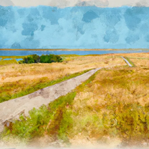
Upper Souris National Wildlife Refuge
Community Reviews
Been here? Share the conditions.
Reviews, ratings & photos are added in the free Snoflo iOS app — rate a spot, tag the conditions, and your visit is verified by location. Add or manage your reviews from the app.
Upper Souris National Wildlife Refuge
Reasons to Visit:
1. Wildlife Viewing: The refuge spans over 32,000 acres and provides a habitat for a variety of wildlife species. Visitors can spot animals such as white-tailed deer, moose, waterfowl, shorebirds, and even bald eagles.
2. Birdwatching: Upper Souris is a haven for bird enthusiasts, with over 240 species recorded within its boundaries. The refuge is particularly famous for its waterfowl population, including large numbers of ducks and geese.
3. Fishing: The refuge offers excellent fishing opportunities, with several lakes and rivers providing habitat for various fish species, including northern pike, walleye, and smallmouth bass.
4. Photography: The scenic landscapes and diverse wildlife make Upper Souris a fantastic destination for photographers. The changing seasons offer unique opportunities to capture stunning shots.
5. Hiking and Wildlife Trails: The refuge offers multiple hiking trails, enabling visitors to explore the beautiful surroundings while observing wildlife and enjoying the peacefulness of nature.
Points of Interest:
1. Upper Souris Lakes: The refuge encompasses a series of interconnected lakes, providing opportunities for boating, canoeing, and kayaking.
2. J. Clark Salyer National Wildlife Refuge: Located adjacent to Upper Souris, this refuge offers additional wildlife viewing opportunities, making it a great extension to any visit.
3. Lake Darling: This reservoir, located within the refuge, is a popular spot for fishing, boating, and camping.
Interesting Facts:
1. Upper Souris is one of the largest National Wildlife Refuges in the northern Great Plains region.
2. The refuge was established in 1935 to provide critical habitat for migratory birds and other wildlife.
3. Upper Souris plays a vital role in the breeding and migration of waterfowl, supporting thousands of nesting pairs and serving as a stopover for migratory birds.
Best Time to Visit:
The best time to visit Upper Souris National Wildlife Refuge is during spring and fall. Spring offers a chance to witness the arrival of migratory birds and the reawakening of nature. Fall brings spectacular foliage colors and the migration of waterfowl. However, each season has its own unique attractions, and summer and winter also offer recreational opportunities.
It is essential to verify this information from multiple independent sources, such as official refuge websites or publications, to ensure accuracy and obtain the most up-to-date information before planning a visit.
Trails in Upper Souris National Wildlife Refuge
Named trails whose route falls inside the park.
Plan your visit down to the hour
Same weather feed Snoflo's iOS app uses -- updated continuously from NOAA / yr.no.
Next 5 days, hour by hour
Temperature line with weather symbols on top, snow + rain accumulation as columns, humidity as a dotted line.
5-day forecast table
Every 3 hours, broken out across temperature, snow, rain, humidity, and wind.
| Time | Condition | Temp (°F) | Snow (in) | Rain (in) | Humidity (%) | Wind (mps) | Wind dir |
|---|---|---|---|---|---|---|---|
| Loading detailed forecast… | |||||||
15-day temperature & precipitation
Daily temperatures, snow, and rain projected over the next two weeks.
Responsible recreation & Leave No Trace
- Know before you go
- Check the operator's site for hours, permit requirements, seasonal closures, and fire restrictions before heading out.
- Stay on trail
- Stick to marked paths to protect vegetation, prevent erosion, and avoid disturbing wildlife habitat.
- Respect wildlife
- Observe from a distance, never feed wildlife, and store food securely if camping is permitted on-site.
- Pack it in, pack it out
- Carry out all trash, food scraps, and gear. Many parks have limited or no trash service.
- Leave what you find
- Don't take rocks, plants, or artifacts. They make the park what it is for the next visitor.
Set push alerts in the Snoflo app
Save Upper Souris National Wildlife Refuge as a favorite, set a custom threshold (precipitation, freezing temperatures, fire-restriction days), and the iOS app will push the moment conditions cross.
About Upper Souris National Wildlife Refuge
What can I do at Upper Souris National Wildlife Refuge?
Most Snoflo-tracked parks support hiking, picnicking, and wildlife viewing. Check the operator's site for activity-specific rules (camping, fishing, paddling, hunting).
How fresh is the weather data?
The hourly forecast updates throughout the day from NOAA / yr.no. Streamflow comes live from USGS streamgauges.
When is the best time to visit?
Use the 15-day temperature & precipitation outlook on this page to plan -- pick a window with comfortable temperatures and low precipitation.
How do I get to Upper Souris National Wildlife Refuge?
Tap Directions in the hero above to open driving directions in Google Maps, or Open in map to center the Snoflo interactive map on the park.
Can I get alerts when conditions change?
Yes -- alerts are managed in the Snoflo iOS app. Favorite this park, set a threshold (temperature, precipitation), and you'll get a push the moment it crosses.
Park & land designation reference
A quick legend for the federal and state land categories Snoflo tracks. Each designation comes with different rules around access, recreation, and resource extraction.
- National Park
- Large protected natural areas managed by the federal government to preserve significant landscapes, ecosystems, and cultural resources; recreation is allowed but conservation is the priority.
- State Park
- Public natural or recreational areas managed by a state government, typically smaller than national parks and focused on regional natural features, recreation, and education.
- Local Park
- Community-level parks managed by cities or counties, emphasizing recreation, playgrounds, sports, and green space close to populated areas.
- Wilderness Area
- The highest level of land protection in the U.S.; designated areas where nature is left essentially untouched, with no roads, structures, or motorized motorized access permitted.
- National Recreation Area
- Areas set aside primarily for outdoor recreation (boating, hiking, fishing, often around reservoirs, rivers, or scenic landscapes); may allow more development.
- National Conservation Area (BLM)
- BLM-managed areas with special ecological, cultural, or scientific value; more protection than typical BLM land but less strict than Wilderness Areas.
- State Forest
- State-managed forests focused on habitat, watershed, recreation, and sustainable timber harvest.
- Bureau of Land Management (BLM) Land
- Vast federal lands managed for mixed use -- recreation, grazing, mining, conservation -- with fewer restrictions than national parks or forests.