Wilderness Mount Thielsen
Community Reviews
Been here? Share the conditions.
Reviews, ratings & photos are added in the free Snoflo iOS app — rate a spot, tag the conditions, and your visit is verified by location. Add or manage your reviews from the app.

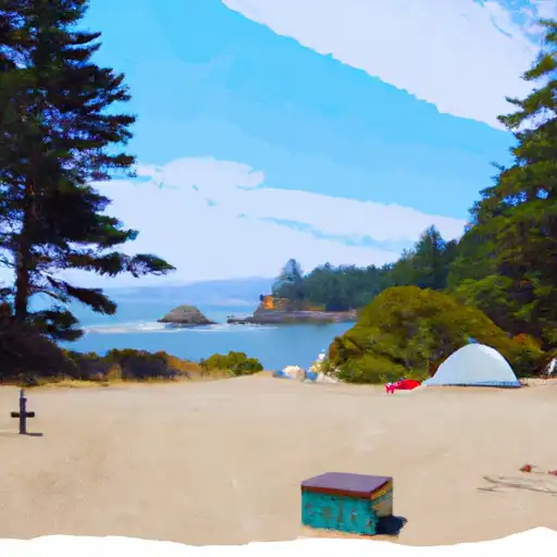
Wilderness Mount Thielsen
One of the primary attractions of Mount Thielsen Wilderness is its namesake peak, Mount Thielsen. Rising to a height of 9,182 feet, Mount Thielsen is known for its distinctive lightning rod-like spire at its summit. This impressive volcanic peak provides opportunities for hiking and climbing, attracting adventure seekers from all over.
The wilderness area is also home to numerous other points of interest. Crater Lake National Park, one of the most iconic national parks in the United States, borders the Mount Thielsen Wilderness. Visitors can explore the pristine Crater Lake, formed in the caldera of Mount Mazama, and enjoy activities such as hiking, fishing, and boating.
Another notable feature of the wilderness is the Pacific Crest Trail (PCT), which traverses through the area. Hikers can embark on a portion of this renowned long-distance trail, taking in the breathtaking views of the surrounding landscapes.
The Mount Thielsen Wilderness boasts a unique flora and fauna. The diverse ecosystems within the wilderness support a variety of plant life, including subalpine meadows, lush forests, and alpine tundra. Wildlife enthusiasts can spot a range of species, such as black bears, elk, mule deer, and various bird species.
The best time to visit the Mount Thielsen Wilderness is during the summer and early fall months. From July to September, the weather is generally mild and allows for comfortable hiking and outdoor activities. However, it is essential to check weather conditions and be prepared for sudden changes, as the high elevation can bring unpredictable weather patterns.
To ensure accuracy, it is advisable to verify information about the Mount Thielsen Wilderness from multiple independent sources, such as official park websites, reputable travel guides, and wilderness conservation organizations. These sources can provide up-to-date and reliable information to plan a successful and enjoyable visit to this stunning wilderness area in Oregon.
Trails in Wilderness Mount Thielsen
Named trails whose route falls inside the park.
Camping in Wilderness Mount Thielsen
Campgrounds inside the park, with today's conditions score.
Plan your visit down to the hour
Same weather feed Snoflo's iOS app uses -- updated continuously from NOAA / yr.no.
Next 5 days, hour by hour
Temperature line with weather symbols on top, snow + rain accumulation as columns, humidity as a dotted line.
5-day forecast table
Every 3 hours, broken out across temperature, snow, rain, humidity, and wind.
| Time | Condition | Temp (°F) | Snow (in) | Rain (in) | Humidity (%) | Wind (mps) | Wind dir |
|---|---|---|---|---|---|---|---|
| Loading detailed forecast… | |||||||
15-day temperature & precipitation
Daily temperatures, snow, and rain projected over the next two weeks.
Responsible recreation & Leave No Trace
- Know before you go
- Check the operator's site for hours, permit requirements, seasonal closures, and fire restrictions before heading out.
- Stay on trail
- Stick to marked paths to protect vegetation, prevent erosion, and avoid disturbing wildlife habitat.
- Respect wildlife
- Observe from a distance, never feed wildlife, and store food securely if camping is permitted on-site.
- Pack it in, pack it out
- Carry out all trash, food scraps, and gear. Many parks have limited or no trash service.
- Leave what you find
- Don't take rocks, plants, or artifacts. They make the park what it is for the next visitor.
Set push alerts in the Snoflo app
Save Wilderness Mount Thielsen as a favorite, set a custom threshold (precipitation, freezing temperatures, fire-restriction days), and the iOS app will push the moment conditions cross.
About Wilderness Mount Thielsen
What can I do at Wilderness Mount Thielsen?
Most Snoflo-tracked parks support hiking, picnicking, and wildlife viewing. Check the operator's site for activity-specific rules (camping, fishing, paddling, hunting).
How fresh is the weather data?
The hourly forecast updates throughout the day from NOAA / yr.no. Streamflow comes live from USGS streamgauges.
When is the best time to visit?
Use the 15-day temperature & precipitation outlook on this page to plan -- pick a window with comfortable temperatures and low precipitation.
How do I get to Wilderness Mount Thielsen?
Tap Directions in the hero above to open driving directions in Google Maps, or Open in map to center the Snoflo interactive map on the park.
Can I get alerts when conditions change?
Yes -- alerts are managed in the Snoflo iOS app. Favorite this park, set a threshold (temperature, precipitation), and you'll get a push the moment it crosses.
Park & land designation reference
A quick legend for the federal and state land categories Snoflo tracks. Each designation comes with different rules around access, recreation, and resource extraction.
- National Park
- Large protected natural areas managed by the federal government to preserve significant landscapes, ecosystems, and cultural resources; recreation is allowed but conservation is the priority.
- State Park
- Public natural or recreational areas managed by a state government, typically smaller than national parks and focused on regional natural features, recreation, and education.
- Local Park
- Community-level parks managed by cities or counties, emphasizing recreation, playgrounds, sports, and green space close to populated areas.
- Wilderness Area
- The highest level of land protection in the U.S.; designated areas where nature is left essentially untouched, with no roads, structures, or motorized motorized access permitted.
- National Recreation Area
- Areas set aside primarily for outdoor recreation (boating, hiking, fishing, often around reservoirs, rivers, or scenic landscapes); may allow more development.
- National Conservation Area (BLM)
- BLM-managed areas with special ecological, cultural, or scientific value; more protection than typical BLM land but less strict than Wilderness Areas.
- State Forest
- State-managed forests focused on habitat, watershed, recreation, and sustainable timber harvest.
- Bureau of Land Management (BLM) Land
- Vast federal lands managed for mixed use -- recreation, grazing, mining, conservation -- with fewer restrictions than national parks or forests.