Sand Hills State Forest
Community Reviews
Been here? Share the conditions.
Reviews, ratings & photos are added in the free Snoflo iOS app — rate a spot, tag the conditions, and your visit is verified by location. Add or manage your reviews from the app.
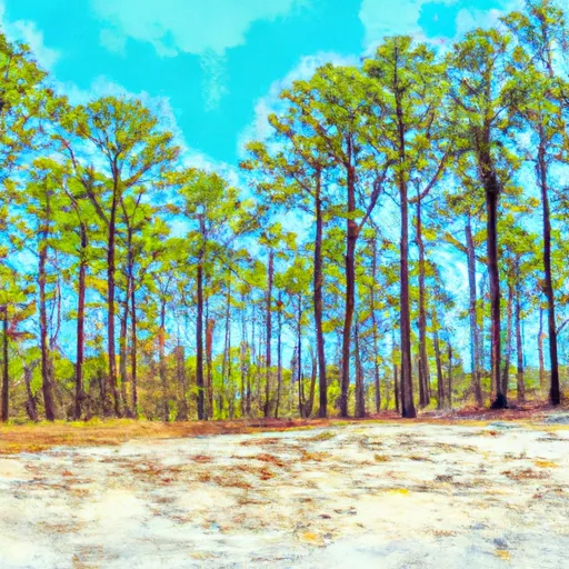
Sand Hills State Forest
One of the primary reasons to explore Sand Hills State Forest is its vast array of outdoor activities. Visitors can engage in hiking, camping, fishing, horseback riding, birdwatching, and hunting (during specific seasons and with the appropriate licenses). The forest provides a well-maintained trail system, offering both novice and experienced hikers ample opportunities to explore its scenic landscapes.
Within Sand Hills State Forest lies the Cheraw Fish Hatchery, a popular attraction worth visiting. The hatchery is responsible for the production and stocking of various fish species in South Carolina's rivers, lakes, and ponds. Visitors can learn about the hatchery's operations, observe fish in different life stages, and even feed them.
The forest's diverse ecosystem is home to numerous wildlife species, including white-tailed deer, wild turkey, bobcats, foxes, and a variety of bird species. Birdwatchers will especially enjoy the forest's avian inhabitants, which include red-cockaded woodpeckers, Bachman's sparrows, and eastern bluebirds.
Notable features of Sand Hills State Forest include the Black Creek and Sugarloaf Mountain. The Black Creek is a scenic waterway that winds through the forest, offering opportunities for fishing and canoeing. Sugarloaf Mountain, standing at 312 feet, offers panoramic views of the surrounding landscape and is a popular spot for photography.
Interesting facts about Sand Hills State Forest include its rich history. The forest played a crucial role in providing timber for the naval stores industry during the 19th and early 20th centuries. The longleaf pine trees found here were highly sought after for their resin, used in shipbuilding and other industries.
The best time to visit Sand Hills State Forest is during the spring and fall seasons when temperatures are mild, and the forest is teeming with vibrant colors. Springtime brings the blooming of wildflowers, while autumn showcases the forest's foliage in stunning shades of red, orange, and yellow.
To ensure accuracy, it is recommended to verify the information provided by consulting multiple independent sources such as official government websites, travel guides, and reputable outdoor organizations.
Streamflow in Sand Hills State Forest
Live USGS discharge at streamgauges inside the park boundary.
Trails in Sand Hills State Forest
Named trails whose route falls inside the park.
Camping in Sand Hills State Forest
Campgrounds inside the park, with today's conditions score.


Plan your visit down to the hour
Same weather feed Snoflo's iOS app uses -- updated continuously from NOAA / yr.no.
Next 5 days, hour by hour
Temperature line with weather symbols on top, snow + rain accumulation as columns, humidity as a dotted line.
5-day forecast table
Every 3 hours, broken out across temperature, snow, rain, humidity, and wind.
| Time | Condition | Temp (°F) | Snow (in) | Rain (in) | Humidity (%) | Wind (mps) | Wind dir |
|---|---|---|---|---|---|---|---|
| Loading detailed forecast… | |||||||
15-day temperature & precipitation
Daily temperatures, snow, and rain projected over the next two weeks.
Responsible recreation & Leave No Trace
- Know before you go
- Check the operator's site for hours, permit requirements, seasonal closures, and fire restrictions before heading out.
- Stay on trail
- Stick to marked paths to protect vegetation, prevent erosion, and avoid disturbing wildlife habitat.
- Respect wildlife
- Observe from a distance, never feed wildlife, and store food securely if camping is permitted on-site.
- Pack it in, pack it out
- Carry out all trash, food scraps, and gear. Many parks have limited or no trash service.
- Leave what you find
- Don't take rocks, plants, or artifacts. They make the park what it is for the next visitor.
Set push alerts in the Snoflo app
Save Sand Hills State Forest as a favorite, set a custom threshold (precipitation, freezing temperatures, fire-restriction days), and the iOS app will push the moment conditions cross.
About Sand Hills State Forest
What can I do at Sand Hills State Forest?
Most Snoflo-tracked parks support hiking, picnicking, and wildlife viewing. Check the operator's site for activity-specific rules (camping, fishing, paddling, hunting).
How fresh is the weather data?
The hourly forecast updates throughout the day from NOAA / yr.no. Streamflow comes live from USGS streamgauges.
When is the best time to visit?
Use the 15-day temperature & precipitation outlook on this page to plan -- pick a window with comfortable temperatures and low precipitation.
How do I get to Sand Hills State Forest?
Tap Directions in the hero above to open driving directions in Google Maps, or Open in map to center the Snoflo interactive map on the park.
Can I get alerts when conditions change?
Yes -- alerts are managed in the Snoflo iOS app. Favorite this park, set a threshold (temperature, precipitation), and you'll get a push the moment it crosses.
Park & land designation reference
A quick legend for the federal and state land categories Snoflo tracks. Each designation comes with different rules around access, recreation, and resource extraction.
- National Park
- Large protected natural areas managed by the federal government to preserve significant landscapes, ecosystems, and cultural resources; recreation is allowed but conservation is the priority.
- State Park
- Public natural or recreational areas managed by a state government, typically smaller than national parks and focused on regional natural features, recreation, and education.
- Local Park
- Community-level parks managed by cities or counties, emphasizing recreation, playgrounds, sports, and green space close to populated areas.
- Wilderness Area
- The highest level of land protection in the U.S.; designated areas where nature is left essentially untouched, with no roads, structures, or motorized motorized access permitted.
- National Recreation Area
- Areas set aside primarily for outdoor recreation (boating, hiking, fishing, often around reservoirs, rivers, or scenic landscapes); may allow more development.
- National Conservation Area (BLM)
- BLM-managed areas with special ecological, cultural, or scientific value; more protection than typical BLM land but less strict than Wilderness Areas.
- State Forest
- State-managed forests focused on habitat, watershed, recreation, and sustainable timber harvest.
- Bureau of Land Management (BLM) Land
- Vast federal lands managed for mixed use -- recreation, grazing, mining, conservation -- with fewer restrictions than national parks or forests.