West Whitlock Recreation Area
Community Reviews
Been here? Share the conditions.
Reviews, ratings & photos are added in the free Snoflo iOS app — rate a spot, tag the conditions, and your visit is verified by location. Add or manage your reviews from the app.

West Whitlock Recreation Area
One of the primary reasons to visit West Whitlock Recreation Area is the stunning beauty it offers. The area encompasses approximately 1,385 acres and features rolling prairies, wooded hills, and scenic views of the lake. The serene atmosphere makes it an ideal location for a peaceful getaway or a day of relaxation.
For those interested in outdoor activities, West Whitlock Recreation Area has a wealth of options. The massive Lake Oahe is renowned for its excellent fishing opportunities, attracting anglers from near and far. The lake is home to a variety of fish species, including walleye, northern pike, smallmouth bass, and catfish, making it a paradise for fishing enthusiasts.
In addition to fishing, the area offers various recreational activities such as boating, swimming, hiking, and picnicking. There are several well-maintained trails that wind through the hills, providing hikers with the opportunity to explore the natural beauty of the region. The picnic areas are equipped with facilities and provide a perfect spot to relax and enjoy a meal with family and friends.
West Whitlock Recreation Area also boasts a rich history. The area is situated on land that was once part of a Native American reservation and later became an agricultural settlement. Visitors can learn about the history of the region through interpretive displays and exhibits available at the visitor center.
The best time to visit West Whitlock Recreation Area depends on personal preferences. Spring and summer are popular seasons, as the weather is generally pleasant, and outdoor activities are in full swing. Additionally, the blooms and greenery during spring add to the area's beauty. Fall is another great time to visit, as the changing colors of the foliage create a stunning backdrop. Winter can be harsh, but it offers opportunities for ice fishing and snowmobiling.
To ensure accuracy, it is recommended to verify the information provided by referring to multiple independent sources, such as the official website of the South Dakota Game, Fish, and Parks department or local tourism websites.
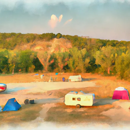
Camping in West Whitlock Recreation Area
Campgrounds inside the park, with today's conditions score.
Plan your visit down to the hour
Same weather feed Snoflo's iOS app uses -- updated continuously from NOAA / yr.no.
Next 5 days, hour by hour
Temperature line with weather symbols on top, snow + rain accumulation as columns, humidity as a dotted line.
5-day forecast table
Every 3 hours, broken out across temperature, snow, rain, humidity, and wind.
| Time | Condition | Temp (°F) | Snow (in) | Rain (in) | Humidity (%) | Wind (mps) | Wind dir |
|---|---|---|---|---|---|---|---|
| Loading detailed forecast… | |||||||
15-day temperature & precipitation
Daily temperatures, snow, and rain projected over the next two weeks.
Responsible recreation & Leave No Trace
- Know before you go
- Check the operator's site for hours, permit requirements, seasonal closures, and fire restrictions before heading out.
- Stay on trail
- Stick to marked paths to protect vegetation, prevent erosion, and avoid disturbing wildlife habitat.
- Respect wildlife
- Observe from a distance, never feed wildlife, and store food securely if camping is permitted on-site.
- Pack it in, pack it out
- Carry out all trash, food scraps, and gear. Many parks have limited or no trash service.
- Leave what you find
- Don't take rocks, plants, or artifacts. They make the park what it is for the next visitor.
Set push alerts in the Snoflo app
Save West Whitlock Recreation Area as a favorite, set a custom threshold (precipitation, freezing temperatures, fire-restriction days), and the iOS app will push the moment conditions cross.
About West Whitlock Recreation Area
What can I do at West Whitlock Recreation Area?
Most Snoflo-tracked parks support hiking, picnicking, and wildlife viewing. Check the operator's site for activity-specific rules (camping, fishing, paddling, hunting).
How fresh is the weather data?
The hourly forecast updates throughout the day from NOAA / yr.no. Streamflow comes live from USGS streamgauges.
When is the best time to visit?
Use the 15-day temperature & precipitation outlook on this page to plan -- pick a window with comfortable temperatures and low precipitation.
How do I get to West Whitlock Recreation Area?
Tap Directions in the hero above to open driving directions in Google Maps, or Open in map to center the Snoflo interactive map on the park.
Can I get alerts when conditions change?
Yes -- alerts are managed in the Snoflo iOS app. Favorite this park, set a threshold (temperature, precipitation), and you'll get a push the moment it crosses.
Park & land designation reference
A quick legend for the federal and state land categories Snoflo tracks. Each designation comes with different rules around access, recreation, and resource extraction.
- National Park
- Large protected natural areas managed by the federal government to preserve significant landscapes, ecosystems, and cultural resources; recreation is allowed but conservation is the priority.
- State Park
- Public natural or recreational areas managed by a state government, typically smaller than national parks and focused on regional natural features, recreation, and education.
- Local Park
- Community-level parks managed by cities or counties, emphasizing recreation, playgrounds, sports, and green space close to populated areas.
- Wilderness Area
- The highest level of land protection in the U.S.; designated areas where nature is left essentially untouched, with no roads, structures, or motorized motorized access permitted.
- National Recreation Area
- Areas set aside primarily for outdoor recreation (boating, hiking, fishing, often around reservoirs, rivers, or scenic landscapes); may allow more development.
- National Conservation Area (BLM)
- BLM-managed areas with special ecological, cultural, or scientific value; more protection than typical BLM land but less strict than Wilderness Areas.
- State Forest
- State-managed forests focused on habitat, watershed, recreation, and sustainable timber harvest.
- Bureau of Land Management (BLM) Land
- Vast federal lands managed for mixed use -- recreation, grazing, mining, conservation -- with fewer restrictions than national parks or forests.