Wilderness Black Elk
Community Reviews
Been here? Share the conditions.
Reviews, ratings & photos are added in the free Snoflo iOS app — rate a spot, tag the conditions, and your visit is verified by location. Add or manage your reviews from the app.

Wilderness Black Elk
Reasons to Visit:
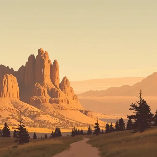
1. Scenic Beauty: Wilderness Black Elk boasts breathtaking landscapes, including picturesque mountains, lush forests, sparkling streams, and serene meadows. It offers visitors a chance to immerse themselves in the beauty of nature and experience tranquility.
2. Wildlife: The area is home to a diverse range of wildlife, including elk, deer, bighorn sheep, coyotes, and various bird species. Nature enthusiasts and wildlife photographers will find plenty of opportunities to observe and capture these fascinating creatures.
3. Historic Significance: Black Elk Wilderness is named after Nicholas Black Elk, a prominent Lakota medicine man and visionary. Exploring the wilderness allows visitors to engage with the history and culture of the Lakota people, gaining a deeper understanding of their traditions and spirituality.
Points of Interest:
1. Harney Peak: Standing at 7,242 feet, Harney Peak is the highest point in South Dakota. Hiking to the summit provides panoramic views of the surrounding Black Hills National Forest and the stunning landscapes beyond.
2. Cathedral Spires: These majestic granite formations, resembling towering spires, are a sight to behold. They attract climbers from all over the world and offer stunning views of the surrounding wilderness.
3. Black Elk Peak: Formerly known as Harney Peak, this summit was renamed to honor Nicholas Black Elk. A hike to the top rewards visitors with breathtaking vistas and a sense of accomplishment.
Interesting Facts:
1. The Black Elk Wilderness was designated as a protected area in 1980 and covers approximately 13,426 acres.
2. Black Elk Wilderness lies within the larger Black Hills National Forest, which spans over 1.2 million acres and offers numerous recreational opportunities.
3. The area is rich in geological diversity, with granite peaks, deep canyons, and rolling hills, resulting in a stunning variety of ecosystems.
Best Time to Visit:
The best time to visit Wilderness Black Elk is during the summer months, from June to August. The weather is generally pleasant with warm temperatures and minimal rainfall. This period allows for optimal hiking and outdoor activities, including wildlife observation. However, it's important to note that the area can get crowded during this time, so planning ahead and making reservations is advisable.
Accuracy Verification:
To ensure accuracy, it's recommended to cross-reference information from multiple independent sources, such as official websites of South Dakota's tourism department, the U.S. Forest Service, reputable travel guides, and firsthand accounts from visitors. Additionally, checking for recent updates and reviews can provide the most up-to-date information on the area.
Trails in Wilderness Black Elk
Named trails whose route falls inside the park.
Points of interest in Wilderness Black Elk
Landmarks and points of interest inside the park boundary.
Plan your visit down to the hour
Same weather feed Snoflo's iOS app uses -- updated continuously from NOAA / yr.no.
Next 5 days, hour by hour
Temperature line with weather symbols on top, snow + rain accumulation as columns, humidity as a dotted line.
5-day forecast table
Every 3 hours, broken out across temperature, snow, rain, humidity, and wind.
| Time | Condition | Temp (°F) | Snow (in) | Rain (in) | Humidity (%) | Wind (mps) | Wind dir |
|---|---|---|---|---|---|---|---|
| Loading detailed forecast… | |||||||
15-day temperature & precipitation
Daily temperatures, snow, and rain projected over the next two weeks.
Responsible recreation & Leave No Trace
- Know before you go
- Check the operator's site for hours, permit requirements, seasonal closures, and fire restrictions before heading out.
- Stay on trail
- Stick to marked paths to protect vegetation, prevent erosion, and avoid disturbing wildlife habitat.
- Respect wildlife
- Observe from a distance, never feed wildlife, and store food securely if camping is permitted on-site.
- Pack it in, pack it out
- Carry out all trash, food scraps, and gear. Many parks have limited or no trash service.
- Leave what you find
- Don't take rocks, plants, or artifacts. They make the park what it is for the next visitor.
Set push alerts in the Snoflo app
Save Wilderness Black Elk as a favorite, set a custom threshold (precipitation, freezing temperatures, fire-restriction days), and the iOS app will push the moment conditions cross.
About Wilderness Black Elk
What can I do at Wilderness Black Elk?
Most Snoflo-tracked parks support hiking, picnicking, and wildlife viewing. Check the operator's site for activity-specific rules (camping, fishing, paddling, hunting).
How fresh is the weather data?
The hourly forecast updates throughout the day from NOAA / yr.no. Streamflow comes live from USGS streamgauges.
When is the best time to visit?
Use the 15-day temperature & precipitation outlook on this page to plan -- pick a window with comfortable temperatures and low precipitation.
How do I get to Wilderness Black Elk?
Tap Directions in the hero above to open driving directions in Google Maps, or Open in map to center the Snoflo interactive map on the park.
Can I get alerts when conditions change?
Yes -- alerts are managed in the Snoflo iOS app. Favorite this park, set a threshold (temperature, precipitation), and you'll get a push the moment it crosses.
Park & land designation reference
A quick legend for the federal and state land categories Snoflo tracks. Each designation comes with different rules around access, recreation, and resource extraction.
- National Park
- Large protected natural areas managed by the federal government to preserve significant landscapes, ecosystems, and cultural resources; recreation is allowed but conservation is the priority.
- State Park
- Public natural or recreational areas managed by a state government, typically smaller than national parks and focused on regional natural features, recreation, and education.
- Local Park
- Community-level parks managed by cities or counties, emphasizing recreation, playgrounds, sports, and green space close to populated areas.
- Wilderness Area
- The highest level of land protection in the U.S.; designated areas where nature is left essentially untouched, with no roads, structures, or motorized motorized access permitted.
- National Recreation Area
- Areas set aside primarily for outdoor recreation (boating, hiking, fishing, often around reservoirs, rivers, or scenic landscapes); may allow more development.
- National Conservation Area (BLM)
- BLM-managed areas with special ecological, cultural, or scientific value; more protection than typical BLM land but less strict than Wilderness Areas.
- State Forest
- State-managed forests focused on habitat, watershed, recreation, and sustainable timber harvest.
- Bureau of Land Management (BLM) Land
- Vast federal lands managed for mixed use -- recreation, grazing, mining, conservation -- with fewer restrictions than national parks or forests.