Stones River National Battlefield
Community Reviews
Been here? Share the conditions.
Reviews, ratings & photos are added in the free Snoflo iOS app — rate a spot, tag the conditions, and your visit is verified by location. Add or manage your reviews from the app.
Stones River National Battlefield
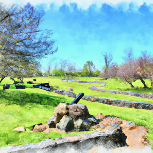
One of the primary reasons to visit Stones River National Battlefield is its historical importance. The battle fought here between Union and Confederate forces was one of the bloodiest conflicts of the Civil War, resulting in over 23,000 casualties. Visitors can explore the battleground and gain a deeper understanding of the sacrifices made by soldiers on both sides.
There are several notable points of interest within the battlefield. The Visitor Center and Museum provide an excellent starting point, offering exhibits, audiovisual presentations, and a bookstore where visitors can learn about the battle and its impact. The Hazen Brigade Monument, constructed in 1863, honors the fallen soldiers of the Union's 9th Brigade. The Stones River National Cemetery, established in 1865, serves as a final resting place for over 6,100 Union soldiers.
Interesting facts about the area include the battlefield's unique geographical features, such as the dense cedar forest in which much of the fighting occurred. The battlefield also features the Stones River, which played a crucial role in shaping the course of the battle. Visitors can witness the preserved landscape, gaining insight into the challenges faced by soldiers during the conflict.
The best time to visit Stones River National Battlefield is during spring and fall when the weather is mild and comfortable. Spring brings blooming wildflowers, while fall offers vibrant foliage, creating picturesque scenery. Summers can be hot and humid, and winters can be cold, but visiting during these seasons still provides an opportunity to explore the historical significance of the site.
To ensure accuracy, it is recommended to verify this summary by consulting multiple independent sources, such as the official National Park Service website for Stones River National Battlefield and reputable historical references.
Trails in Stones River National Battlefield
Named trails whose route falls inside the park.
Points of interest in Stones River National Battlefield
Landmarks and points of interest inside the park boundary.

Plan your visit down to the hour
Same weather feed Snoflo's iOS app uses -- updated continuously from NOAA / yr.no.
Next 5 days, hour by hour
Temperature line with weather symbols on top, snow + rain accumulation as columns, humidity as a dotted line.
5-day forecast table
Every 3 hours, broken out across temperature, snow, rain, humidity, and wind.
| Time | Condition | Temp (°F) | Snow (in) | Rain (in) | Humidity (%) | Wind (mps) | Wind dir |
|---|---|---|---|---|---|---|---|
| Loading detailed forecast… | |||||||
15-day temperature & precipitation
Daily temperatures, snow, and rain projected over the next two weeks.
Responsible recreation & Leave No Trace
- Know before you go
- Check the operator's site for hours, permit requirements, seasonal closures, and fire restrictions before heading out.
- Stay on trail
- Stick to marked paths to protect vegetation, prevent erosion, and avoid disturbing wildlife habitat.
- Respect wildlife
- Observe from a distance, never feed wildlife, and store food securely if camping is permitted on-site.
- Pack it in, pack it out
- Carry out all trash, food scraps, and gear. Many parks have limited or no trash service.
- Leave what you find
- Don't take rocks, plants, or artifacts. They make the park what it is for the next visitor.
Set push alerts in the Snoflo app
Save Stones River National Battlefield as a favorite, set a custom threshold (precipitation, freezing temperatures, fire-restriction days), and the iOS app will push the moment conditions cross.
About Stones River National Battlefield
What can I do at Stones River National Battlefield?
Most Snoflo-tracked parks support hiking, picnicking, and wildlife viewing. Check the operator's site for activity-specific rules (camping, fishing, paddling, hunting).
How fresh is the weather data?
The hourly forecast updates throughout the day from NOAA / yr.no. Streamflow comes live from USGS streamgauges.
When is the best time to visit?
Use the 15-day temperature & precipitation outlook on this page to plan -- pick a window with comfortable temperatures and low precipitation.
How do I get to Stones River National Battlefield?
Tap Directions in the hero above to open driving directions in Google Maps, or Open in map to center the Snoflo interactive map on the park.
Can I get alerts when conditions change?
Yes -- alerts are managed in the Snoflo iOS app. Favorite this park, set a threshold (temperature, precipitation), and you'll get a push the moment it crosses.
Park & land designation reference
A quick legend for the federal and state land categories Snoflo tracks. Each designation comes with different rules around access, recreation, and resource extraction.
- National Park
- Large protected natural areas managed by the federal government to preserve significant landscapes, ecosystems, and cultural resources; recreation is allowed but conservation is the priority.
- State Park
- Public natural or recreational areas managed by a state government, typically smaller than national parks and focused on regional natural features, recreation, and education.
- Local Park
- Community-level parks managed by cities or counties, emphasizing recreation, playgrounds, sports, and green space close to populated areas.
- Wilderness Area
- The highest level of land protection in the U.S.; designated areas where nature is left essentially untouched, with no roads, structures, or motorized motorized access permitted.
- National Recreation Area
- Areas set aside primarily for outdoor recreation (boating, hiking, fishing, often around reservoirs, rivers, or scenic landscapes); may allow more development.
- National Conservation Area (BLM)
- BLM-managed areas with special ecological, cultural, or scientific value; more protection than typical BLM land but less strict than Wilderness Areas.
- State Forest
- State-managed forests focused on habitat, watershed, recreation, and sustainable timber harvest.
- Bureau of Land Management (BLM) Land
- Vast federal lands managed for mixed use -- recreation, grazing, mining, conservation -- with fewer restrictions than national parks or forests.