Wilderness Box-Death Hollow
Community Reviews
Been here? Share the conditions.
Reviews, ratings & photos are added in the free Snoflo iOS app — rate a spot, tag the conditions, and your visit is verified by location. Add or manage your reviews from the app.

Wilderness Box-Death Hollow
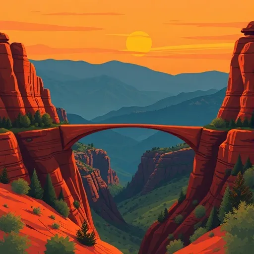
One of the main points of interest in Wilderness Box-Death Hollow is the Death Hollow itself, a deep and narrow canyon with towering walls that offers breathtaking views. The canyon is perfect for adventurous hikers and backpackers, as it provides opportunities for challenging and rewarding treks. Along the way, visitors can expect to encounter picturesque waterfalls, lush greenery, and crystal-clear pools ideal for swimming or cooling off.
Another highlight of Wilderness Box-Death Hollow is the Escalante River, which meanders through the area. This river is renowned for its scenic beauty and offers opportunities for fishing, kayaking, and canoeing. Visitors can also explore the various side canyons that branch off from the Escalante River, each offering its own unique charm and exploration possibilities.
In terms of interesting facts, Wilderness Box-Death Hollow is part of the Grand Staircase-Escalante National Monument, a vast and protected area in southern Utah. This designation ensures the preservation and conservation of the unique ecosystems and geological formations found in the region. Additionally, the area is home to a diverse array of wildlife, including mule deer, coyotes, bobcats, mountain lions, and a variety of bird species.
The best time to visit Wilderness Box-Death Hollow is generally in the spring (April to June) and fall (September to November). During these seasons, temperatures are milder, ranging from comfortable to warm, making outdoor activities more enjoyable. The summer months can be extremely hot, with temperatures often surpassing 100°F (38°C). It is important to note that flash floods can occur, especially during the summer monsoon season (July to August), so it is recommended to stay updated on weather conditions and exercise caution.
To ensure the accuracy of this information, it is advised to verify across multiple independent sources, such as official websites of the Grand Staircase-Escalante National Monument or reputable travel guides focusing on Utah's natural attractions.
Points of interest in Wilderness Box-Death Hollow
Landmarks and points of interest inside the park boundary.
Plan your visit down to the hour
Same weather feed Snoflo's iOS app uses -- updated continuously from NOAA / yr.no.
Next 5 days, hour by hour
Temperature line with weather symbols on top, snow + rain accumulation as columns, humidity as a dotted line.
5-day forecast table
Every 3 hours, broken out across temperature, snow, rain, humidity, and wind.
| Time | Condition | Temp (°F) | Snow (in) | Rain (in) | Humidity (%) | Wind (mps) | Wind dir |
|---|---|---|---|---|---|---|---|
| Loading detailed forecast… | |||||||
15-day temperature & precipitation
Daily temperatures, snow, and rain projected over the next two weeks.
Responsible recreation & Leave No Trace
- Know before you go
- Check the operator's site for hours, permit requirements, seasonal closures, and fire restrictions before heading out.
- Stay on trail
- Stick to marked paths to protect vegetation, prevent erosion, and avoid disturbing wildlife habitat.
- Respect wildlife
- Observe from a distance, never feed wildlife, and store food securely if camping is permitted on-site.
- Pack it in, pack it out
- Carry out all trash, food scraps, and gear. Many parks have limited or no trash service.
- Leave what you find
- Don't take rocks, plants, or artifacts. They make the park what it is for the next visitor.
Set push alerts in the Snoflo app
Save Wilderness Box-Death Hollow as a favorite, set a custom threshold (precipitation, freezing temperatures, fire-restriction days), and the iOS app will push the moment conditions cross.
About Wilderness Box-Death Hollow
What can I do at Wilderness Box-Death Hollow?
Most Snoflo-tracked parks support hiking, picnicking, and wildlife viewing. Check the operator's site for activity-specific rules (camping, fishing, paddling, hunting).
How fresh is the weather data?
The hourly forecast updates throughout the day from NOAA / yr.no. Streamflow comes live from USGS streamgauges.
When is the best time to visit?
Use the 15-day temperature & precipitation outlook on this page to plan -- pick a window with comfortable temperatures and low precipitation.
How do I get to Wilderness Box-Death Hollow?
Tap Directions in the hero above to open driving directions in Google Maps, or Open in map to center the Snoflo interactive map on the park.
Can I get alerts when conditions change?
Yes -- alerts are managed in the Snoflo iOS app. Favorite this park, set a threshold (temperature, precipitation), and you'll get a push the moment it crosses.
Park & land designation reference
A quick legend for the federal and state land categories Snoflo tracks. Each designation comes with different rules around access, recreation, and resource extraction.
- National Park
- Large protected natural areas managed by the federal government to preserve significant landscapes, ecosystems, and cultural resources; recreation is allowed but conservation is the priority.
- State Park
- Public natural or recreational areas managed by a state government, typically smaller than national parks and focused on regional natural features, recreation, and education.
- Local Park
- Community-level parks managed by cities or counties, emphasizing recreation, playgrounds, sports, and green space close to populated areas.
- Wilderness Area
- The highest level of land protection in the U.S.; designated areas where nature is left essentially untouched, with no roads, structures, or motorized motorized access permitted.
- National Recreation Area
- Areas set aside primarily for outdoor recreation (boating, hiking, fishing, often around reservoirs, rivers, or scenic landscapes); may allow more development.
- National Conservation Area (BLM)
- BLM-managed areas with special ecological, cultural, or scientific value; more protection than typical BLM land but less strict than Wilderness Areas.
- State Forest
- State-managed forests focused on habitat, watershed, recreation, and sustainable timber harvest.
- Bureau of Land Management (BLM) Land
- Vast federal lands managed for mixed use -- recreation, grazing, mining, conservation -- with fewer restrictions than national parks or forests.