Lewis And Clark State Park park
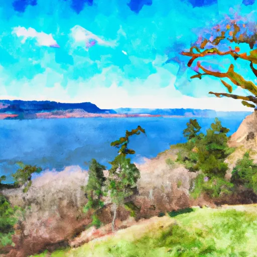
Lewis And Clark State Park
One of the main attractions of the park is the Sacajawea Interpretive Center, which provides visitors with a fascinating insight into the life and legacy of the famous Native American guide who accompanied Lewis and Clark on their expedition. The center features interactive exhibits, displays, and artifacts that showcase the culture and history of the region.
Other points of interest in Lewis and Clark State Park include the park's extensive trail system, which offers visitors stunning views of the surrounding landscape, and the adjacent Snake River, which is renowned for its excellent fishing opportunities. The park also features a variety of campsites, picnic areas, and recreational facilities, making it a great place for families and groups to spend time together.
Interesting facts about the area include the fact that Lewis and Clark State Park is named after the famous explorers who passed through the area on their way to the Pacific Ocean in the early 1800s. The park is also home to a wide range of wildlife, including eagles, ospreys, and beavers.
The best time of year to visit Lewis and Clark State Park is during the summer months, when the weather is warm and sunny, and the park is bustling with activity. However, visitors should also be aware that the park can be crowded during peak season, and that reservations may be necessary for camping and other activities.
Park & land designation reference
A quick legend for the federal and state land categories Snoflo tracks. Each designation comes with different rules around access, recreation, and resource extraction.
- National Park
- Large protected natural areas managed by the federal government to preserve significant landscapes, ecosystems, and cultural resources; recreation is allowed but conservation is the priority.
- State Park
- Public natural or recreational areas managed by a state government, typically smaller than national parks and focused on regional natural features, recreation, and education.
- Local Park
- Community-level parks managed by cities or counties, emphasizing recreation, playgrounds, sports, and green space close to populated areas.
- Wilderness Area
- The highest level of land protection in the U.S.; designated areas where nature is left essentially untouched, with no roads, structures, or motorized motorized access permitted.
- National Recreation Area
- Areas set aside primarily for outdoor recreation (boating, hiking, fishing, often around reservoirs, rivers, or scenic landscapes); may allow more development.
- National Conservation Area (BLM)
- BLM-managed areas with special ecological, cultural, or scientific value; more protection than typical BLM land but less strict than Wilderness Areas.
- State Forest
- State-managed forests focused on habitat, watershed, recreation, and sustainable timber harvest.
- Bureau of Land Management (BLM) Land
- Vast federal lands managed for mixed use -- recreation, grazing, mining, conservation -- with fewer restrictions than national parks or forests.
Plan your visit down to the hour
Same weather feed Snoflo's iOS app uses -- updated continuously from NOAA / yr.no.
Next 5 days, hour by hour
Temperature line with weather symbols on top, snow + rain accumulation as columns, humidity as a dotted line.
5-day forecast table
Every 3 hours, broken out across temperature, snow, rain, humidity, and wind.
| Time | Condition | Temp (°F) | Snow (in) | Rain (in) | Humidity (%) | Wind (mps) | Wind dir |
|---|---|---|---|---|---|---|---|
| Loading detailed forecast… | |||||||
15-day temperature & precipitation
Daily temperatures, snow, and rain projected over the next two weeks.
Area campgrounds
Snoflo-tracked campgrounds within reach of Lewis And Clark State Park, with reservations status.
| Campground | Reservations | Toilets | View |
|---|---|---|---|
| Stan Hedwall Park | ✗ | ✗ | → |
| Mayfield Lake - Tacoma Power | ✓ | ✓ | → |
| Kid Valley Campground | ✗ | ✗ | → |
| Ike Kinswa State Park | ✓ | ✗ | → |
| Yurt Village | ✗ | ✗ | → |
| Seaquest State Park Campground | ✗ | ✗ | → |
Plan a longer trip
The closest parks, lakes, fishing spots, and POIs so a park visit can grow into a full weekend.
Responsible recreation & Leave No Trace
- Know before you go
- Check the operator's site for hours, permit requirements, seasonal closures, and fire restrictions before heading out.
- Stay on trail
- Stick to marked paths to protect vegetation, prevent erosion, and avoid disturbing wildlife habitat.
- Respect wildlife
- Observe from a distance, never feed wildlife, and store food securely if camping is permitted on-site.
- Pack it in, pack it out
- Carry out all trash, food scraps, and gear. Many parks have limited or no trash service.
- Leave what you find
- Don't take rocks, plants, or artifacts. They make the park what it is for the next visitor.
Set push alerts in the Snoflo app
Save Lewis And Clark State Park as a favorite, set a custom threshold (precipitation, freezing temperatures, fire-restriction days), and the iOS app will push the moment conditions cross.
About Lewis And Clark State Park
What can I do at Lewis And Clark State Park?
Most Snoflo-tracked parks support hiking, picnicking, and wildlife viewing. Check the operator's site for activity-specific rules (camping, fishing, paddling, hunting).
How fresh is the weather data?
The hourly forecast updates throughout the day from NOAA / yr.no. Streamflow comes live from USGS streamgauges.
When is the best time to visit?
Use the 15-day temperature & precipitation outlook on this page to plan -- pick a window with comfortable temperatures and low precipitation.
How do I get to Lewis And Clark State Park?
Tap Directions in the hero above to open driving directions in Google Maps, or Open in map to center the Snoflo interactive map on the park.
Can I get alerts when conditions change?
Yes -- alerts are managed in the Snoflo iOS app. Favorite this park, set a threshold (temperature, precipitation), and you'll get a push the moment it crosses.
Other parks near here
Snoflo-tracked parks within driving distance of Lewis And Clark State Park.