Community Reviews
Been here? Share the conditions.
Reviews, ratings & photos are added in the free Snoflo iOS app — rate a spot, tag the conditions, and your visit is verified by location. Add or manage your reviews from the app.
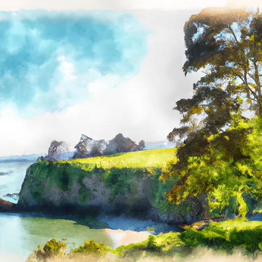
Stretch Point State Park
One of the main reasons to visit Stretch Point State Park is to experience its picturesque beauty. Visitors can enjoy peaceful walks along the shoreline, taking in the serene atmosphere and admiring the diverse flora and fauna. The park is also an ideal spot for birdwatching, with a wide range of species inhabiting the area.
A notable point of interest in the park is the stretch of beach that emerges at low tide. This unique phenomenon reveals a hidden world of tide pools, where visitors can observe various marine creatures, colorful sea anemones, and fascinating rock formations. Exploring these tide pools is a favorite activity among families and nature enthusiasts.
Stretch Point State Park also offers several opportunities for recreational activities. The park features picnic areas, perfect for enjoying a meal with friends or family while surrounded by stunning natural scenery. Additionally, there are hiking trails that wind through the forested areas, allowing visitors to soak up the tranquility of the surroundings and spot wildlife along the way.
Interesting facts about Stretch Point State Park include its historical significance as a former Native American gathering place. The park's name is derived from the Native American word "Toma-tsoo-lah," meaning "stretching point." This reflects the area's rich cultural heritage and its importance as a gathering and fishing site for the local tribes.
The best time to visit Stretch Point State Park is during the summer months when the weather is pleasant and the park is bustling with activity. However, the park offers year-round beauty, with each season providing its unique charm. Spring brings blooming wildflowers, while autumn showcases vibrant foliage. Winter offers a quieter and more secluded experience, perfect for those seeking solitude.
To ensure accuracy, it is always recommended to cross-verify information across multiple independent sources, such as official park websites, travel guides, and local tourism boards.
Plan your visit down to the hour
Same weather feed Snoflo's iOS app uses -- updated continuously from NOAA / yr.no.
Next 5 days, hour by hour
Temperature line with weather symbols on top, snow + rain accumulation as columns, humidity as a dotted line.
5-day forecast table
Every 3 hours, broken out across temperature, snow, rain, humidity, and wind.
| Time | Condition | Temp (°F) | Snow (in) | Rain (in) | Humidity (%) | Wind (mps) | Wind dir |
|---|---|---|---|---|---|---|---|
| Loading detailed forecast… | |||||||
15-day temperature & precipitation
Daily temperatures, snow, and rain projected over the next two weeks.
Responsible recreation & Leave No Trace
- Know before you go
- Check the operator's site for hours, permit requirements, seasonal closures, and fire restrictions before heading out.
- Stay on trail
- Stick to marked paths to protect vegetation, prevent erosion, and avoid disturbing wildlife habitat.
- Respect wildlife
- Observe from a distance, never feed wildlife, and store food securely if camping is permitted on-site.
- Pack it in, pack it out
- Carry out all trash, food scraps, and gear. Many parks have limited or no trash service.
- Leave what you find
- Don't take rocks, plants, or artifacts. They make the park what it is for the next visitor.
Area streamflow levels
USGS streamgauges around Stretch Point State Park -- live water levels for paddling, fishing, and swimming conditions around the park.
| Streamgauge | Discharge | View |
|---|---|---|
| Huge Creek Near Wauna | 5 cfs | → |
| Chambers Creek Bl Leach Creek Near Steilacoom | 41 cfs | → |
| Leach Creek Near Fircrest | 1 cfs | → |
| Skokomish River Near Potlatch | 327 cfs | → |
| Flett Creek At Tacoma | 4 cfs | → |
| Clover Creek Near Tillicum | · | → |
Plan a longer trip
The closest fishing spots, campgrounds, boat launches, and points of interest so you can build a full day around the park.
Set push alerts in the Snoflo app
Save Stretch Point State Park as a favorite, set a custom threshold (precipitation, freezing temperatures, fire-restriction days), and the iOS app will push the moment conditions cross.
About Stretch Point State Park
What can I do at Stretch Point State Park?
Most Snoflo-tracked parks support hiking, picnicking, and wildlife viewing. Check the operator's site for activity-specific rules (camping, fishing, paddling, hunting).
How fresh is the weather data?
The hourly forecast updates throughout the day from NOAA / yr.no. Streamflow comes live from USGS streamgauges.
When is the best time to visit?
Use the 15-day temperature & precipitation outlook on this page to plan -- pick a window with comfortable temperatures and low precipitation.
How do I get to Stretch Point State Park?
Tap Directions in the hero above to open driving directions in Google Maps, or Open in map to center the Snoflo interactive map on the park.
Can I get alerts when conditions change?
Yes -- alerts are managed in the Snoflo iOS app. Favorite this park, set a threshold (temperature, precipitation), and you'll get a push the moment it crosses.
Park & land designation reference
A quick legend for the federal and state land categories Snoflo tracks. Each designation comes with different rules around access, recreation, and resource extraction.
- National Park
- Large protected natural areas managed by the federal government to preserve significant landscapes, ecosystems, and cultural resources; recreation is allowed but conservation is the priority.
- State Park
- Public natural or recreational areas managed by a state government, typically smaller than national parks and focused on regional natural features, recreation, and education.
- Local Park
- Community-level parks managed by cities or counties, emphasizing recreation, playgrounds, sports, and green space close to populated areas.
- Wilderness Area
- The highest level of land protection in the U.S.; designated areas where nature is left essentially untouched, with no roads, structures, or motorized motorized access permitted.
- National Recreation Area
- Areas set aside primarily for outdoor recreation (boating, hiking, fishing, often around reservoirs, rivers, or scenic landscapes); may allow more development.
- National Conservation Area (BLM)
- BLM-managed areas with special ecological, cultural, or scientific value; more protection than typical BLM land but less strict than Wilderness Areas.
- State Forest
- State-managed forests focused on habitat, watershed, recreation, and sustainable timber harvest.
- Bureau of Land Management (BLM) Land
- Vast federal lands managed for mixed use -- recreation, grazing, mining, conservation -- with fewer restrictions than national parks or forests.
Create a free account, or sign in.
Get the free Stretch Point State Park report — alerts, favorites, and history & forecasts, plus the free iPhone app.