


Lake Shelbyville Dam Spillway Access
Last Updated: April 21, 2026
Leave a Rating°F
°F
mph
Wind
%
Humidity
Lake Shelbyville Dam Spillway Access is a popular attraction located in the state of Illinois.
Summary
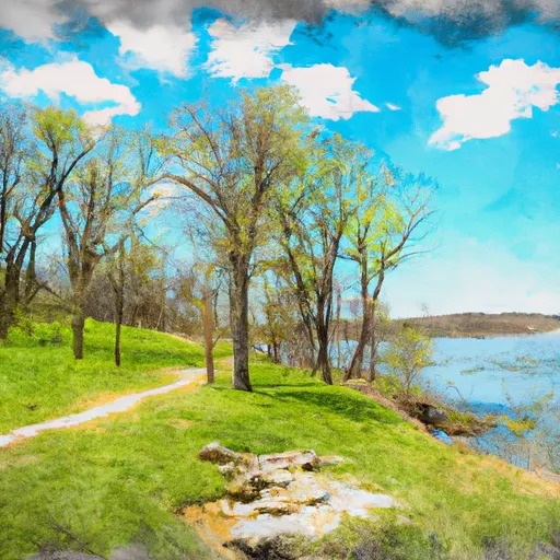
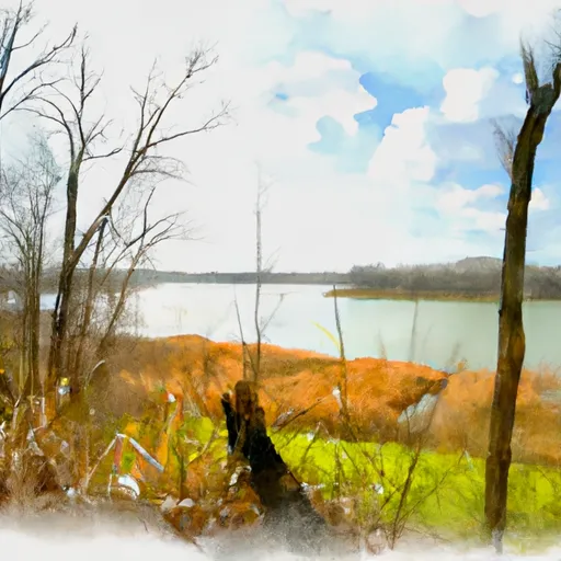
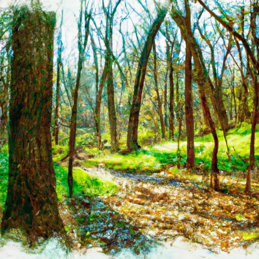
This site offers a variety of activities, including fishing, hiking, and picnicking. Visitors can also enjoy a stunning view of the dam and spillway.
One of the main reasons to visit the Lake Shelbyville Dam Spillway Access is to enjoy the scenic surroundings and take part in outdoor activities. The area is particularly popular for fishing, as the lake is home to a variety of fish species, including bass and crappie. Hiking trails are available for visitors who want to explore the area on foot, while picnic areas provide a great spot for a relaxing lunch or dinner.
One of the most interesting points of interest at the Lake Shelbyville Dam Spillway Access is the dam itself. The dam was completed in 1970 and provides flood control, hydroelectric power, and recreational opportunities for visitors. The spillway, which is used to release excess water from the lake, is also an impressive sight to see.
Visitors to the area can also learn about the history of the lake and dam through interpretive displays and exhibits. For example, the Lake Shelbyville Visitor Center provides information on the lake's geology, wildlife, and history.
The best time of year to visit the Lake Shelbyville Dam Spillway Access depends on the activities you want to enjoy. Fishing is best in the spring and fall, while hiking and picnicking are popular during the summer months. Fall is also a great time to visit, as the surrounding foliage provides a beautiful backdrop for outdoor activities.
In conclusion, the Lake Shelbyville Dam Spillway Access is a must-see attraction in Illinois. Whether you're interested in fishing, hiking, or simply enjoying a picnic, there's something for everyone at this scenic location.
15-Day Long Term Forecast
5-Day Hourly Forecast Detail
Park & Land Designation Reference
Large protected natural areas managed by the federal government to preserve significant landscapes, ecosystems, and cultural resources; recreation is allowed but conservation is the priority.
State Park
Public natural or recreational areas managed by a state government, typically smaller than national parks and focused on regional natural features, recreation, and education.
Local Park
Community-level parks managed by cities or counties, emphasizing recreation, playgrounds, sports, and green space close to populated areas.
Wilderness Area
The highest level of land protection in the U.S.; designated areas where nature is left essentially untouched, with no roads, structures, or motorized access permitted.
National Recreation Area
Areas set aside primarily for outdoor recreation (boating, hiking, fishing), often around reservoirs, rivers, or scenic landscapes; may allow more development.
National Conservation Area (BLM)
BLM-managed areas with special ecological, cultural, or scientific value; more protection than typical BLM land but less strict than Wilderness Areas.
State Forest
State-managed forests focused on habitat, watershed, recreation, and sustainable timber harvest.
National Forest
Federally managed lands focused on multiple use—recreation, wildlife habitat, watershed protection, and resource extraction (like timber)—unlike the stricter protections of national parks.
Wilderness
A protected area set aside to conserve specific resources—such as wildlife, habitats, or scientific features—with regulations varying widely depending on the managing agency and purpose.
Bureau of Land Management (BLM) Land
Vast federal lands managed for mixed use—recreation, grazing, mining, conservation—with fewer restrictions than national parks or forests.
Related References
 Wolf Creek State Park
 Eagle Creek State Recreation Area
 Hidden Springs State Forest