Coastal Flood Statement
2026-11-13T18:00:00-05:00

* WHAT...Up to one half foot of inundation above ground level expected in low-lying areas near shorelines and tidal waterways (3.2 to 11.6 feet Mean Lower Low Water). * WHERE...Barnstable MA and Nantucket MA Counties. * WHEN...Friday afternoon. * IMPACTS...Roads remain passable. Low lying areas and roads near Nantucket Harbor, including Easy Street, may experience pockets of shallow flooding less than one foot deep. * ADDITIONAL DETAILS...Splashover and very minor coastal flooding are possible during the Friday afternoon high tide along north facing beaches on Cape Cod Bay as well as Nantucket sound. No significant impacts are expected and any splashover/very minor coastal flooding will be quite short- lived, no more than an hour on either side of high tide.
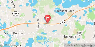
Herring River At North Harwich, Ma Historical Data

Historical Data


Streamflow Range


Date Average 2026 2025 2024 2023 2022 2021 2020 2019 2018 2017 2016 2015 2014 2013 2012 2011
01-01 9.16
01-02 8.87
01-03 8.11
01-04 8.3
01-05 8.35
01-06 8.39
01-07 7.83
01-08 7.77
01-09 7.55
01-10 7.76
01-11 7.93
01-12 7.85
01-13 8.7
01-14 8.91
01-15 9.05
01-16 8.7
01-17 9.52
01-18 9.24
01-19 8.84
01-20 9.29
01-21 9.02
01-22 8.76
01-23 9.59
01-24 9.36
01-25 9.28
01-26 10.64
01-27 10.71
01-28 10.25
01-29 10.16
01-30 9.54
01-31 10.26
02-01 9.75
02-02 9.44
02-03 9.13
02-04 9.16
02-05 10.0
02-06 10.45
02-07 10.96
02-08 11.75
02-09 11.16
02-10 10.86
02-11 10.54
02-12 11.36
02-13 11.19
02-14 11.39
02-15 11.44
02-16 11.17
02-17 10.81
02-18 11.05
02-19 10.79
02-20 11.66
02-21 10.81
02-22 10.41
02-23 10.91
02-24 11.16
02-25 11.72
02-26 11.3
02-27 11.2
02-28 11.96
02-29 11.45
03-01 11.37
03-02 11.47
03-03 12.85
03-04 12.64
03-05 12.33
03-06 12.02
03-07 11.82
03-08 11.64
03-09 14.8
03-10 12.95
03-11 14.3
03-12 13.46
03-13 13.36
03-14 14.15
03-15 14.85
03-16 13.92
03-17 12.79
03-18 12.06
03-19 12.68
03-20 12.64
03-21 13.66
03-22 13.9
03-23 11.91
03-24 13.55
03-25 12.86
03-26 13.43
03-27 12.37
03-28 12.78
03-29 13.43
03-30 13.27
03-31 12.65
04-01 12.94
04-02 13.96
04-03 14.54
04-04 14.72
04-05 14.63
04-06 14.06
04-07 14.04
04-08 13.7
04-09 13.75
04-10 13.35
04-11 12.71
04-12 11.91
04-13 12.32
04-14 12.64
04-15 12.45
04-16 12.35
04-17 13.3
04-18 12.94
04-19 12.68
04-20 12.12
04-21 12.91
04-22 12.53
04-23 12.54
04-24 12.41
04-25 11.72
04-26 12.61
04-27 13.12
04-28 12.8
04-29 12.42
04-30 12.52
05-01 12.92
05-02 14.44
05-03 14.12
05-04 13.67
05-05 13.32
05-06 13.04
05-07 13.38
05-08 12.76
05-09 12.74
05-10 12.62
05-11 12.48
05-12 12.83
05-13 12.96
05-14 11.66
05-15 13.16
05-16 12.26
05-17 12.97
05-18 12.42
05-19 12.05
05-20 12.39
05-21 12.27
05-22 11.38
05-23 12.03
05-24 11.83
05-25 12.47
05-26 12.23
05-27 11.88
05-28 11.64
05-29 11.69
05-30 12.38
05-31 12.31
06-01 11.97
06-02 11.37
06-03 11.22
06-04 11.32
06-05 11.62
06-06 10.95
06-07 10.86
06-08 11.05
06-09 10.74
06-10 10.57
06-11 11.1
06-12 11.35
06-13 11.06
06-14 11.38
06-15 10.85
06-16 10.33
06-17 10.13
06-18 10.24
06-19 10.47
06-20 9.93
06-21 9.64
06-22 10.11
06-23 9.85
06-24 9.89
06-25 9.68
06-26 9.7
06-27 9.96
06-28 10.65
06-29 10.4
06-30 10.36
07-01 9.79
07-02 10.35
07-03 10.37
07-04 10.08
07-05 10.7
07-06 11.03
07-07 9.61
07-08 9.86
07-09 9.99
07-10 9.65
07-11 9.63
07-12 9.51
07-13 8.29
07-14 9.09
07-15 8.65
07-16 8.38
07-17 8.23
07-18 7.43
07-19 7.75
07-20 7.27
07-21 7.05
07-22 7.46
07-23 7.05
07-24 6.9
07-25 6.67
07-26 6.4
07-27 6.75
07-28 6.41
07-29 6.74
07-30 6.34
07-31 6.05
08-01 5.94
08-02 5.83
08-03 5.58
08-04 5.4
08-05 5.59
08-06 5.18
08-07 4.88
08-08 5.53
08-09 5.52
08-10 5.47
08-11 5.47
08-12 5.34
08-13 5.13
08-14 5.12
08-15 4.79
08-16 4.86
08-17 4.63
08-18 4.31
08-19 7.71
08-20 5.25
08-21 4.98
08-22 3.96
08-23 4.46
08-24 4.36
08-25 4.17
08-26 4.02
08-27 3.8
08-28 3.75
08-29 3.72
08-30 3.63
08-31 3.33
09-01 3.37
09-02 3.07
09-03 3.02
09-04 3.26
09-05 3.07
09-06 3.44
09-07 4.3
09-08 3.85
09-09 3.73
09-10 4.01
09-11 4.09
09-12 3.72
09-13 3.48
09-14 3.74
09-15 3.53
09-16 3.44
09-17 3.36
09-18 3.29
09-19 3.48
09-20 3.48
09-21 3.37
09-22 3.55
09-23 3.32
09-24 3.37
09-25 3.43
09-26 3.38
09-27 3.39
09-28 3.2
09-29 3.3
09-30 3.43
10-01 3.64
10-02 3.85
10-03 3.68
10-04 3.13
10-05 3.41
10-06 2.94
10-07 2.85
10-08 2.84
10-09 2.9
10-10 3.31
10-11 3.32
10-12 3.59
10-13 3.91
10-14 3.73
10-15 3.76
10-16 3.36
10-17 3.91
10-18 3.57
10-19 3.28
10-20 3.33
10-21 3.34
10-22 3.7
10-23 3.91
10-24 4.24
10-25 3.96
10-26 3.47
10-27 5.31
10-28 5.09
10-29 5.21
10-30 5.86
10-31 4.97
11-01 5.71
11-02 5.47
11-03 4.93
11-04 5.15
11-05 4.79
11-06 4.29
11-07 4.47
11-08 4.58
11-09 4.62
11-10 4.52
11-11 4.53
11-12 4.63
11-13 4.86
11-14 5.33
11-15 5.03
11-16 5.55
11-17 5.34
11-18 6.06
11-19 5.82
11-20 5.6
11-21 5.33
11-22 5.47
11-23 5.26
11-24 5.41
11-25 5.57
11-26 5.96
11-27 7.01
11-28 6.71
11-29 6.27
11-30 6.01
12-01 6.13
12-02 6.44
12-03 7.19
12-04 6.84
12-05 6.48
12-06 7.25
12-07 7.11
12-08 7.45
12-09 7.32
12-10 9.29
12-11 9.2
12-12 8.66
12-13 8.2
12-14 8.27
12-15 8.71
12-16 8.43
12-17 8.89
12-18 9.5
12-19 9.23
12-20 8.93
12-21 7.33
12-22 7.39
12-23 7.39
12-24 7.88
12-25 7.48
12-26 7.75
12-27 7.52
12-28 7.62
12-29 7.87
12-30 8.45
12-31 8.68

Annual Peak Streamflow


Seasonal Comparison


Oceanic Nino Index