Flood Warning
2026-10-26T15:30:00-06:00

* WHAT...Flooding caused by excessive rainfall continues. * WHERE...Northwestern Valencia County in central New Mexico... Northeastern Cibola County in west central New Mexico... * WHEN...Until 330 PM MDT Monday. * IMPACTS...Flooding of rivers, creeks, streams, and other low-lying and flood-prone locations is imminent or occurring. Numerous roads remain closed due to flooding. * ADDITIONAL DETAILS... - At 226 PM MDT, emergency management reported continued flooding through the Rio San Jose basin, which is still out of banks in large stretches. Any additional rainfall this afternoon will exacerbate ongoing flooding. - Flooding will continue along the Rio San Jose. - Some locations that will experience flooding include... Grants, Laguna Pueblo, New Laguna, Cubero, Mesita, San Fidel, Skyline-Ganipa, McCartys, Paraje and Seama. - http://www.weather.gov/safety/flood
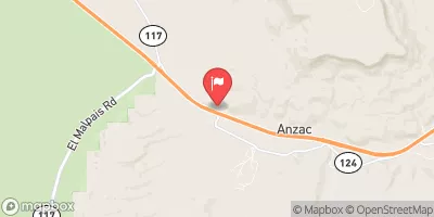
Rio San Jose Near Grants, Nm Historical Data

Historical Data


Streamflow Range


Date Average 2026 2025 2024 2023 2022 2021 2020 2019 2018 2017 2016 2015 2014 2013 2012
01-01 2.91
01-02 2.98
01-03 2.84
01-04 2.96
01-05 2.97
01-06 3.0
01-07 2.92
01-08 2.94
01-09 2.82
01-10 3.05
01-11 2.96
01-12 2.9
01-13 3.01
01-14 2.74
01-15 2.97
01-16 3.0
01-17 3.04
01-18 3.12
01-19 3.09
01-20 3.11
01-21 3.12
01-22 3.15
01-23 3.23
01-24 3.2
01-25 3.21
01-26 3.19
01-27 3.14
01-28 3.14
01-29 3.14
01-30 3.06
01-31 2.99
02-01 2.97
02-02 3.01
02-03 3.08
02-04 3.05
02-05 3.04
02-06 3.01
02-07 3.19
02-08 3.24
02-09 3.16
02-10 3.14
02-11 3.16
02-12 3.14
02-13 3.16
02-14 3.09
02-15 3.12
02-16 3.11
02-17 3.22
02-18 3.25
02-19 3.18
02-20 3.11
02-21 3.06
02-22 3.03
02-23 3.05
02-24 3.05
02-25 3.03
02-26 3.04
02-27 3.08
02-28 3.06
02-29 1.94
03-01 3.07
03-02 3.09
03-03 3.1
03-04 3.09
03-05 3.09
03-06 3.14
03-07 3.06
03-08 3.02
03-09 2.94
03-10 2.91
03-11 3.03
03-12 3.02
03-13 2.99
03-14 2.99
03-15 2.99
03-16 2.97
03-17 2.97
03-18 2.98
03-19 2.97
03-20 2.87
03-21 2.97
03-22 3.06
03-23 3.0
03-24 3.01
03-25 3.02
03-26 2.99
03-27 2.99
03-28 3.08
03-29 3.02
03-30 2.93
03-31 2.87
04-01 2.98
04-02 2.99
04-03 2.95
04-04 2.91
04-05 2.93
04-06 2.97
04-07 2.98
04-08 2.97
04-09 2.89
04-10 2.99
04-11 3.01
04-12 3.13
04-13 3.15
04-14 3.14
04-15 3.13
04-16 3.08
04-17 3.06
04-18 3.12
04-19 3.06
04-20 2.99
04-21 3.01
04-22 2.98
04-23 2.98
04-24 2.82
04-25 2.85
04-26 2.86
04-27 2.83
04-28 2.88
04-29 2.92
04-30 2.9
05-01 3.16
05-02 3.08
05-03 3.15
05-04 3.17
05-05 3.22
05-06 3.25
05-07 3.28
05-08 3.36
05-09 3.33
05-10 3.08
05-11 3.19
05-12 3.19
05-13 3.14
05-14 3.16
05-15 3.26
05-16 3.32
05-17 3.29
05-18 3.22
05-19 3.19
05-20 3.36
05-21 3.18
05-22 3.2
05-23 3.2
05-24 3.23
05-25 3.08
05-26 3.14
05-27 3.08
05-28 3.08
05-29 3.06
05-30 3.07
05-31 3.11
06-01 3.02
06-02 3.02
06-03 3.11
06-04 3.01
06-05 3.05
06-06 3.03
06-07 2.98
06-08 2.97
06-09 3.03
06-10 2.93
06-11 2.96
06-12 2.95
06-13 2.97
06-14 2.98
06-15 3.05
06-16 2.92
06-17 2.95
06-18 3.0
06-19 2.89
06-20 2.86
06-21 2.82
06-22 2.78
06-23 13.82
06-24 3.19
06-25 2.93
06-26 2.91
06-27 2.86
06-28 2.98
06-29 2.92
06-30 2.93
07-01 2.91
07-02 2.99
07-03 3.05
07-04 3.03
07-05 3.38
07-06 3.66
07-07 3.1
07-08 3.17
07-09 3.27
07-10 3.4
07-11 3.5
07-12 6.06
07-13 5.53
07-14 6.06
07-15 4.53
07-16 4.3
07-17 4.05
07-18 4.88
07-19 6.05
07-20 5.06
07-21 4.32
07-22 3.9
07-23 4.0
07-24 3.52
07-25 3.49
07-26 3.47
07-27 3.69
07-28 3.53
07-29 3.68
07-30 3.43
07-31 6.1
08-01 4.42
08-02 4.79
08-03 4.59
08-04 4.43
08-05 3.69
08-06 3.96
08-07 3.44
08-08 3.84
08-09 3.55
08-10 3.27
08-11 3.21
08-12 3.45
08-13 3.29
08-14 10.28
08-15 3.65
08-16 3.34
08-17 4.11
08-18 4.91
08-19 3.89
08-20 3.55
08-21 3.13
08-22 3.37
08-23 3.57
08-24 4.16
08-25 3.32
08-26 3.09
08-27 4.28
08-28 3.47
08-29 3.24
08-30 3.39
08-31 2.93
09-01 3.07
09-02 3.11
09-03 3.11
09-04 3.03
09-05 3.06
09-06 3.04
09-07 3.04
09-08 3.08
09-09 3.07
09-10 3.14
09-11 3.23
09-12 3.24
09-13 3.6
09-14 4.09
09-15 4.29
09-16 4.72
09-17 4.89
09-18 14.09
09-19 6.32
09-20 4.48
09-21 3.42
09-22 11.13
09-23 4.49
09-24 4.73
09-25 3.38
09-26 3.04
09-27 2.89
09-28 2.87
09-29 24.28
09-30 6.89
10-01 3.24
10-02 2.78
10-03 2.8
10-04 2.65
10-05 8.44
10-06 3.09
10-07 3.72
10-08 3.17
10-09 3.11
10-10 3.0
10-11 3.04
10-12 2.97
10-13 2.84
10-14 2.84
10-15 3.21
10-16 3.29
10-17 3.62
10-18 4.2
10-19 4.25
10-20 3.06
10-21 3.04
10-22 2.94
10-23 45.53
10-24 58.59
10-25 45.5
10-26 9.22
10-27 2.8
10-28 2.8
10-29 3.02
10-30 2.9
10-31 2.91
11-01 2.88
11-02 2.76
11-03 2.83
11-04 2.84
11-05 2.81
11-06 2.76
11-07 2.77
11-08 2.7
11-09 2.66
11-10 2.66
11-11 2.62
11-12 2.65
11-13 2.59
11-14 2.61
11-15 2.64
11-16 2.54
11-17 2.5
11-18 2.53
11-19 2.55
11-20 2.58
11-21 2.63
11-22 2.66
11-23 2.58
11-24 2.53
11-25 2.5
11-26 2.63
11-27 2.65
11-28 2.63
11-29 2.57
11-30 2.67
12-01 2.56
12-02 2.69
12-03 2.66
12-04 2.66
12-05 2.64
12-06 2.66
12-07 2.58
12-08 2.68
12-09 2.56
12-10 2.54
12-11 2.75
12-12 2.8
12-13 2.94
12-14 2.52
12-15 2.93
12-16 3.19
12-17 3.43
12-18 3.5
12-19 2.68
12-20 2.74
12-21 2.86
12-22 2.72
12-23 2.86
12-24 2.83
12-25 2.9
12-26 2.85
12-27 2.76
12-28 2.65
12-29 2.78
12-30 2.87
12-31 2.77

Annual Peak Streamflow


Seasonal Comparison


Oceanic Nino Index