


Impounding Basin No 1 Reservoir Report
Last Updated: April 27, 2026
Nearby: Impounding Basin No 2 Murray Lake
°F
°F
mph
Wind
%
Humidity
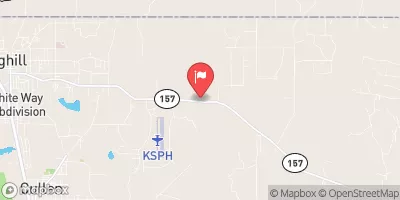
Impounding Basin No 1, also known as Paper Mill Pond, is a private water resource located in Sarepta, Louisiana.
Summary
Managed by International Paper Co., this basin serves as a Fish and Wildlife Pond, offering recreational opportunities for visitors. The dam, constructed in 1938, is primarily made of earth and stands at a height of 40 feet with a storage capacity of 4821 acre-feet. The controlled spillway helps regulate water levels, with a maximum discharge capacity of 820 cubic feet per second.
Situated along the Bodcau Bayou, Impounding Basin No 1 covers a surface area of 1723 acres and has a drainage area of 4.5 square miles. Despite its fair condition assessment and low hazard potential, the basin is classified as having a very high risk due to its age and structural makeup. The Louisiana Department of Transportation and Development oversees the state-regulated site, ensuring that inspections and enforcement measures are in place to maintain its integrity. With its historical significance and importance for wildlife conservation, Impounding Basin No 1 serves as a vital resource for water and climate enthusiasts in the region.
Regional Streamflow Levels
 Bayou Dorcheat Near Springhill
|
22cfs |
 Red River At Spring Bank
|
9740cfs |
 Red Chute Bayou At Sligo
|
144cfs |
 Big Cypress Ck Abv Sh 43 Nr Karnack
|
565cfs |
 Sulphur Rv Nr Texarkana
|
2030cfs |
 Cypress Bayou Near Keithville
|
1cfs |
15-Day Long Term Forecast
Year Completed |
1938 |
Dam Length |
24870 |
Dam Height |
40 |
River Or Stream |
BODCAU BAYOU |
Primary Dam Type |
Earth |
Surface Area |
1723 |
Hydraulic Height |
30 |
Drainage Area |
4.5 |
Nid Storage |
4821 |
Structural Height |
40 |
Hazard Potential |
Low |
Foundations |
Soil |
Nid Height |
40 |
Seasonal Comparison
5-Day Hourly Forecast Detail
Dam Data Reference
Condition Assessment
SatisfactoryNo existing or potential dam safety deficiencies are recognized. Acceptable performance is expected under all loading conditions (static, hydrologic, seismic) in accordance with the minimum applicable state or federal regulatory criteria or tolerable risk guidelines.
Fair
No existing dam safety deficiencies are recognized for normal operating conditions. Rare or extreme hydrologic and/or seismic events may result in a dam safety deficiency. Risk may be in the range to take further action. Note: Rare or extreme event is defined by the regulatory agency based on their minimum
Poor A dam safety deficiency is recognized for normal operating conditions which may realistically occur. Remedial action is necessary. POOR may also be used when uncertainties exist as to critical analysis parameters which identify a potential dam safety deficiency. Investigations and studies are necessary.
Unsatisfactory
A dam safety deficiency is recognized that requires immediate or emergency remedial action for problem resolution.
Not Rated
The dam has not been inspected, is not under state or federal jurisdiction, or has been inspected but, for whatever reason, has not been rated.
Not Available
Dams for which the condition assessment is restricted to approved government users.
Hazard Potential Classification
HighDams assigned the high hazard potential classification are those where failure or mis-operation will probably cause loss of human life.
Significant
Dams assigned the significant hazard potential classification are those dams where failure or mis-operation results in no probable loss of human life but can cause economic loss, environment damage, disruption of lifeline facilities, or impact other concerns. Significant hazard potential classification dams are often located in predominantly rural or agricultural areas but could be in areas with population and significant infrastructure.
Low
Dams assigned the low hazard potential classification are those where failure or mis-operation results in no probable loss of human life and low economic and/or environmental losses. Losses are principally limited to the owner's property.
Undetermined
Dams for which a downstream hazard potential has not been designated or is not provided.
Not Available
Dams for which the downstream hazard potential is restricted to approved government users.
Area Campgrounds
| Location | Reservations | Toilets |
|---|---|---|
 Highway 157 Primitive
|
||
 Frank Anthony RV Park
|
||
 Teague Lake Primitive
|
||
 Ivan Lake
|