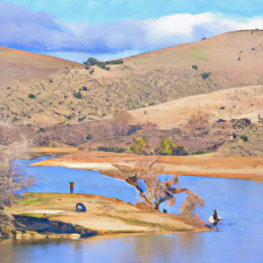
Chabot Reservoir Report
Nearby: Dunsmuir Reservoir Almond
Last Updated: February 21, 2026
Chabot Reservoir is a man-made lake located in Alameda County, California.
Summary
It was created in 1874 by the construction of an earthen dam across San Leandro Creek to provide water for the growing population of Oakland. The reservoir has a capacity of 3.2 billion gallons and is used as a major water supply source for the East Bay Municipal Utility District. The hydrology of Chabot is primarily fed by San Leandro Creek and a network of smaller tributaries. The snowpack from the Sierra Nevada Mountains also contributes to the reservoir's water supply. The water from Chabot is mainly used for domestic purposes, irrigation, and recreation. The reservoir is a popular spot for fishing, boating, hiking, and picnicking. The surrounding area is also home to several parks, including the Anthony Chabot Regional Park.
°F
°F
mph
Wind
%
Humidity
15-Day Weather Outlook
Reservoir Details
| Storage 24hr Change | -0.11% |
| Percent of Normal | 100% |
| Minimum |
7,060.0 acre-ft
2021-10-16 |
| Maximum |
12,010.0 acre-ft
2023-01-11 |
| Average | 9,330 acre-ft |
| Nid_Height | 142 |
| Hydraulic_Height | 119.2 |
| Drainage_Area | 41.4 |
| Year_Completed | 1892 |
| Dam_Height | 142 |
| River_Or_Stream | San Leandro Creek |
| Primary_Dam_Type | Earth |
| Surface_Area | 340 |
| Hazard_Potential | High |
| Nid_Storage | 10281 |
| Dam_Length | 450 |
Seasonal Comparison
Storage Levels
Pool Elevation Levels
Top Conserv Storage Levels
Inflow Levels
5-Day Hourly Forecast Detail
Nearby Streamflow Levels
Dam Data Reference
Condition Assessment
SatisfactoryNo existing or potential dam safety deficiencies are recognized. Acceptable performance is expected under all loading conditions (static, hydrologic, seismic) in accordance with the minimum applicable state or federal regulatory criteria or tolerable risk guidelines.
Fair
No existing dam safety deficiencies are recognized for normal operating conditions. Rare or extreme hydrologic and/or seismic events may result in a dam safety deficiency. Risk may be in the range to take further action. Note: Rare or extreme event is defined by the regulatory agency based on their minimum
Poor A dam safety deficiency is recognized for normal operating conditions which may realistically occur. Remedial action is necessary. POOR may also be used when uncertainties exist as to critical analysis parameters which identify a potential dam safety deficiency. Investigations and studies are necessary.
Unsatisfactory
A dam safety deficiency is recognized that requires immediate or emergency remedial action for problem resolution.
Not Rated
The dam has not been inspected, is not under state or federal jurisdiction, or has been inspected but, for whatever reason, has not been rated.
Not Available
Dams for which the condition assessment is restricted to approved government users.
Hazard Potential Classification
HighDams assigned the high hazard potential classification are those where failure or mis-operation will probably cause loss of human life.
Significant
Dams assigned the significant hazard potential classification are those dams where failure or mis-operation results in no probable loss of human life but can cause economic loss, environment damage, disruption of lifeline facilities, or impact other concerns. Significant hazard potential classification dams are often located in predominantly rural or agricultural areas but could be in areas with population and significant infrastructure.
Low
Dams assigned the low hazard potential classification are those where failure or mis-operation results in no probable loss of human life and low economic and/or environmental losses. Losses are principally limited to the owner's property.
Undetermined
Dams for which a downstream hazard potential has not been designated or is not provided.
Not Available
Dams for which the downstream hazard potential is restricted to approved government users.
Area Campgrounds
| Location | Reservations | Toilets |
|---|---|---|
 Anthony Chabot Family Campground
|
||
 Anthony Chabot Regional Park
|
||
 Bort Meadow Group Camp
|
||
 Pal Camp
|
||
 Corral Camp
|
||
 Girls Camp
|


 Chabot
 Chabot
 U San Leandro
 Lake Chabot
 Almond Reservoir
 Lake Temescal
 Lafayette Reservoir