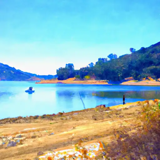
San Pablo Reservoir
As of August 2, 2026, San Pablo is holding 29,040 acre-ft of water — 91% of normal storage for this date. Storage data refreshed throughout the day.

San Pablo
San Pablo is a city located in Contra Costa County, California. The region has a rich history, with the Ohlone people being the original inhabitants. The area was later colonized by the Spanish, and the Mexican government granted land to the San Pablo Rancho. The city is situated in a hydrological basin and gets its water supply from the San Pablo Reservoir. The reservoir is also a popular recreational spot for fishing, hiking, and horseback riding. The city's water system is managed by the East Bay Municipal Utility District. The area has a Mediterranean climate with mild winters and warm summers. The region receives about 25 inches of annual rainfall and relies heavily on snowpack from the Sierra Nevada Mountains for its water supply. The primary agricultural products in the area are walnuts, grapes, and apricots. The San Pablo Bay is a vital habitat for various aquatic species and is used for recreational activities like boating and fishing.
Daily levels at San Pablo
Storage volume, pool elevation, and total release plotted from the operating agency's daily observations.
Storage
acre-ft · code 2
Pool Elevation
ft · code 1
Plan around the weather
Same NOAA / yr.no feed Snoflo's iOS app uses. Watch the precipitation column on the meteogram -- rain on the basin upstream typically lifts inflow 24-72 hours later.
Next 5 days, hour by hour
Temperature line with weather symbols on top, snow + rain accumulation as columns, humidity as a dotted line.
5-day forecast table
Every 3 hours, broken out across temperature, snow, rain, humidity, and wind. Each cell is colour-coded relative to the column min/max.
| Time | Condition | Temp (°F) | Snow (in) | Rain (in) | Humidity (%) | Wind (mps) | Wind dir |
|---|---|---|---|---|---|---|---|
| Loading detailed forecast… | |||||||
15-day temperature & precipitation
Daily temperatures, snow, and rain projected over the next two weeks.
Nearby streamflow gauges
USGS streamgauges around San Pablo -- inflows here typically show up in storage 24-72 hours later.
| Streamgauge | Discharge | View |
|---|---|---|
| Corte Madera C A Ross Ca | 0 cfs | → |
| Redwood C A Hwy 1 Bridge A Muir Beach Ca | 0 cfs | → |
| San Ramon C A San Ramon Ca | 0 cfs | → |
| San Lorenzo C A San Lorenzo Ca | 2 cfs | → |
| Cull C Ab Cull C Res Nr Castro Valley Ca | · | → |
| Crow C Nr Hayward Ca | 1 cfs | → |


About San Pablo
What is the water level at San Pablo Reservoir right now?
As of August 2, 2026, San Pablo Reservoir is holding 29,040 acre-ft, about 91% of normal for this date. Pool elevation and the year-over-year trend are shown above.
Is San Pablo Reservoir high or low right now?
Compare the percent-of-normal figure on this page: above 100% means storage is higher than the historical average for the date (a wet year), below 100% means lower (a dry year or drought). The daily-levels chart shows the current trend.
Where does the data for San Pablo come from?
Daily storage, pool elevation, and release rates are sourced from USGS, USBR, and USACE monitoring stations. Weather forecast comes from NOAA / yr.no -- the same feed Snoflo's iOS app uses.
How often is the report updated?
Storage observations are updated daily by the operating agency. The 15-day weather forecast refreshes throughout the day. Snoflo caches and renders the most recent observation -- check the "as of" timestamp on the storage card.
What does the Hazard hazard rating mean?
The Corps of Engineers' hazard potential classification grades probable consequences if the dam fails: High = probable loss of human life; Significant = no probable loss of human life but possible economic loss / environmental damage; Low = no probable loss of human life, only minor economic / environmental losses. See the Dam Data Reference card below for the full definitions.
What's "% of normal"?
The current storage value compared to the historical average storage on this calendar day. 100% = right on average; values above 100% mean above-normal storage (wet year); values below mean below-normal (dry year or drought).
Can I get alerts when storage crosses a threshold?
Yes -- alerts are managed in the Snoflo iOS app. Favorite this reservoir, set a threshold, and you'll get a push the moment conditions cross.