
Van Vleck Reservoir Report
Nearby: Michigan Bar No. 2 Michigan Bar No. 1
Last Updated: December 25, 2025
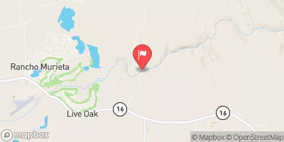
Van Vleck, located in Sacramento, California, is a privately owned dam with a primary purpose of water supply, serving irrigation and water supply needs.
°F
°F
mph
Wind
%
Humidity
Summary
Built in 1950, this earth dam stands at a height of 26 feet and has a hydraulic height of 22 feet. With a storage capacity of 2000 acre-feet and a surface area of 216 acres, Van Vleck plays a significant role in water resource management in the area.
Managed by the Natural Resources Conservation Service, Van Vleck is regulated and inspected by the California Department of Water Resources for safety and compliance. The dam is considered to have a significant hazard potential but is currently in satisfactory condition based on a 2017 assessment. The last inspection in February 2021 confirmed its structural integrity, ensuring the safety of the surrounding community in the event of any emergencies.
Located on the Tr Arkansas Creek in the city of Cosumne, Van Vleck is a vital infrastructure contributing to the water supply and irrigation systems in the region. With its historical significance dating back to the mid-20th century, this dam continues to play a crucial role in water resource management and climate resilience efforts in Sacramento, California.
Year Completed |
1950 |
Dam Length |
4100 |
Dam Height |
26 |
River Or Stream |
Tr Arkansas Cr |
Primary Dam Type |
Earth |
Surface Area |
216 |
Hydraulic Height |
22 |
Nid Storage |
2000 |
Hazard Potential |
Significant |
Nid Height |
26 |
Seasonal Comparison
Weather Forecast
Nearby Streamflow Levels
 Cosumnes R A Michigan Bar Ca
|
6100cfs |
 Deer C Nr Cameron Park Ca
|
8cfs |
 American R A Fair Oaks Ca
|
9720cfs |
 Laguna C Nr Elk Grove Ca
|
1cfs |
 Arcade C Nr Del Paso Heights Ca
|
64cfs |
 Morrison C Nr Sacramento Ca
|
11cfs |
Dam Data Reference
Condition Assessment
SatisfactoryNo existing or potential dam safety deficiencies are recognized. Acceptable performance is expected under all loading conditions (static, hydrologic, seismic) in accordance with the minimum applicable state or federal regulatory criteria or tolerable risk guidelines.
Fair
No existing dam safety deficiencies are recognized for normal operating conditions. Rare or extreme hydrologic and/or seismic events may result in a dam safety deficiency. Risk may be in the range to take further action. Note: Rare or extreme event is defined by the regulatory agency based on their minimum
Poor A dam safety deficiency is recognized for normal operating conditions which may realistically occur. Remedial action is necessary. POOR may also be used when uncertainties exist as to critical analysis parameters which identify a potential dam safety deficiency. Investigations and studies are necessary.
Unsatisfactory
A dam safety deficiency is recognized that requires immediate or emergency remedial action for problem resolution.
Not Rated
The dam has not been inspected, is not under state or federal jurisdiction, or has been inspected but, for whatever reason, has not been rated.
Not Available
Dams for which the condition assessment is restricted to approved government users.
Hazard Potential Classification
HighDams assigned the high hazard potential classification are those where failure or mis-operation will probably cause loss of human life.
Significant
Dams assigned the significant hazard potential classification are those dams where failure or mis-operation results in no probable loss of human life but can cause economic loss, environment damage, disruption of lifeline facilities, or impact other concerns. Significant hazard potential classification dams are often located in predominantly rural or agricultural areas but could be in areas with population and significant infrastructure.
Low
Dams assigned the low hazard potential classification are those where failure or mis-operation results in no probable loss of human life and low economic and/or environmental losses. Losses are principally limited to the owner's property.
Undetermined
Dams for which a downstream hazard potential has not been designated or is not provided.
Not Available
Dams for which the downstream hazard potential is restricted to approved government users.
 Van Vleck