
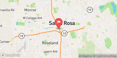
Pond No. 2 Reservoir Report
Nearby: Piner Creek Fountaingrove
Last Updated: December 23, 2025
Pond No.
°F
°F
mph
Wind
%
Humidity
Summary
2 is a vital water resource infrastructure located in Santa Rosa, California, with a primary purpose of water supply. Built in 1952, this offstream earth dam stands at 12 feet high and has a storage capacity of 290 acre-feet. It serves numerous purposes including flood risk reduction, irrigation, and water supply for the local community.
Managed by the local government and regulated by the California Department of Water Resources (DWR), Pond No. 2 has a low hazard potential and is deemed to be in satisfactory condition as of the last assessment in September 2017. The dam has a drainage area of 0.08 square miles and covers a surface area of 54 acres. With a hydraulic height of 10.5 feet, this infrastructure plays a crucial role in maintaining water security in the region.
Despite its relatively modest size, Pond No. 2 is a key component of the water management system in Sonoma County. With its efficient design and satisfactory condition, this earth dam ensures the reliable supply of water for various purposes while minimizing flood risks and supporting irrigation practices in the area. As climate change continues to impact water resources, the importance of well-maintained structures like Pond No. 2 becomes increasingly apparent for sustainable water management in the region.
Year Completed |
1952 |
Dam Length |
7920 |
Dam Height |
12 |
River Or Stream |
Offstream |
Primary Dam Type |
Earth |
Surface Area |
54 |
Hydraulic Height |
10.5 |
Drainage Area |
0.08 |
Nid Storage |
290 |
Hazard Potential |
Low |
Nid Height |
12 |
Seasonal Comparison
Weather Forecast
Nearby Streamflow Levels
Dam Data Reference
Condition Assessment
SatisfactoryNo existing or potential dam safety deficiencies are recognized. Acceptable performance is expected under all loading conditions (static, hydrologic, seismic) in accordance with the minimum applicable state or federal regulatory criteria or tolerable risk guidelines.
Fair
No existing dam safety deficiencies are recognized for normal operating conditions. Rare or extreme hydrologic and/or seismic events may result in a dam safety deficiency. Risk may be in the range to take further action. Note: Rare or extreme event is defined by the regulatory agency based on their minimum
Poor A dam safety deficiency is recognized for normal operating conditions which may realistically occur. Remedial action is necessary. POOR may also be used when uncertainties exist as to critical analysis parameters which identify a potential dam safety deficiency. Investigations and studies are necessary.
Unsatisfactory
A dam safety deficiency is recognized that requires immediate or emergency remedial action for problem resolution.
Not Rated
The dam has not been inspected, is not under state or federal jurisdiction, or has been inspected but, for whatever reason, has not been rated.
Not Available
Dams for which the condition assessment is restricted to approved government users.
Hazard Potential Classification
HighDams assigned the high hazard potential classification are those where failure or mis-operation will probably cause loss of human life.
Significant
Dams assigned the significant hazard potential classification are those dams where failure or mis-operation results in no probable loss of human life but can cause economic loss, environment damage, disruption of lifeline facilities, or impact other concerns. Significant hazard potential classification dams are often located in predominantly rural or agricultural areas but could be in areas with population and significant infrastructure.
Low
Dams assigned the low hazard potential classification are those where failure or mis-operation results in no probable loss of human life and low economic and/or environmental losses. Losses are principally limited to the owner's property.
Undetermined
Dams for which a downstream hazard potential has not been designated or is not provided.
Not Available
Dams for which the downstream hazard potential is restricted to approved government users.
Area Campgrounds
| Location | Reservations | Toilets |
|---|---|---|
 Sonoma County Fairgrounds RV Park
|
||
 Spring Lake Regional Park
|
||
 Sugarloaf Ridge State Park
|
 Pond No. 2