
Curlew Valley Reservoir Report
Nearby: Rose Ranch Sandarosa
Last Updated: December 20, 2025
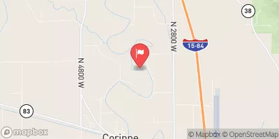
Curlew Valley, also known as Stone Reservoir, is a private water resource located in Oneida, Idaho.
°F
°F
mph
Wind
%
Humidity
Summary
This reservoir, completed in 1911, serves a variety of purposes, including water storage and irrigation for the surrounding area. With a storage capacity of 3800 acre-feet and a significant hazard potential, Curlew Valley plays a crucial role in managing water resources in the region.
The dam at Curlew Valley is an earth-fill structure with a height of 40.5 feet and a hydraulic height of 35.5 feet. It spans a length of 1100 feet and has a spillway width of 84 feet. The reservoir is regulated by the Idaho Department of Water Resources and undergoes regular inspections to ensure its safety and functionality. Despite its poor condition assessment, efforts are being made to mitigate risks and manage the very high potential for emergencies.
The area around Curlew Valley is characterized by its unique geographical features and proximity to Deep Creek and the Great Salt Lake. This reservoir, managed by private owners, is a vital component of the water infrastructure in the region and contributes to the overall water management efforts in Idaho. For water resource and climate enthusiasts, Curlew Valley presents an interesting case study in the intersection of water conservation, infrastructure maintenance, and environmental stewardship.
Year Completed |
1911 |
Dam Length |
1100 |
Dam Height |
40.5 |
River Or Stream |
DEEP CREEK GREAT SALT LAKE |
Surface Area |
247 |
Hydraulic Height |
35.5 |
Drainage Area |
253 |
Nid Storage |
3800 |
Outlet Gates |
Slide (sluice gate) |
Hazard Potential |
Significant |
Foundations |
Rock, Soil |
Nid Height |
41 |
Seasonal Comparison
Weather Forecast
Nearby Streamflow Levels
Dam Data Reference
Condition Assessment
SatisfactoryNo existing or potential dam safety deficiencies are recognized. Acceptable performance is expected under all loading conditions (static, hydrologic, seismic) in accordance with the minimum applicable state or federal regulatory criteria or tolerable risk guidelines.
Fair
No existing dam safety deficiencies are recognized for normal operating conditions. Rare or extreme hydrologic and/or seismic events may result in a dam safety deficiency. Risk may be in the range to take further action. Note: Rare or extreme event is defined by the regulatory agency based on their minimum
Poor A dam safety deficiency is recognized for normal operating conditions which may realistically occur. Remedial action is necessary. POOR may also be used when uncertainties exist as to critical analysis parameters which identify a potential dam safety deficiency. Investigations and studies are necessary.
Unsatisfactory
A dam safety deficiency is recognized that requires immediate or emergency remedial action for problem resolution.
Not Rated
The dam has not been inspected, is not under state or federal jurisdiction, or has been inspected but, for whatever reason, has not been rated.
Not Available
Dams for which the condition assessment is restricted to approved government users.
Hazard Potential Classification
HighDams assigned the high hazard potential classification are those where failure or mis-operation will probably cause loss of human life.
Significant
Dams assigned the significant hazard potential classification are those dams where failure or mis-operation results in no probable loss of human life but can cause economic loss, environment damage, disruption of lifeline facilities, or impact other concerns. Significant hazard potential classification dams are often located in predominantly rural or agricultural areas but could be in areas with population and significant infrastructure.
Low
Dams assigned the low hazard potential classification are those where failure or mis-operation results in no probable loss of human life and low economic and/or environmental losses. Losses are principally limited to the owner's property.
Undetermined
Dams for which a downstream hazard potential has not been designated or is not provided.
Not Available
Dams for which the downstream hazard potential is restricted to approved government users.
 Curlew Valley